
Cyclists.com

Splügen Pass from Chiavenna

31 km road cycling route1,798 m climbing2 h 12 minGPX

Chiavenna, Italy · Road

A mountainous 31 km road cycling route from Chiavenna through San Giacomo Filippo, Gallivaggio and Prestone, with 1,798 m of climbing over the Chiavenna climb and the Montespluga climb. Most of it (28.3 km) is on main roads without a cycle lane.

Routed from the map This classic road was traced on OpenStreetMap and measured against the terrain model; no member has recorded it yet. Ridden it? Add your recording and photos.

Download GPXMap

At a glance

Best for
Short, climbing-heavy rides for confident riders at ease in traffic
Distance
30.7 km
Point to point
Elevation gain
1,798 m
59 m per km
Riding time
2 h 12 min
moving time, estimated
Difficulty
Hard
Bike
Road bike
from the mapped surface
Surface
Paved
97% paved · 3% unpaved
Traffic
Mostly main roads
28.3 km on main roads without a cycle lane
Food & water
Regular
51 cafés and restaurants · 8 shops · 43 water points · 3 petrol stations · 1 public toilet · 2 bike shops
Best months
Apr to Oct
Chiavenna climate, 10 years
Navigation
GPX download
free, no sign-in
Start → finish
Chiavenna

Map and elevation profile

Elevation profile

Total ascent
1,798 m
Distance
31 km
05001,0001,5002,0002,500m0 km102031 km2,115 m · highest, at 30.7 kmStartFinish

Route description

  1. Chiavenna
  2. Chiavenna climbkm 0
  3. San Giacomo Filippokm 4
  4. Gallivaggiokm 7
  5. Prestonekm 12
  6. Pietrakm 12
  7. Acerokm 13
  8. Pianazzokm 18
  9. Montespluga climbkm 27

The route starts in Chiavenna at 328 m and climbs steadily for 25 km, gaining 1575 m at an average gradient of 6.2%, reaching 1904 m near Montespluga. There is a final 3 km push climbing 208 m at 6.9% average gradient to the pass at 2114 m. The road is mainly main road (SS36) for 93% of the route, with almost no cycle lanes on the 28 km main road section.

Surface is mostly paved, with just 3% gravel or unpaved. The profile is mountainous with 86% climbing, including 19.8 km over 5% gradient and 7.8 km over 8%. The steepest sustained gradient is 23.4% over 500 m near the start. Facilities are available along the way with shops and cafes in Chiavenna and Campodolcino, and occasional drinking water points and restaurants up the route. The longest stretch without a café, shop or water is 4.5 km between 20.8 km and 25.3 km.

Bailouts are possible at Chiavenna and Campodolcino train stations. Notable settlements en route include Bette, San Giacomo Filippo, Gallivaggio, Lirone, and Montespluga close to the pass.

Why ride this route?

  • Climbs the Chiavenna climb (25.2 km at 6.2 %) and the Montespluga climb (3 km at 6.9 %).
  • Tops out at 2,114 m, 30.4 km in.
  • Crosses a border: Italy and Switzerland.

Highlights

  • Santuario della Madonna di Gallivaggio near 7.6 km
  • Final high point at Passo dello Spluga, 2114 m
  • Multiple food stops including Ca’ nei Sass restaurant at 8.8 km
  • Viewpoint at Acque Rosse, 19.7 km

Along the route

Measured from the route line, the Copernicus elevation model and OpenStreetMap.

Places passed· crosses into Switzerland

  1. San Giacomo Filippo 3.7 km
  2. Motta San Guglielmo 4.2 km
  3. Gallivaggio 7.4 km
  4. Lirone 8.6 km
  5. Cimaganda 9.3 km
  6. Prestone 11.5 km
  7. Portarezza 11.8 km
  8. Pietra 12.2 km
  9. Tini 12.6 km
  10. Campodolcino 13.1 km
  11. Acero 13.2 km
  12. Corti 13.6 km
  13. Pianazzo 17.5 km
  14. Stuetta 23.8 km
  15. Montespluga 27.6 km

Climbs

Climbs in ride order: where each starts, what this ride climbs, and the full named ascent
ClimbStarts atOn this rideFull ascentTop on this ride
Chiavenna climb0.2 km25.2 km · 1575 m · 6.2 % · max 12.8 %25.2 km · 1575 m · 6.2 %1904 m
Montespluga climb27.3 km3 km · 208 m · 6.9 % · max 13 %3 km · 208 m · 6.9 %2114 m

High point 2114 m at 30.4 km; low point 328 m.

On this ride: the part this route climbs, cut from its own elevation profile. Full ascent: the whole named climb, measured the same way on every ride that uses it (its climb page).

Chiavenna climb · full ascent, starts at 0.2 km

25.2 km at 6.2% · 1575 m
4006008001,0001,2001,4001,6001,800m7.2%7.2%7.1%7.0%6.7%7.5%7.2%1.4%2.4%4.0%8.3%8.0%9.1%8.5%8.8%7.4%7.7%8.8%5.1%3.9%0.8%0 km23456789101112131415161718192021222325.0 km1,904 msteepest 9.1%
< 4%4 – 7%7 – 10%> 10%

Montespluga climb · full ascent, starts at 27.3 km

3 km at 6.9% · 208 m
1,9502,0002,0502,100m7.9%6.7%0 km123.0 km2,112 msteepest 7.9%

Traffic, surface and gradient

Measured from OpenStreetMap along the track and the elevation profile.

This is not a cycle-track route: 92% is on main roads without a cycle lane. Riders should be comfortable sharing the road with faster traffic.

Roads
93% main road · 5% quiet street · 2% other roads and tracks
Main roads
28.3 km on main roads without a cycle lane — likely busier
Main roads used
SS36 (28 km)
Surface
Paved: 97% of the route is mapped as paved, 3% as unpaved.
Gradient
86% climbing · 2% descending · 12% flat
Steep sections
19.8 km over 5% · 7.8 km over 8% · 2 km over 10% · steepest 500 m averages 23.4% at 0 km

Food, water and services

Within a few hundred metres of the track, from OpenStreetMap. Opening hours change — treat this as where to look, not a promise.

No stretch is longer than 15 km without a café, shop or water. Along the route: 51 cafés and restaurants, 8 shops, 43 water points, 3 petrol stations, 1 public toilet and 2 bike shops.

Food, water and shops in ride order

  1. 0 kmCrai · supermarket · on the route
  2. 0 kmFarmacia Dottor Dolci · pharmacy · 40 m off route
  3. 0.2 kmLa Casa del Pane · bakery · on the route
  4. 0.2 km4 Bike · bike shop · 30 m off route
  5. 0.3 kmStazione di Servizio IP di Balatti Andrea · petrol station · 90 m off route
  6. 1.4 kmDrinking water · on the route
  7. 5 kmSpring · 110 m off route
  8. 7.4 kmToilets · 40 m off route
  9. 8.8 kmCa’ nei Sass · restaurant · 40 m off route
  10. 13 kmLafarmacia. Edelweiss · pharmacy · on the route
  11. 13.3 kmRetitalia · petrol station · 30 m off route
  12. 13.4 kmDrinking water · on the route
  13. 13.5 kmAntico Borgo · café · on the route
  14. 13.5 kmMoiola Market Campodolcino Corti · supermarket · on the route
  15. 17.5 kmDrinking water · on the route
  16. 20.8 kmRifugio Teggiate · restaurant · 30 m off route
  17. 27.6 kmLa Capriata · restaurant · 100 m off route
  18. 27.6 kmKiosco · kiosk · on the route

Need to bail out?

  • 0 kmChiavenna (station), 340 m off route
  • 14.2 kmCampodolcino (station), 50 m off route

Whether bikes are carried depends on the service — check before relying on it.

Worth a stop

  • 7.6 kmSantuario della Madonna di Gallivaggio (attraction)
  • 19.7 kmAcque Rosse (viewpoint)
  • 30.4 kmPasso dello Spluga (viewpoint, 2100 m)

Stay after this ride

  • Albergo della Posta · hotel · 1.9 km from the finish
  • Albergo Vittoria · hotel · 1.8 km from the finish

Start and access

Starts at Chiavenna. Mapped within a short walk of the start and finish, from OpenStreetMap.

At the start

Food and coffee
Caffé Pestalozzi (20 m), Il Fornaio (20 m), La Casa del Pane (180 m)
Shops
Crai (10 m), Sigma (210 m)

Know before you go

  • Longest stretch without café, shop or water: 4.5 km from 20.8 to 25.3 km
  • 28 km on main roads without cycle lanes (SS36)
  • Steepest sustained gradient: 23.4% over 500 m at route start
  • 7.8 km over 8% gradient climbs

Routes are for inspiration. Roads, surfaces and conditions change — check locally and ride within your limits.

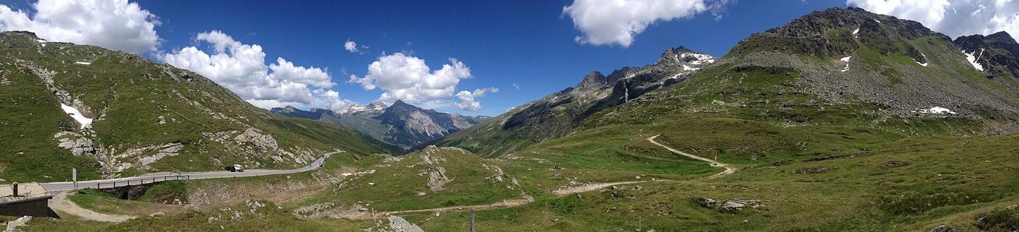
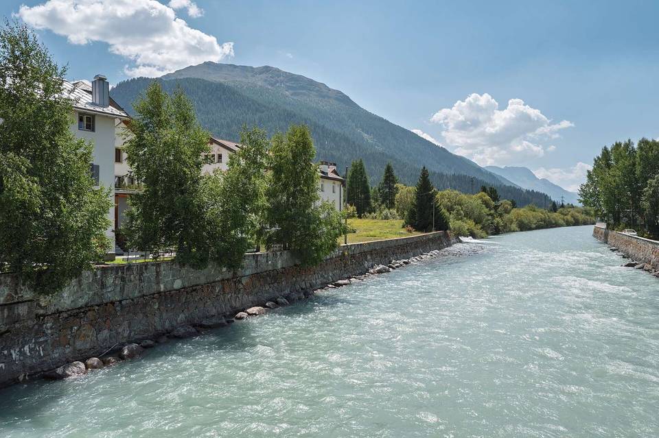
2 photographs from the road

Photo: Kso · CC BY-SA 4.0 · Wikimedia Commons · Photo: Hansueli Krapf This file was uploaded with Commonist. · CC BY-SA 3.0 · Wikimedia Commons · Photo: Aniello Bizzoco · CC BY-SA 4.0 · Wikimedia Commons

About this route

Route line
Routed on OpenStreetMap roads with bicycle routing, then measured like a recorded ride.
Elevation
Recalculated from the Copernicus GLO-90 terrain model every 50 m, not the device’s barometer.
Roads, surface, services
Measured along the line from OpenStreetMap extracts.
Best months
Ten years of ERA5 weather for Chiavenna (Open-Meteo).
GPX
Generated from the route line: track points only, no timestamps or personal data.
Page added
Page last updated

See something wrong with this ride?

Rides starting nearby