
Pisa to Livorno Return
A flat 81 km road cycling loop from Porta a Mare, Tuscany through CEP, San Piero a Grado and Marina di Pisa, with 14 m of climbing.
At a glance
- Best for
- Flat, steady riding
- Distance
- 80.9 km
- Elevation gain
- 14 m
- Riding time
- 4–5½ hours
- Difficulty
- Moderate
- Bike
- Road bike
- Surface
- Mostly paved
- Traffic
- Some main roads
- Food & water
- Regular
- Best months
- Apr to Oct
- Navigation
- GPX download
- Start and finish
- Porta a Mare
Map and elevation profile
Elevation profile
- 14 m
- 81 km
What it was like to ride
Route description
- Porta a Mare
- CEP
- San Piero a Grado
- Marina di Pisa
- Calambrone
- Fattoria Arno Vecchio
- Barbaricina
- San Francesco
- La Cella
- Porta a Mare
This 80.9 km coastal loop from Pisa heads first through Porta a Mare, CEP, and La Vettola, then follows the shoreline passing San Piero a Grado, La Bigattiera and Marina di Pisa before reaching Livorno at 37.3 km. The route then continues through Stagno, Calambrone, and Tirrenia before turning back through Fattoria Arno Vecchio, Cascine Nuove, Barbaricina and returning to Pisa.
The ride has almost no climbing, with only 30 m elevation gain, and is entirely flat. The highest point is at 14 m at 39.3 km, near Livorno. The surface is mostly paved (90%) with some gravel or unpaved sections amounting to 6%. The roads are a mix of cycle paths (39%), main roads (26%), minor roads, quiet streets, and paths. There is 22 km on main roads without cycle lanes and 32 km on cycle paths or lanes, including 19.6 km on the Ciclopista del Trammino.
Food and drink options appear at multiple points, for example cafés at 1.3 km and 13.6 km, bakeries at 60.4 km and 65.2 km, and a patisserie near 39.2 km. Shops and supermarkets are around 13.1 km, 18.6 km and 29.9 km. The longest stretch without a café, shop or water is 9.6 km from 1.6 km to 11.2 km. Water points and toilets are distributed along the route. Bike shops are available at 0.1 km, 12.3 km and beyond. Bailout options exist at train stations in Pisa and ferries near Livorno.
Highlights
- Ciclopista del Trammino cycle path for 19.6 km
- Livorno at 37.3 km on the coast
- Marina di Pisa at 12.3 km
- Flat ride with 30 m gain overall
Along the route
Places passed
Traffic, surface and gradient
Expect stretches on main roads without a cycle lane (22 km in all) between quieter sections.
- Roads
- 39% cycle path · 26% main road · 9% minor road · 9% quiet street · 17% other roads and tracks
- Main roads
- 22 km on main roads without a cycle lane — likely busier
- Cycle paths
- 32.1 km on cycle paths or roads with a cycle lane
- Main roads used
- Ciclopista del Trammino (20 km), SP224 (10 km), Via Leonardo da Vinci (3 km)
- Surface
- Predominantly paved: 90% is mapped as paved, 6% as unpaved or gravel and 4% has no surface data.
- Gradient
- 0% climbing · 0% descending · 100% flat
Food, water and services
No stretch is longer than 15 km without a café, shop or water. Along the route: 633 cafés and restaurants, 80 shops, 58 water points, 19 petrol stations, 33 public toilets and 36 bike shops.
Food, water and shops in ride order
- 0.1 kmSmile & Ride - Bike Rental · bike shop · 60 m off route
- 1 kmEni · petrol station · 30 m off route
- 12.3 kmToilets · 30 m off route
- 13.1 kmCoop.fi · supermarket · 110 m off route
- 20.8 kmZanobini 1989 · café · 70 m off route
- 29.3 kmL.E.F. · café · 80 m off route
- 30.7 kmBiciclettaio matto · bike shop · 100 m off route
- 31.3 kmToilets · on the route
- 36.1 kmToilets · 70 m off route
- 39.1 kmAlma farmacie · pharmacy · on the route
- 39.5 kmEuropam · petrol station · 40 m off route
- 45.1 kmDrinking water · 40 m off route
- 50.5 kmToilets · 110 m off route
- 57.8 kmToilets · 130 m off route
- 60.4 kmCoop.fi · supermarket · 70 m off route
- 65.2 kmPaolicchi · bakery · 120 m off route
- 76.5 kmCoop.fi · supermarket · 50 m off route
- 77.7 kmDrinking water · on the route
Need to bail out?
- 0.8 km — Pisa San Rossore (station), 1.4 km off route
- 28.7 km — Stazione Marittima (ferry), 180 m off route
- 36.6 km — Toremar (ferry), 220 m off route
- 55.2 km — Ferry, 360 m off route
- 78.2 km — Central Station of Pisa (station), 90 m off route
Worth a stop
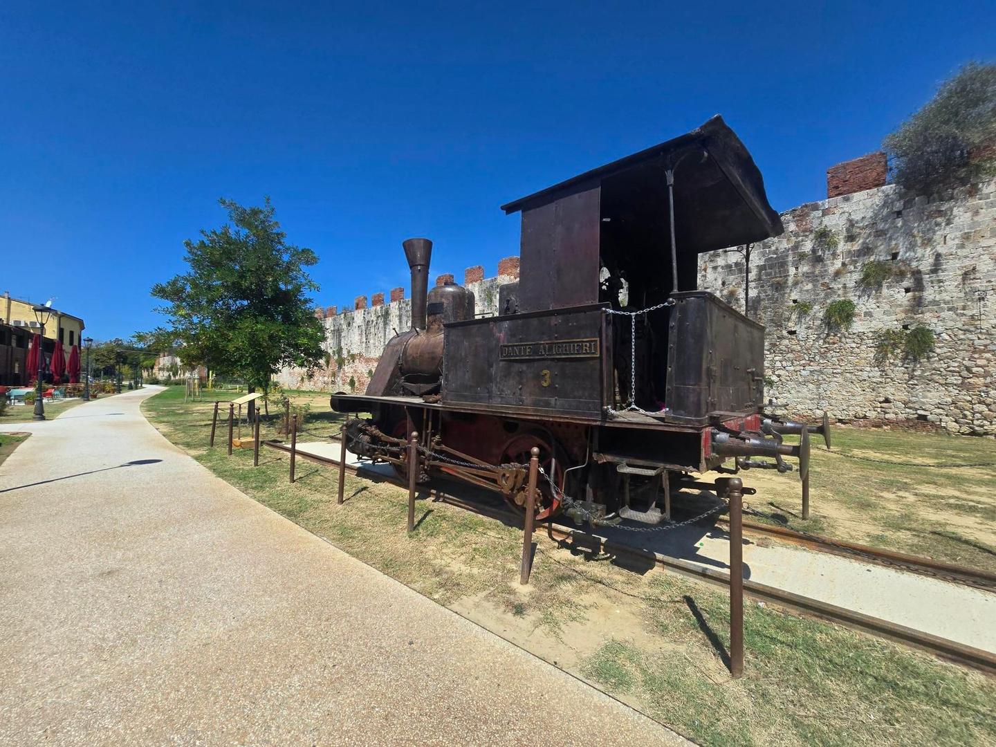
- 0.3 km — Locomotiva "Dante Alighieri" (attraction)
- 32.1 km — Muro danneggiato (ruins)
- 36.8 km — Monumento dei Quattro Mori (attraction)
- 64.9 km — Ex Stazione di Marina di Pisa (attraction)
- 77.1 km — Torre Ghibellina (ruins)
Start and access
At the start and finish
- Trains and ferries
- Central Station of Pisa (100 m)
- Bikes and repair
- Smile & Ride (40 m), Smile & Ride - Bike Rental (140 m)
- Food and coffee
- Kinzica (210 m), Bijou (110 m), Panetteria Al Binario 1 (50 m)
Know before you go
- Longest stretch without café, shop or water: 9.6 km from 1.6 km
- 22 km on main roads without cycle lane
- 6% gravel or unpaved sections