
Cycling in Aulus-les-Bains
1 cycling route from Aulus-les-Bains, France, 10 km, 10 km mapped in all, with up to 813 m of climbing in a day. Mountainous riding (81 m of climbing per km on average), mostly road routes, 97% of the riding on main roads without a cycle lane. 1 named climb; the high point is 1,569 m on Col d'Agnes from Aulus-les-Bains. Best months to ride: May to Oct.
At a glance
- Routes
- 1
- Lengths
- 10 km
- Biggest day
- 813 m
- Terrain
- Mountainous
- Surface
- Mostly paved
- Bike
- Road bike
- Difficulty
- Moderate
- Named climbs
- 1
- Best months
- May to Oct
- GPX
- Every route
Know before you go
Added up from the recorded routes and OpenStreetMap; nothing estimated.
- Surface
- Paved almost throughout.
- Roads
- 97% of the riding on main roads without a cycle lane.
- High point
- 1,569 m on Col d'Agnes from Aulus-les-Bains.
- Climbs
- 1 named climb · 1 ascent of 500 m or more.
Cycling guide to Aulus-les-Bains
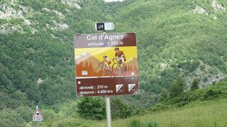
Aulus-les-Bains serves as the start for a 10 km climb to Col d'Agnes, offering cyclists a challenging ascent. The route gains 812 metres in elevation over 10 km, making it suitable for those seeking climbing efforts. No other places are passed along this climb. The summit reaches 1569 metres, providing a mountain riding experience beneath the high Pyrenean terrain. The road is almost entirely paved with a very small portion of gravel or unpaved surface.
The climb from Aulus-les-Bains to Col d'Agnes has no cycle paths, and nearly all 9.7 km on main roads lack a dedicated cycle lane. There are no railway stations near the route. Services are limited, with the longest stretch without any services being 3.6 km. This route is ideal for cyclists looking for a focused climb starting directly from this town.
More on terrain
Terrain
The terrain is mountainous with a continuous climb averaging an 8.1% gradient and maximum of 11.3%. The highest point on the route is 1569 metres above sea level. The climb gains 812 metres over its 10 km length, indicating a sustained steep ascent.