
Cycling in Jausiers
1 cycling route from Jausiers, France, 23 km, 23 km mapped in all, with up to 1,483 m of climbing in a day. Mountainous riding (64 m of climbing per km on average), mostly road routes. 2 named climbs; the high point is 2,701 m on Col de la Bonette from Jausiers. Best months to ride: Jul to Sep.
At a glance
- Routes
- 1
- Lengths
- 23 km
- Biggest day
- 1,483 m
- Terrain
- Mountainous
- Bike
- Road bike
- Difficulty
- Hard
- Named climbs
- 2
- Best months
- Jul to Sep
- GPX
- Every route
Know before you go
Added up from the recorded routes and OpenStreetMap; nothing estimated.
- High point
- 2,701 m on Col de la Bonette from Jausiers.
- Climbs
- 2 named climbs · 1 ascent of 500 m or more.
Cycling guide to Jausiers
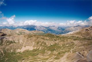
Jausiers provides two main cycling routes that head into the French Alps, tackling long, steady climbs. Both routes start from Jausiers and pass through places like Le Canton, Guégnier, Les Magnans, and Lans. The first route reaches the Cime de la Bonette at 2832 m over 24.1 km, while the Col de la Bonette route reaches 2701 m over 22.5 km. These routes offer significant elevation gains of over 1400 m, mostly on paved roads with some short gravel sections and cycle paths. The routes feature stretches without shops or services of up to 9.2 km. There are no nearby railway stations. Cyclists typically ride these demanding alpine climbs to reach the highest road points in the area and experience significant altitude changes within short distances.
More on terrain
Terrain
The terrain is mountainous with long, sustained climbs of approximately 23 km. Average gradients are around 6.8–6.9%, maximum gradients reach up to 10.6%, and elevation gains approach 1600 m. The highest points reach over 2800 m.