
Cycling in Mosset
1 cycling route from Mosset, France, 14 km, 14 km mapped in all, with up to 790 m of climbing in a day. Mountainous riding (56 m of climbing per km on average), mostly road routes. 1 named climb; the high point is 1,498 m on Col de Jau from Mosset. Best months to ride: Jun to Oct.
At a glance
- Routes
- 1
- Lengths
- 14 km
- Biggest day
- 790 m
- Terrain
- Mountainous
- Bike
- Road bike
- Difficulty
- Moderate
- Named climbs
- 1
- Best months
- Jun to Oct
- GPX
- Every route
Know before you go
Added up from the recorded routes and OpenStreetMap; nothing estimated.
- High point
- 1,498 m on Col de Jau from Mosset.
- Climbs
- 1 named climb · 1 ascent of 500 m or more.
Cycling guide to Mosset
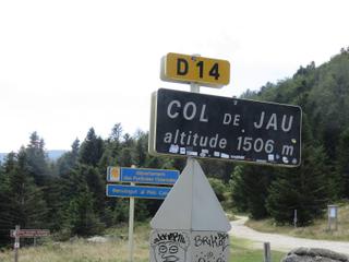
Mosset offers a challenging route to Col de Jau, with a 13.8 km point-to-point ride that gains 790 m in elevation. This climb begins shortly after leaving Mosset and rises steadily to a summit at 1498 m. The route is mostly paved with a very small proportion of gravel or unpaved surface, and has no cycle paths. The climb averages 6% gradient with a maximum gradient of 9.4%, making it a sustained uphill effort.
The longest stretch without services along this route is 13.6 km, so riders need to plan accordingly. There are no nearby railway stations or stops on the way. This ride is solely within France and offers a specific climb destination for cyclists looking to ride in the area around Mosset.
More on terrain
Terrain
The terrain is mountainous with a consistent climb. The main ascent is 13.1 km long, reaching a top elevation of 1498 m, with an average gradient of 6% and maximum gradient of 9.4%. The road surface is mostly paved with a small portion of unpaved sections.