
Cycling in Selva di Cadore
1 cycling route from Selva di Cadore, Italy, 14 km, 14 km mapped in all, with up to 905 m of climbing in a day. Mountainous riding (65 m of climbing per km on average), mostly road routes. 1 named climb; the high point is 2,230 m on Giau Pass from Selva di Cadore. Best months to ride: Jun to Aug.
At a glance
- Routes
- 1
- Lengths
- 14 km
- Biggest day
- 905 m
- Terrain
- Mountainous
- Bike
- Road bike
- Difficulty
- Moderate
- Named climbs
- 1
- Best months
- Jun to Aug
- GPX
- Every route
Know before you go
Added up from the recorded routes and OpenStreetMap; nothing estimated.
- High point
- 2,230 m on Giau Pass from Selva di Cadore.
- Climbs
- 1 named climb · 1 ascent of 500 m or more.
Cycling guide to Selva di Cadore
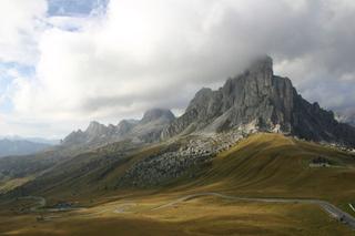
Selva di Cadore features a notable cycling route to Passo Giau, covering 13.7 km and climbing 905 m. The ride passes through several places including Santa Fosca, L'Andria, Bernart, Franceschin, Costa, Codalonga, and Posalz before reaching the pass. The route is mostly paved, with 98% pavement and just 2% gravel or unpaved sections. It involves 11.8 km on main roads without a cycle lane and has no cycle path. There are no railway stations near the route and the longest stretch without services is 5.6 km, requiring some preparation.
More on terrain
Terrain
The climb from Selva di Cadore to Passo Giau is mountainous with a 9.8 km ascent starting from 3.9 km into the route. The average gradient is 9.3%, with a maximum gradient of 12.1%, reaching a high point of 2230 m.