Cyclists.com

Giau Pass from Selva di Cadore

Selva di Cadore, ItalyRoad

Routed from the map This classic road was traced on OpenStreetMap and measured against the terrain model; no member has recorded it yet. Ridden it? Add your recording and photos.

14 km
Distance
905 m
Elevation gain
Moderate
Difficulty
Paved
Surface

Elevation profile

Total ascent
905 m
Distance
14 km
Elevation (m)05001,0001,5002,0002,5000 km5 km10 km14 kmHighest point2,230 m at 13.7 kmStart0 kmFinish14 km

Route overview

Riders looking for a challenging climb with sustained gradients over a mid-distance route.

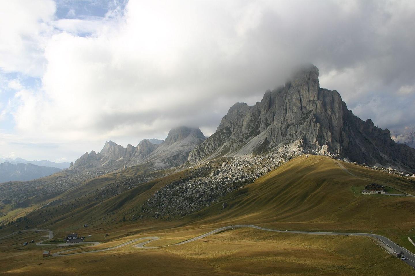
Giau Pass in Italy, a 13.7 km climb from Selva di Cadore gaining 905 m elevation.

Starting near Santa Fosca (0.3 km) and passing through several small localities including Selva di Cadore at 3.4 km, the route begins its main ascent from around 3.9 km. The climb is 9.8 km long, gaining 905 m, with an average gradient of 9.3% and sections up to 12.1%. It ends at Passo Giau at 13.6 km with an elevation of 2230 m. Almost all the route is paved (98%) and mostly on main roads (86%, mainly SP638 for 9.6 km). There are 11.8 km on main roads without a cycle lane. The profile features 72% climbing, with more than 8 km over 8% gradient and 2.4 km steeper than 10%. The longest descent of 3.6 km is near the start. Facilities include a café and supermarket around 3.3 km, water points at 1 km and 9.3 km, and a petrol station at 3.7 km. There is a 5.6 km stretch without cafés, shops or water between 3.7 and 9.3 km. The route passes near several peaks such as Col de Giatei (2184 m at 10.2 km), Torre Anna (2450 m at 12.5 km), Ra Gusela (2595 m at 13.3 km) and Punta di Zonia (2280 m at 13.7 km). Worth stopping at are the viewpoint at Passo Giau (13.6 km) and the peak Col de Giatei.

Highlights

  • Climbs 905 m over 9.8 km from Selva di Cadore
  • Passo Giau summit at 2230 m
  • Near peaks Ra Gusela (2595 m) and Punta di Zonia (2280 m)
  • Viewpoint at Passo Giau (13.6 km)

Along the route

Measured from the recorded track and OpenStreetMap.

Places passed

  1. Selva di Cadore 3.4 km
  2. Codalonga 3.7 km
  3. Posalz 4.4 km

Climbs

ClimbStarts atLengthGainAverageMaxTop
Punta di Zonia3.9 km9.8 km905 m9.3 %12.1 %2230 m

High point 2230 m at 13.7 km; low point 1325 m. Passes beneath Col de Giatei, Torre Anna, Ra Gusela.

Punta di Zonia · starts at 3.9 km

9.8 km at 9.3% · 905 m
14001600180020002200ELEVATION (M)9.0%9.0%9.6%9.3%9.4%9.2%8.5%9.8%8.6%0 km1234567899.7 kmDISTANCE (KM)Punta di Zonia · 2,230 mSTEEPEST 10.4%
< 4%4 – 7%7 – 10%> 10%

What this ride is like

Measured from OpenStreetMap along the track and the elevation profile.

Roads
86% main road · 12% minor road
Main roads
11.8 km on main roads without a cycle lane — likely busier
Main roads used
SP638 (10 km)
Surface
Paved throughout
Gradient
72% climbing · 28% descending · 1% flat
Steep sections
9.7 km over 5% · 8.8 km over 8% · 2.4 km over 10%
Longest descent
3.6 km from 0.1 km, dropping 253 m

Along the way

Within a few hundred metres of the track, from OpenStreetMap. Opening hours change — treat this as where to look, not a promise.

Food, water and shops

  1. 1 kmDrinking water · on the route
  2. 3.2 kmPharmacy · on the route
  3. 3.3 kmBar Val Fiorentina · café · on the route
  4. 3.3 kmCooperativa di San Vito · supermarket · on the route
  5. 3.7 kmPetrol station · on the route
  6. 9.3 kmDrinking water · on the route
  7. 13.6 kmRestaurant · 40 m off route

Worth a stop

  • 1.1 kmFaèr (attraction)
  • 10.2 kmCol de Giatei (peak, 2184 m)
  • 13.6 kmPasso Giau (viewpoint)

Stay after this ride

  • Berghotel Passo Giau · hotel · 80 m from the finish

Practical information

Surface
Paved
Route shape
Point to point
Riding time
59 min

Know before you go

  • 5.6 km without café, shop or water from 3.7 km to 9.3 km
  • 11.8 km on main roads without a cycle lane
  • Steep gradients: up to 12.1% maximum, 2.4 km over 10%

Routes are for inspiration. Roads, surfaces and conditions change — check locally and ride within your limits.