
Cyclists.com

Col de la Core from Castillon-en-Couserans

Castillon-en-Couserans, FranceRoad

Routed from the map This classic road was traced on OpenStreetMap and measured against the terrain model; no member has recorded it yet. Ridden it? Add your recording and photos.

16 km
Distance
858 m
Elevation gain
Moderate
Difficulty
Paved
Surface

Elevation profile

Total ascent
858 m
Distance
16 km
Elevation (m)02505007501,0001,2501,5000 km5 km10 km16 kmHighest point1,390 m at 16.2 kmStart0 kmFinish16 km

Route overview

Suitable for cyclists seeking a challenging 16 km climb with over 850 m ascent.

16.2 km cycle from Castillon-en-Couserans to Col de la Core, climbing 858 m in southern France.

The ride starts at Castillon-en-Couserans at 543 m elevation. It passes the hamlet of Hameau de Laffitte shortly after 0.5 km, then begins the first climb at 2 km. This initial ascent covers 4 km with an elevation gain of 191 m at an average gradient of 4.8%, reaching 753 m. After a brief flat or gentle section, the route tackles the main climb at 6.6 km. This second climb extends for 9.6 km, gaining 638 m with an average gradient of 6.7% and max of 8.8%, reaching the highest point at 1389 m at the finish. The road surface is 99% paved, predominantly on main roads with 14.3 km ridden without a cycle lane, including 12.4 km on road D 17. There is a longest stretch of 5.4 km without access to cafe, shop, or water from 6 to 11.4 km, so prepare accordingly. Along the route, convenient facilities are clustered near the start: several bakeries, convenience stores, a bar, and bike rental are within the first kilometre. Toilets and drinking water are available near 0 km and again close to 11.3 km. The area also features nearby peaks Le Castera and Couret near the start, and peak 1328 a few km before the finish.

Highlights

  • Summit at 1389 m Col de la Core
  • Peak 1328 near 12.7 km
  • Peaks Le Castera and Couret near start
  • Main climb 9.6 km at 6.7% average gradient

Along the route

Measured from the recorded track and OpenStreetMap.

Climbs

ClimbStarts atLengthGainAverageMaxTop
Hameau de Laffitte climb2 km4 km191 m4.8 %6.8 %753 m
Castillon-en-Couserans climb6.6 km9.6 km638 m6.7 %8.8 %1389 m

High point 1389 m at 16.2 km; low point 543 m. Passes beneath Le Castera, Couret.

Hameau de Laffitte climb · starts at 2 km

3.9 km at 4.9% · 191 m
600650700750ELEVATION (M)5.7%5.7%2.4%0 km1233.9 kmDISTANCE (KM)Hameau de Laffitte climb · 752 mSTEEPEST 5.7%
< 4%4 – 7%7 – 10%> 10%

Castillon-en-Couserans climb · starts at 6.6 km

9.6 km at 6.7% · 638 m
8009001000110012001300ELEVATION (M)6.0%7.9%7.3%5.9%7.9%6.5%7.3%5.1%0 km123456789.6 kmDISTANCE (KM)Castillon-en-Couserans climb · 1,389 mSTEEPEST 7.9%
< 4%4 – 7%7 – 10%> 10%

What this ride is like

Measured from OpenStreetMap along the track and the elevation profile.

Roads
88% main road · 8% minor road · 4% quiet street
Main roads
14.3 km on main roads without a cycle lane — likely busier
Main roads used
D 17 (12 km)
Surface
Paved throughout
Gradient
88% climbing · 3% descending · 9% flat
Steep sections
11.2 km over 5% · 1.3 km over 8%

Along the way

Within a few hundred metres of the track, from OpenStreetMap. Opening hours change — treat this as where to look, not a promise.

Food, water and shops

  1. 0 kmWC Public · toilets · 200 m off route
  2. 0.1 kmCarrefour Express · convenience store · on the route
  3. 0.1 kmDrinking water · 210 m off route
  4. 0.1 kmPharmacie Dubarry · pharmacy · on the route
  5. 0.3 kmBoulangerie Pâtisserie Aux délices des 4 vallées · bakery · on the route
  6. 0.3 kmEscapade · bike rental · on the route
  7. 6 kmCafé · 140 m off route
  8. 11.3 kmToilets · 120 m off route
  9. 11.4 kmWater tap · 140 m off route

Worth a stop

  • 12.7 km1328 (peak)

At the start

  • L'Escrive · bakery · 80 m
  • Boulangerie Pâtisserie Aux délices des 4 vallées · bakery · 300 m
  • Carrefour Express · convenience store · 50 m
  • Le Picolo · bar · 50 m
  • Rôtisserie des 4 Vallées · fast food · 110 m

Practical information

Surface
Paved
Route shape
Point to point
Riding time
1 h 09 min
Best months
May to Oct — daily highs of 18–25 °C in those months

Know before you go

  • 14.3 km on main roads without cycle lane
  • 5.4 km longest stretch without café, shop or water from 6 to 11.4 km
  • Sections of gradient up to 8.8% max
  • Almost entire route is climbing (88%)

Routes are for inspiration. Roads, surfaces and conditions change — check locally and ride within your limits.

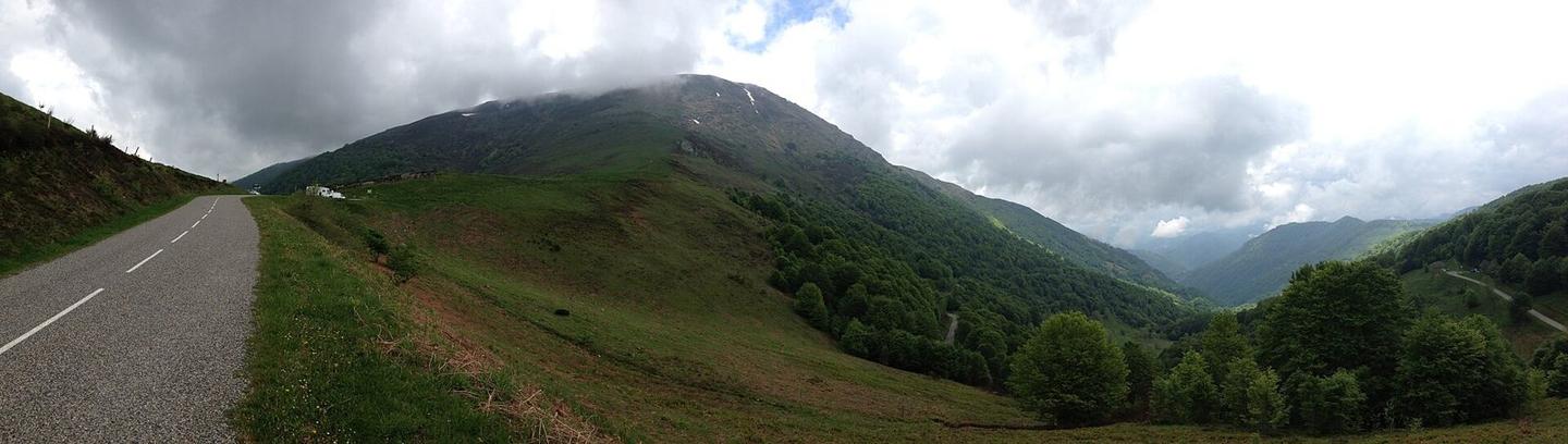
2 photographs from the road

Photo: Ronde de l'Isard · CC BY 2.0 · Wikimedia Commons · Photo: Vassil · CC0 · Wikimedia Commons