
Cyclists.com

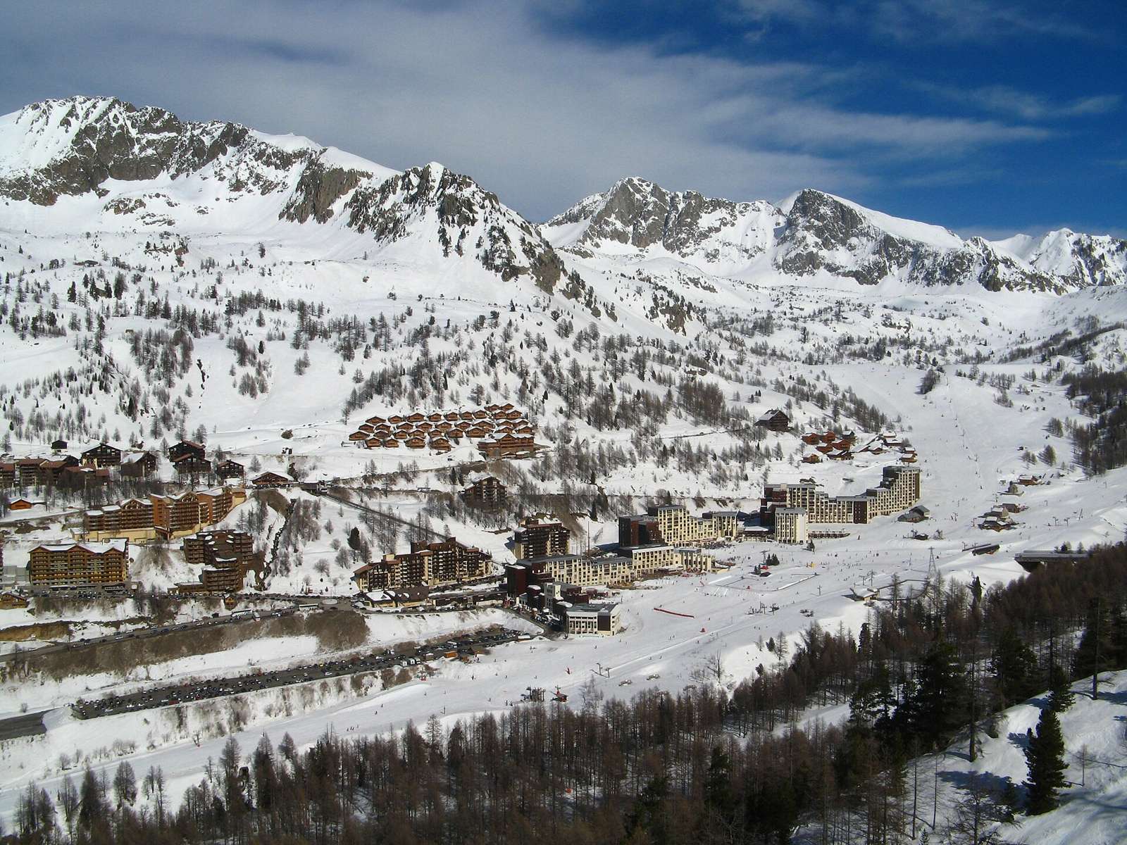
Isola 2000 from Isola

Isola, FranceRoad

Routed from the map This classic road was traced on OpenStreetMap and measured against the terrain model; no member has recorded it yet. Ridden it? Add your recording and photos.

16 km
Distance
1,147 m
Elevation gain
Moderate
Difficulty
Paved
Surface

Elevation profile

Total ascent
1,147 m
Distance
16 km
Elevation (m)05001,0001,5002,0002,5000 km5 km10 km16 kmHighest point2,028 m at 16.2 kmStart0 kmFinish16 km

Route overview

Cyclists suited to a fairly steep 16 km climb with over 1100 m elevation gain.

16.2 km climb from Isola to Isola 2000 in France, gaining 1147 m.

This route starts in Isola at 881 m and ascends 16.2 km to Isola 2000 at 2028 m, gaining 1147 m. The climb averages 7.1% gradient with a maximum of 14.8% and is mostly uphill (99% climbing). The first half of the ascent accounts for 49% of the total elevation gain. The road is nearly fully paved (98%), with 15 km on main roads and 0.8 km on quiet streets. The main climb follows the M 97 road for 12.2 km. Almost all main roads lack cycle lanes (15 km), and 14.5 km have speed limits above 80 km/h. The surface includes 2% gravel or unpaved and 1% unmapped. Facilities include bakeries, supermarkets and drinking water close at both start and finish: "La Baguette Magic" bakery and La Guerche supermarket near the start, Sherpa supermarket and pubs and restaurants like The Hunter - Irish pub, La Marmotte, and L'Avalanche at the finish. Toilets and a bike repair stand are also available near the start. There is a long stretch of 15.8 km without café, shop or water after the first 0.2 km from Isola.

Highlights

  • 16.2 km climb to 2028 m
  • Average gradient 7.1%, max 14.8%
  • M 97 main road for 12.2 km
  • Isola 2000 finish with shops and restaurants

Along the route

Measured from the recorded track and OpenStreetMap.

Climbs

ClimbStarts atLengthGainAverageMaxTop
Isola climb0 km16.2 km1146 m7.1 %14.8 %2028 m

High point 2028 m at 16.2 km; low point 881 m.

Isola climb · starts at 0 km

16.2 km at 7.1% · 1146 m
100012001400160018002000ELEVATION (M)9.5%6.3%6.6%6.7%8.7%8.4%5.8%6.9%6.8%3.8%6.1%6.7%6.4%6.4%0 km123456789101112131415.9 kmDISTANCE (KM)Isola climb · 2,028 mSTEEPEST 10.5%
< 4%4 – 7%7 – 10%> 10%

What this ride is like

Measured from OpenStreetMap along the track and the elevation profile.

Roads
93% main road · 5% quiet street
Main roads
15 km on main roads without a cycle lane — likely busier
Fast roads
14.5 km on roads with a limit of 80 km/h or more
Main roads used
M 97 (12 km)
Surface
Paved throughout
Gradient
99% climbing · 1% descending · 0% flat
Steep sections
14.1 km over 5% · 4.3 km over 8% · 1.5 km over 10%

Along the way

Within a few hundred metres of the track, from OpenStreetMap. Opening hours change — treat this as where to look, not a promise.

Longest stretch without a café, shop or water: 16 km, from 0 km to 16 km.

Food, water and shops

  1. 0 kmToilets · 160 m off route
  2. 0.1 kmLa Baguette Magic · bakery · 40 m off route
  3. 0.1 kmLa Guerche · supermarket · 30 m off route
  4. 0.1 kmDrinking water · on the route
  5. 0.1 kmRepair stand · 100 m off route
  6. 16.1 kmSherpa · supermarket · 60 m off route
  7. 16.1 kmDrinking water · 40 m off route
  8. 16.1 kmToilets · 70 m off route
  9. 16.1 kmPharmacy · 50 m off route
  10. 16.2 kmBakery · 50 m off route

Worth a stop

  • 0 kmLe Village (viewpoint)

At the start

  • La Baguette Magic · bakery · 50 m
  • La Guerche · supermarket · 40 m

At the finish

  • Sherpa · supermarket · 140 m
  • The hunter - Irish pub · pub · 70 m
  • La marmotte · restaurant · 140 m
  • L'avalanche · restaurant · 170 m

Stay after this ride

  • Pas Du Loup · hotel · 80 m from the finish
  • Le Chastillon · hotel · 270 m from the finish
  • Le Bristol · hotel · 380 m from the finish
  • Hôtel Druos · hotel · 180 m from the finish
  • Le Diva · hotel · 260 m from the finish

Practical information

Surface
Paved
Route shape
Point to point
Riding time
1 h 09 min

Know before you go

  • 15 km on main roads without cycle lane
  • 14.5 km on roads with 80 km/h+ speed limit
  • 15.8 km longest stretch without café, shop or water
  • Steep gradients up to 14.8%

Routes are for inspiration. Roads, surfaces and conditions change — check locally and ride within your limits.

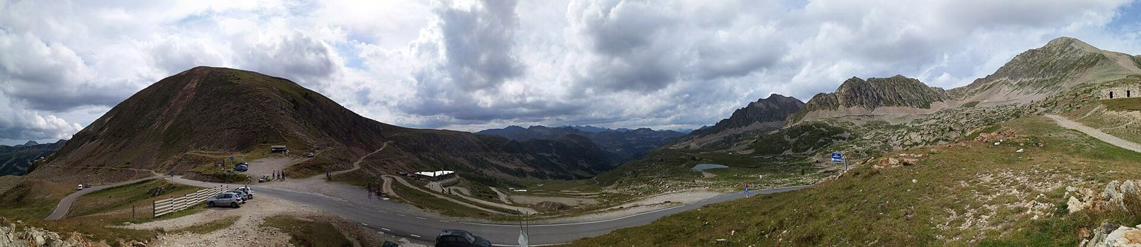
2 photographs from the road

Photo: Patrick Rouzet · CC BY-SA 3.0 · Wikimedia Commons · Photo: Jpchevreau · CC BY-SA 4.0 · Wikimedia Commons

More rides from Isola