
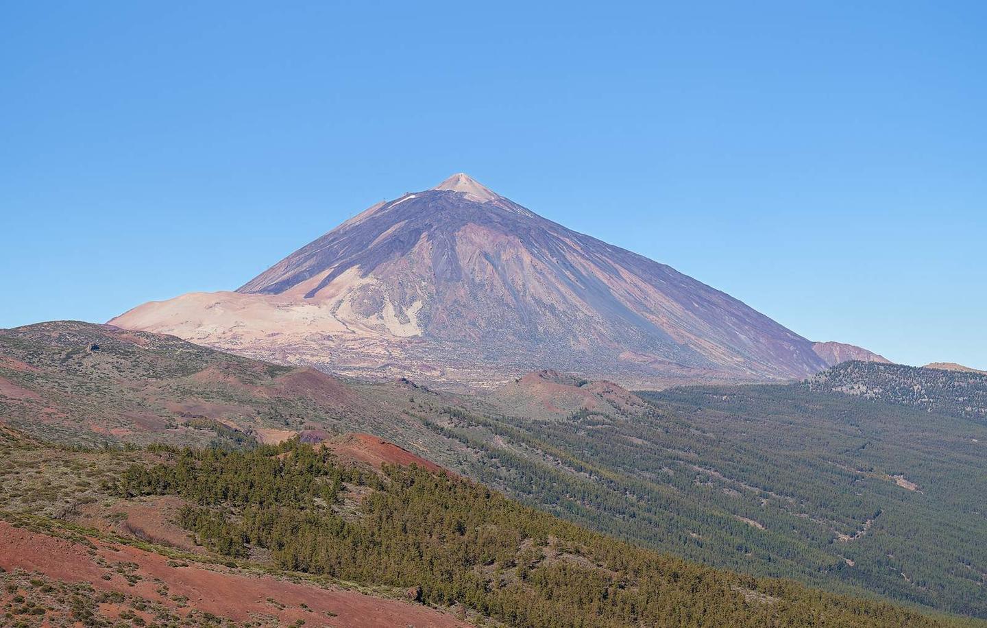
Teide from Los Cristianos
- 44 km
- 2,512 m
- Hard
- Paved
Elevation profile
- 2,512 m
- 44 km
Route overview
Suitable for experienced climbers seeking a challenging 44 km ascent with over 2500m climbing.
44 km climb from Los Cristianos to 2346m near Teide, Spain with 2512m elevation gain.
The route starts at Los Cristianos (23m) and quickly reaches Oasis del Sur at 1.8 km. From 1 km there is a 29.3 km climb gaining 2176m at an average gradient of 7.4%, peaking at 17.1%. This climb follows main roads for 29.6 km, mostly on TF-21 for 24 km. The surface is 98% paved with 2% gravel or unpaved. After the initial climb, the route continues with a smaller 7.2 km ascent from 36.8 km gaining 335m at 4.7%. The road reaches a high point near 2346m at 43.9 km. The profile shows 80% of the route is climbing, 9% descending, and 11% flat. Steep sections include a 500m stretch at 16.1% gradient near 10.4 km. Along the way are several places: La Camella, Arona, Trevejos, and Vilaflor de Chasna. Facilities include cafes like Palmera (0.7 km), Aroma (8.6 km), Dulceria Vilaflor bakery (18.2 km), and cafes near the top. There are shops, petrol stations, bike shops, and toilets mostly near the start and around Vilaflor. The route includes 11.5 km from 28.2 to 39.7 km with no cafes, shops, or water.
Highlights
- Climb from 23m to 2346m elevation
- Steepest 500m at 16.1% gradient near 10.4 km
- Passing through Vilaflor de Chasna at 18.3 km
- Longest climb 29.3 km ascending 2176m
Along the route
Places passed
Climbs
| Climb | Starts at | Length | Gain | Average | Max | Top |
|---|---|---|---|---|---|---|
| Oasis del Sur climb | 1 km | 29.3 km | 2176 m | 7.4 % | 17.1 % | 2199 m |
| Los Cristianos climb | 36.8 km | 7.2 km | 335 m | 4.7 % | 8.7 % | 2346 m |
Oasis del Sur climb · starts at 1 km
Los Cristianos climb · starts at 36.7 km
What this ride is like
- Roads
- 67% main road · 16% quiet street · 15% minor road · 2% path
- Main roads
- 29.6 km on main roads without a cycle lane — likely busier
- Main roads used
- TF-21 (24 km), TF-51 (4 km)
- Surface
- Paved throughout
- Gradient
- 80% climbing · 9% descending · 11% flat
- Steep sections
- 24.6 km over 5% · 11.2 km over 8% · 5.9 km over 10% · steepest 500 m averages 16.1% at 10.4 km
- Longest descent
- 3.8 km from 30.6 km, dropping 166 m
Along the way
Food, water and shops
- 0 kmPlaya Los Cristianos · toilets · 210 m off route
- 0.7 kmPalmera · café · on the route
- 1 kmSupercor · supermarket · on the route
- 1 kmBP · petrol station · 50 m off route
- 1 kmBlesa · pharmacy · on the route
- 6.2 kmEstación de Servicio Disa La Camella · petrol station · on the route
- 6.4 kmSupermarket · 60 m off route
- 8.6 kmAroma · café · on the route
- 12 kmLa Escalona · supermarket · on the route
- 17.9 kmConsultorio Vilaflor · clinic · on the route
- 18.2 kmDulceria Vilaflor · bakery · on the route
- 18.2 kmSupermercado Vilaflor · convenience store · on the route
- 18.8 kmBiciBox · repair stand · on the route
- 27.9 kmToilets · 180 m off route
- 32.8 kmToilets · 80 m off route
- 39.7 kmCafetería Los Roques · café · 150 m off route
- 39.7 kmToilets · 160 m off route
- 43.9 kmCafeteria · café · 120 m off route
Need to bail out?
- 0 km — Fred. Olsen Express terminal (ferry), 560 m off route
Worth a stop
- 19.3 km — Pino de las dos Pernadas (attraction)
- 23.3 km — Mirador de Vilaflor (viewpoint)
- 28.2 km — Área Recreativa Las Lajas (picnic site)
- 33.2 km — Mirador de Boca Tauce (viewpoint)
- 37.7 km — Mirador del Llano de Ucanca (viewpoint)
At the start
- Rincón del Pan · bakery · 70 m
- Palmera · café · 240 m
- Panaderia Croquant · patisserie · 110 m
- Churrería Marcos · café · 140 m
- Panaderia Ducleria · bakery · 320 m
At the finish
- Cafeteria · café · 120 m
- Cafetería Teleférico del Teide · restaurant · 110 m
Stay after this ride
- Parador de Las Cañadas del Teide · hotel · 3.5 km from the finish
- Zona de bivac · campsite · 3.6 km from the finish
Practical information
- Paved
- Point to point
- 3 h 10 min
Know before you go
- 11.5 km without café, shop or water between 28.2 km and 39.7 km
- 29.6 km on main roads without cycle lane
- Steep gradient sections over 10%, max 17.1%
- 2% gravel or unpaved surface
