

Cyclists.com

Col du Platzerwasel from Munster

16 km road cycling route804 m climbing1 h 07 minGPX

Munster, France · Road

A mountainous 16 km road cycling route from Munster through Luttenbach-près-Munster, Breitenbach-Haut-Rhin and Muhlbach-sur-Munster, with 804 m of climbing over the Metzeral climb.

Routed from the map This classic road was traced on OpenStreetMap and measured against the terrain model; no member has recorded it yet. Ridden it? Add your recording and photos.

Download GPXMap

At a glance

Best for
Short, climbing-heavy rides
Distance
15.6 km
Point to point
Elevation gain
804 m
52 m per km
Riding time
1 h 07 min
moving time, estimated
Difficulty
Moderate
Bike
Road bike
Surface
Paved
Best months
May to Sep
Munster climate, 10 years
Navigation
GPX download
free, no sign-in
Start → finish
Munster

Map and elevation profile

Elevation profile

Total ascent
804 m
Distance
16 km
02505007501,0001,250m0 km51016 km1,189 m · highest, at 15.6 kmStartFinish

Route description

  1. Munster
  2. Luttenbach-près-Munsterkm 2
  3. Breitenbach-Haut-Rhinkm 4
  4. Muhlbach-sur-Munsterkm 5
  5. Metzeralkm 7
  6. Metzeral climbkm 7
  7. Sondernachkm 8

The ride starts in Munster at 385 m and ascends steadily to 1189 m at Col du Platzerwasel over 15.6 km. The route features a significant climb starting at 6.6 km: a 9 km ascent with 705 m gain, averaging 7.8% gradient and maxing at 16.4%. The profile is predominantly climbing for 83% of the distance, especially in the second half after the first 6.6 km, including 7.1 km over 5% and 4.7 km exceeding 8%.

Why ride this route?

  • Climbs the Metzeral climb (9 km at 7.8 %).
  • Tops out at 1,189 m, 15.6 km in.

Highlights

  • Col du Platzerwasel at 1189 m
  • Long climb of 9 km from km 6.6
  • Max gradient of 16.4%
  • Ride starts and ends in Munster

Along the route

Measured from the route line, the Copernicus elevation model and OpenStreetMap.

Places passed

  1. Breitenbach-Haut-Rhin 3.7 km
  2. Muhlbach-sur-Munster 4.8 km
  3. Metzeral 6.6 km
  4. Sondernach 8.4 km

On the road

  • Water 0 km
  • Au P'tit Munster (Restaurant) 0 km
  • Meyer (Café) 0 km
  • Restaurant Winstub la Schlitte (Restaurant) 0 km
  • Winstub S’Stewla (Restaurant) 0 km
  • Hôtel-Restaurant de la Cigogne (Restaurant) 0 km
  • L'olivier (Restaurant) 0.1 km
  • Salon de The Gilg (Café) 0.1 km
  • La Dolce Vita (Restaurant) 0.1 km
  • La table des Malker (Restaurant) 0.1 km
  • Auberge aux quatre saisons (Restaurant) 0.3 km
  • Chez Vincent (Café) 0.3 km

Climbs

Climbs in ride order: where each starts, what this ride climbs, and the full named ascent
ClimbStarts atOn this rideFull ascentTop on this ride
Metzeral climb6.6 km9 km · 705 m · 7.8 % · max 16.4 %9 km · 705 m · 7.8 %1189 m

High point 1189 m at 15.6 km; low point 385 m. Passes beneath Schnepfenriedkopf.

On this ride: the part this route climbs, cut from its own elevation profile. Full ascent: the whole named climb, measured the same way on every ride that uses it (its climb page).

Metzeral climb · full ascent, starts at 6.6 km

9 km at 7.8% · 705 m
5006007008009001,0001,100m8.8%8.4%8.1%8.0%7.2%9.6%0 km123456788.9 km1,189 msteepest 12.3%
< 4%4 – 7%7 – 10%> 10%

Know before you go

  • 9.2 km on main roads without cycle lanes
  • 6.4 km on roads with speed limits of 80 km/h or more
  • Longest stretch without café, shop, or water is 5.8 km from km 9.8 to 15.6
  • Gravel or unpaved for 3% of the route

Routes are for inspiration. Roads, surfaces and conditions change — check locally and ride within your limits.

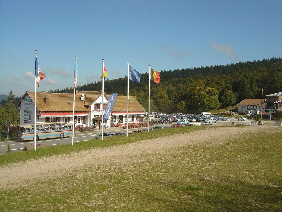
2 photographs from the road

Photo: Maxence Lagalle from Poitiers, France · CC BY-SA 2.0 · Wikimedia Commons · Photo: Gilles Guillamot · CC BY-SA 3.0 · Wikimedia Commons · Photo: mededeler · CC BY 2.0 · Wikimedia Commons

About this route

Route line
Routed on OpenStreetMap roads with bicycle routing, then measured like a recorded ride.
Elevation
Recalculated from the Copernicus GLO-90 terrain model every 50 m, not the device’s barometer.
Best months
Ten years of ERA5 weather for Munster (Open-Meteo).
GPX
Generated from the route line: track points only, no timestamps or personal data.
Page added
Page last updated

See something wrong with this ride?

Similar length from Munster