
Col de Portet from Saint-Lary-Soulan
- 18 km
- 1,397 m
- Moderate
- Paved
Elevation profile
- 1,397 m
- 18 km
Route overview
This ride suits cyclists looking for a challenging 17.6 km mountain climb with significant elevation gain.
A 17.6 km climb from Saint-Lary-Soulan to Col de Portet in France with 1397 m ascent.
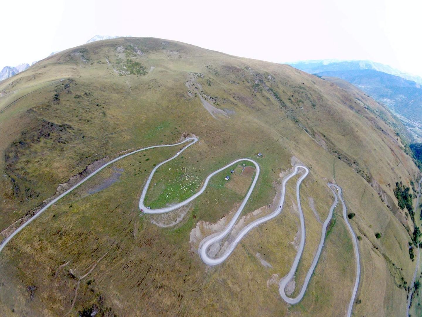
Starting from Saint-Lary-Soulan near Trachère and Vignec, the route begins its main climb at 1.3 km. This 16.2 km ascent gains 1387 m at an average gradient of 8.6%, reaching a height of 2207 m at the Col de Portet. The gradient is sustained with 16 km over 5%, 11.3 km over 8%, and 3.6 km over 10%, with a maximum gradient of 11.1%. The climb passes places including Vielle-Aure at 2.2 km, Soulan at 6.5 km, and Espiaube at 9.4 km. The road surface is 99% paved with a negligible 1% unpaved, mostly on minor roads (9.4 km) and main roads (7.2 km) including the Route du Col de Portet and D 123. The main roads have no cycle lanes over the full 7.2 km section. Cafés and shops are available at the start within Saint-Lary-Soulan, including the Coucaril café and Carrefour Montagne convenience store, but the longest stretch without café, shop or water spans 9.3 km between 6.3 km and 15.6 km. The route finishes near La Tourette peak (2328 m) and Soum de Terre Nère (2331 m).
Highlights
- Col de Portet summit at 2207 m
- La Tourette peak nearby at 2328 m
- Long climb of 16.2 km starting at km 1.3
- Route du Col de Portet and D 123 roads
Along the route
Places passed
Climbs
| Climb | Starts at | Length | Gain | Average | Max | Top |
|---|---|---|---|---|---|---|
| La Tourette | 1.3 km | 16.2 km | 1387 m | 8.6 % | 11.1 % | 2207 m |
La Tourette · starts at 1.3 km
What this ride is like
- Roads
- 54% minor road · 41% main road · 3% quiet street
- Main roads
- 7.2 km on main roads without a cycle lane — likely busier
- Main roads used
- Route du Col de Portet (8 km), D 123 (7 km)
- Surface
- Paved throughout
- Gradient
- 95% climbing · 1% descending · 5% flat
- Steep sections
- 16 km over 5% · 11.3 km over 8% · 3.6 km over 10%
Along the way
Food, water and shops
- 0 kmDrinking water · on the route
- 0 kmToilets · 40 m off route
- 0.1 kmCoucaril · café · on the route
- 0.1 kmCarrefour Montagne · convenience store · on the route
- 0.1 kmPharmacie Principale · pharmacy · 40 m off route
- 0.2 kmBike Shop · bike shop · 130 m off route
- 6.3 kmDrinking water · on the route
- 17.4 kmBar · 50 m off route
- 17.4 kmToilets · 50 m off route
Worth a stop
- 0 km — Carrousel (attraction)
- 6.4 km — Vierge (monument)
- 17.1 km — La Tourette (peak, 2328 m)
At the start
- L'Épi d'Aure · bakery · 10 m
- Coucaril · café · 80 m
- Le desman Café · café · 70 m
- Carrefour Montagne · convenience store · 30 m
- L'atelier du burger · restaurant · 90 m
At the finish
- Les Trois Guides · restaurant · 830 m
Practical information
- Paved
- Point to point
- 1 h 15 min
Know before you go
- Longest stretch without café, shop or water: 9.3 km from km 6.3 to 15.6
- 7.2 km on main roads without a cycle lane
