
Cycling in Aywaille
1 cycling route from Aywaille, Belgium, 6 km, 6 km mapped in all, with up to 104 m of climbing in a day. Mountainous riding (17 m of climbing per km on average), mostly road routes, 89% paved. Best months to ride: May to Sep.
At a glance
- Routes
- 1
- Lengths
- 6 km
- Biggest day
- 104 m
- Terrain
- Mountainous
- Surface
- 89% paved
- Bike
- Road bike with sturdy tyres, or gravel bike
- Difficulty
- Easy
- Best months
- May to Sep
- GPX
- Every route
Know before you go
Added up from the recorded routes and OpenStreetMap; nothing estimated.
- Surface
- 89% paved · 11% gravel or unpaved.
- Roads
- 10% of the riding on main roads without a cycle lane.
- High point
- 301 m on Côte de La Redoute from Aywaille.
- Bail-outs
- A railway station or ferry within reach on 1 route.
Cycling guide to Aywaille
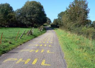
Aywaille serves as a starting point for routes such as the Côte de La Redoute from Aywaille, a 6.3 km point-to-point ride passing through Remouchamps, Stoqueu, Kin, and Sougné. The route features one main climb beginning at 4.8 km, stretching 1.6 km with a 100 m elevation gain. The paths are mostly paved with 90% tarmac and 10% gravel or unpaved surfaces, and include a short cycle path section of 0.9 km. Along the 6.3 km route, there is under 1 km on main roads without cycle lanes, and a railway station close by to Aywaille. No specific months or temperatures are recorded for this route.
More on terrain
Terrain
The route includes a steady climb starting at 4.8 km for 1.6 km with an average gradient of 6.4% and a maximum of 8.9%, reaching the top at 230 m. The highest point on the route is 301 m above sea level. The terrain is a mix of paved and some gravel surfaces.