
Cycling in Geraardsbergen
1 cycling route from Geraardsbergen, Belgium, 1 km, 1 km mapped in all, with up to 57 m of climbing in a day. Mountainous riding (57 m of climbing per km on average), mostly road routes. Best months to ride: May to Sep.
At a glance
- Routes
- 1
- Lengths
- 1 km
- Biggest day
- 57 m
- Terrain
- Mountainous
- Bike
- Road bike
- Difficulty
- Easy
- Best months
- May to Sep
- GPX
- Every route
Know before you go
Added up from the recorded routes and OpenStreetMap; nothing estimated.
Cycling guide to Geraardsbergen
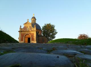
Geraardsbergen offers cycling routes centred on the Muur van Geraardsbergen, a 0.9 km climb starting within the town. Riders tackle a 57 m elevation gain entirely on paved roads, with an average gradient of 6.1% and maximum of 7.2%, reaching a height of 95 m. The journey begins and ends in Geraardsbergen itself, which has a railway station close to the route. Services appear frequently, with no more than 0.4 km without amenities along this short climb.
More on terrain
Terrain
The terrain is steep and short, with the climb averaging 6.1% gradient and peaking at 7.2%. The highest point on the route is 95 m, and the surface is fully paved.