
Cycling in Carrick Castle
1 cycling route from Carrick Castle, Argyll and Bute, United Kingdom, 33 km, 33 km mapped in all, with up to 654 m of climbing in a day. Mountainous riding (20 m of climbing per km on average), mostly gravel routes, 17% paved. Best months to ride: Jun to Aug.
At a glance
- Routes
- 1
- Lengths
- 33 km
- Biggest day
- 654 m
- Terrain
- Mountainous
- Surface
- 17% paved
- Bike
- Gravel or mountain bike
- Difficulty
- Moderate
- Best months
- Jun to Aug
- Longest gap
- 26 km
- GPX
- Every route
Know before you go
Added up from the recorded routes and OpenStreetMap; nothing estimated.
- Surface
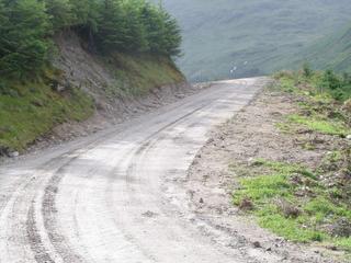
- 17% paved · 83% gravel or unpaved — 27 km of gravel or unpaved road across the routes.
- Roads
- 5% of the riding on main roads without a cycle lane.
- High point
- 320 m on Ardgartan Peninsula Circuit.
- No services
- 26 km on Ardgartan Peninsula Circuit.
Cycling guide to Carrick Castle
Carrick Castle in Argyll and Bute offers cycling mainly on the Ardgartan Peninsula Circuit. This 32.8 km loop starts near Lochgoilhead and features 654 m of elevation gain. The route is predominantly unpaved or gravel, with 83% of the distance not paved and only 17% paved. Riders use main roads without cycle lanes for just 1.5 km. There are no railway stations or cycle paths on this loop, and services are absent for stretches up to 25.6 km.
The biggest climb on this route begins at 24.8 km, lasting 6.2 km with an average gradient of 4.9% and a maximum of 12.5%, reaching a top height of 320 m. This provides challenging elevation suitable for cyclists seeking climbs in the area. The route does not offer access to other places but remains a significant regional option in Argyll and Bute.
More on terrain
Terrain
The terrain is mountainous with a 320 m high point. The main climb is 6.2 km long, averaging 4.9% gradient and peaking at 12.5%. Most of the surfaces are gravel or unpaved, covering 83% of the loop.