
Cycling in Grenoble
2 cycling routes from Grenoble, France, 18 km, 36 km mapped in all, with up to 1,110 m of climbing in a day. Mountainous riding (57 m of climbing per km on average), mostly road routes. 2 named climbs; the high point is 1,323 m on Col de Porte from Grenoble. Best months to ride: Apr to Oct.
At a glance
- Routes
- 2
- Lengths
- 18 km
- Biggest day
- 1,110 m
- Terrain
- Mountainous
- Bike
- Road bike
- Difficulty
- Moderate
- Named climbs
- 2
- Best months
- Apr to Oct
- GPX
- Every route
Know before you go
Added up from the recorded routes and OpenStreetMap; nothing estimated.
- High point
- 1,323 m on Col de Porte from Grenoble.
- Climbs
- 2 named climbs · 2 ascents of 500 m or more.
Cycling guide to Grenoble
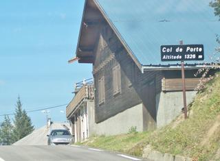
Grenoble is a starting point for routes climbing into the mountains, including the Col de Porte and Saint-Nizier-du-Moucherotte. The Col de Porte route is 17.7 km with 1110 m of ascent, mostly paved and features a main climb 15.4 km long averaging 7.2% gradient. The Saint-Nizier-du-Moucherotte route covers 18 km with 941 m of gain, including a 13.2 km climb averaging 7% gradient. Both routes involve main roads without cycle lanes for over 10 km and have short sections of cycle paths. Services are limited, with the longest stretch without any for 4.2 km on the Col de Porte and 6 km on the Saint-Nizier-du-Moucherotte route.
More on terrain
Terrain
Routes from Grenoble are mountainous with sustained climbing, averaging around 7% gradients and maximum gradients between 12.8% and 14.4%. Summits reach heights of 1156 m to 1323 m on these routes.