
Cycling in Le Falgoux
1 cycling route from Le Falgoux, France, 11 km, 11 km mapped in all, with up to 654 m of climbing in a day. Mountainous riding (59 m of climbing per km on average), mostly road routes. 1 named climb; the high point is 1,575 m on Pas de Peyrol from Le Falgoux. Best months to ride: Jun to Sep.
At a glance
- Routes
- 1
- Lengths
- 11 km
- Biggest day
- 654 m
- Terrain
- Mountainous
- Bike
- Road bike
- Difficulty
- Easy
- Named climbs
- 1
- Best months
- Jun to Sep
- GPX
- Every route
Know before you go
Added up from the recorded routes and OpenStreetMap; nothing estimated.
- High point
- 1,575 m on Pas de Peyrol from Le Falgoux.
- Climbs
- 1 named climb · 1 ascent of 500 m or more.
Cycling guide to Le Falgoux
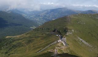
Le Falgoux is a starting point for the Pas de Peyrol climb, a popular cycling route in France. Riders begin close to the village and travel 11.2 km on paved roads to reach the summit at 1575 m. The route involves a continuous climb of 9.4 km averaging 6.7% gradient, with sections reaching 14.5%. There are no towns or services along the entire 11.2 km route, and the road is mostly main road class with no cycle lanes. The lack of nearby railway stations means that access is likely by road transport. This climb provides a sustained challenge beneath the peak at Pas de Peyrol and is suitable for those seeking a tough ascent in a single effort from Le Falgoux.
More on terrain
Terrain
The terrain is mountainous with a continuous 9.4 km climb gaining 630 m at an average gradient of 6.7%, peaking at a maximum gradient of 14.5%. The summit lies at 1575 m above sea level. The entire route is paved and follows main roads without cycle lanes.