Cyclists.com

Col des Bordères from Arrens-Marsous

Arrens-Marsous, FranceRoad

Routed from the map This classic road was traced on OpenStreetMap and measured against the terrain model; no member has recorded it yet. Ridden it? Add your recording and photos.

5 km
Distance
298 m
Elevation gain
Easy
Difficulty
Paved
Surface

Elevation profile

Total ascent
298 m
Distance
5 km
Elevation (m)02004006008001,0001,2000 km2 km4 km5 kmHighest point1,162 m at 5.0 kmStart0 kmFinish5 km

Route overview

Suitable for riders looking for a short but steep 5 km climb with 298 m elevation gain.

A 5 km climb from Arrens-Marsous to Col des Bordères in France with 298 m elevation gain.

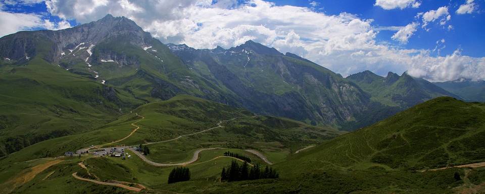
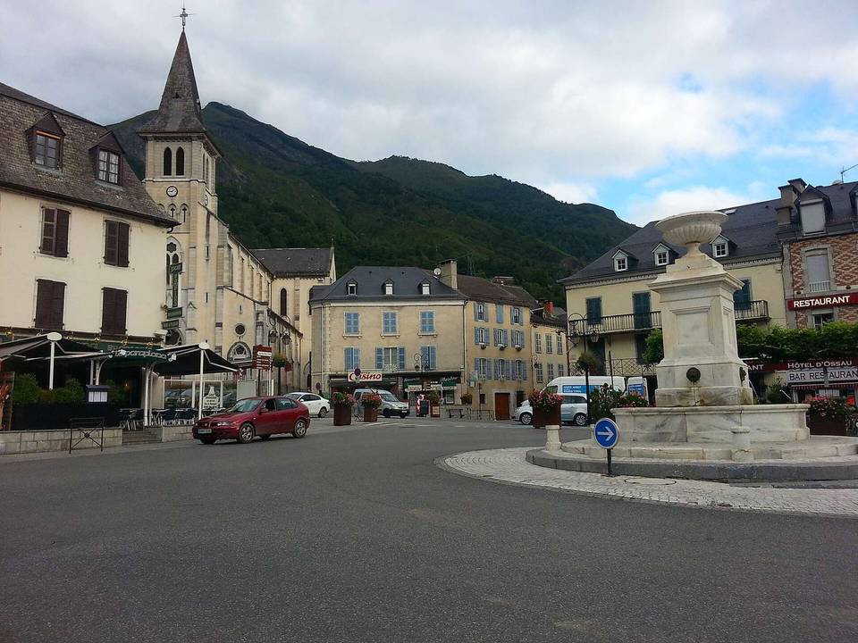
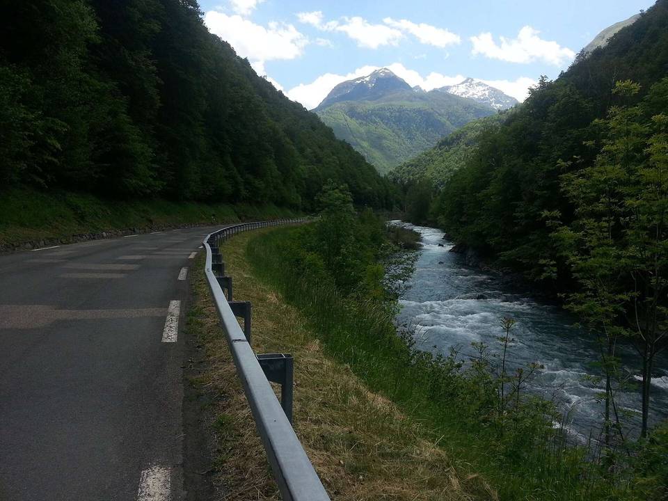
This route starts at Arrens-Marsous (also encompassing Marsous and Arrens) and immediately begins climbing at about 1 km. The climb extends for 4 km and gains around 282 m, topping out at 1,162 m. The average gradient is 7% with sections reaching a maximum of 10.5%. The climb ends at Col des Bordères. The road surface is 94% paved with a small 4% gravel/unpaved section and 2% unmapped. The route mainly travels on minor roads, covering about 4 km, with 3.7 km on the D 603. The profile is mostly climbing (94%), with minor descending and flat sections. There is a stretch of nearly 4 km (from 1.1 to 4.9 km) without any café, shop, or water source. At the start, there are several amenities including a bakery (Boulangerie cafe), convenience store (Proxi), bar (l'isard perché), and restaurant (L'Apistomaque). Mid-route, drinking water is available close to km 1.1 and toilets near km 0.7. Near the finish, the restaurant Auberge du Pic de Pan lies just off route at 4.9 km. Peaks near the road include Le belvédere near km 2, pic de Prédouset at km 3.3, Tuc de Picou at km 4.5, and Pic de Pan at the top at km 5.

Highlights

  • Climb averaging 7%, max gradient 10.5%
  • Peaks near the route: Pic de Prédouset, Tuc de Picou
  • Route mainly on minor roads and D 603
  • Amenities at start and finish including bakery and restaurants

Along the route

Measured from the recorded track and OpenStreetMap.

Climbs

ClimbStarts atLengthGainAverageMaxTop
Pic de Pan1 km4 km282 m7 %10.5 %1162 m

High point 1162 m at 5 km; low point 864 m. Passes beneath Le belvédere, pic de Prédouset, Tuc de Picou.

Pic de Pan · starts at 1 km

4 km at 7% · 282 m
9009501000105011001150ELEVATION (M)8.7%9.0%5.6%0 km1234.0 kmDISTANCE (KM)Pic de Pan · 1,162 mSTEEPEST 9.0%
< 4%4 – 7%7 – 10%> 10%

What this ride is like

Measured from OpenStreetMap along the track and the elevation profile.

Roads
79% minor road
Main roads used
D 603 (4 km)
Surface
Paved throughout
Gradient
94% climbing · 2% descending · 4% flat
Steep sections
3.1 km over 5% · 2 km over 8% · 0.7 km over 10%

Along the way

Within a few hundred metres of the track, from OpenStreetMap. Opening hours change — treat this as where to look, not a promise.

Food, water and shops

  1. 0.4 kmProxi · petrol station · on the route
  2. 0.5 kmProxi · convenience store · on the route
  3. 0.5 kmRepair stand · 170 m off route
  4. 0.5 kmPharmacie du Val d'Azun · pharmacy · on the route
  5. 0.6 kmBoulangerie cafe · bakery · on the route
  6. 0.7 kmToilets · on the route
  7. 1.1 kmDrinking water · on the route
  8. 4.9 kmAuberge du Pic de Pan · restaurant · 110 m off route

Worth a stop

  • 4.5 kmTuc de Picou (peak, 1165 m)

At the start

  • Boulangerie cafe · bakery · 630 m
  • Proxi · convenience store · 470 m
  • l'isard perché · bar · 560 m
  • L'Apistomaque · restaurant · 640 m

At the finish

  • Auberge du Pic de Pan · restaurant · 200 m

Stay after this ride

  • Camping la Hèche · campsite · 1.1 km from the finish
  • Camping Mialanne · campsite · 1.5 km from the finish
  • Gîte-auberge Camélat · hostel · 1.7 km from the finish
  • maison camelat · guest house · 1.7 km from the finish
  • GCU Arrens-Marsous · campsite · 1.7 km from the finish

Practical information

Surface
Paved
Route shape
Point to point
Riding time
21 min
Best months
May to Oct — daily highs of 16–22 °C in those months

Know before you go

  • 3.8 km stretch from 1.1 to 4.9 km without café, shop or water
  • 0.7 km gravel or unpaved section
  • 3.7 km on main road D 603

Routes are for inspiration. Roads, surfaces and conditions change — check locally and ride within your limits.