Cyclists.com

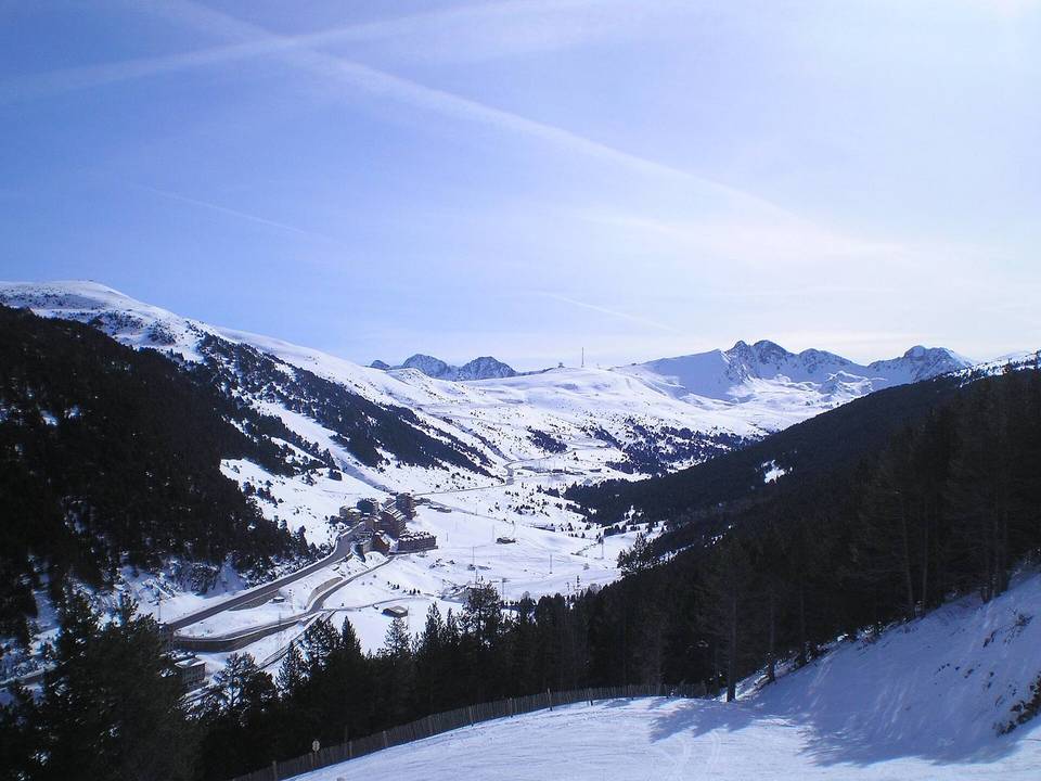
Col de Beixalis from Encamp

Encamp, AndorraRoad

Routed from the map This classic road was traced on OpenStreetMap and measured against the terrain model; no member has recorded it yet. Ridden it? Add your recording and photos.

6 km
Distance
440 m
Elevation gain
Easy
Difficulty
Paved
Surface

Elevation profile

Total ascent
440 m
Distance
6 km
Elevation (m)05001,0001,5002,0000 km2 km4 km6 kmHighest point1,682 m at 6.1 kmStart0 kmFinish6 km

Route overview

This ride suits cyclists ready for a short but steep 6.1 km climb with 440 m ascent.

6.1 km climb from Encamp to Col de Beixalis in Andorra with 440 m elevation gain.

Starting in Encamp, the route passes through les Bons at 0.1 km and Vila at 2.1 km before reaching the Col de Beixalis at 6.1 km with an elevation of 1682 m. The main climb starts around 1 km, covering 5.2 km with 439 m of gain at an average gradient of 8.5%, reaching a maximum of 13.4%. The route descends briefly and flattens for small sections but is predominantly climbing (84%). The route mainly uses the CS-210, a main road which makes up 88% of the ride, ridden without a cycle lane for 5.4 km. The surface is 95% paved with minor gravel and unmapped parts. Riders should note there is a 5.2 km stretch between 0.9 km and 6.1 km without café, shop or water. At the start, facilities include a supermarket, restaurant, café, drinking water, fast food and a petrol station nearby. No facilities are listed at the finish point.

Highlights

  • Col de Beixalis at 1682 m
  • Average gradient 8.5%, max 13.4%
  • Main road CS-210 for 5.3 km
  • 5.2 km without café or shop after 0.9 km

Along the route

Measured from the recorded track and OpenStreetMap.

Places passed

  1. Vila 2.1 km

Climbs

ClimbStarts atLengthGainAverageMaxTop
les Bons climb1 km5.2 km439 m8.5 %13.4 %1682 m

High point 1682 m at 6.1 km; low point 1242 m.

les Bons climb · starts at 1 km

5.2 km at 8.5% · 439 m
125013001350140014501500155016001650ELEVATION (M)12%10%9.0%5.3%0 km12345.1 kmDISTANCE (KM)les Bons climb · 1,682 mSTEEPEST 11.6%
< 4%4 – 7%7 – 10%> 10%

What this ride is like

Measured from OpenStreetMap along the track and the elevation profile.

Roads
88% main road
Main roads
5.4 km on main roads without a cycle lane — likely busier
Main roads used
CS-210 (5 km)
Surface
Paved throughout
Gradient
84% climbing · 11% descending · 5% flat
Steep sections
4.6 km over 5% · 3.3 km over 8% · 1.8 km over 10%

Along the way

Within a few hundred metres of the track, from OpenStreetMap. Opening hours change — treat this as where to look, not a promise.

Food, water and shops

  1. 0.1 kmFarmàcia Manresa · pharmacy · on the route
  2. 0.2 kmECO · supermarket · on the route
  3. 0.3 kmFont · drinking water · on the route
  4. 0.5 kmGanja Bar Valira · café · 110 m off route
  5. 0.9 kmCepsa · petrol station · 270 m off route

At the start

  • ECO · supermarket · 120 m
  • Can Fontcuberta · restaurant · 20 m
  • Can font cuberta · restaurant · 40 m
  • Font · drinking water · 160 m
  • Kebab · fast food · 110 m

Stay after this ride

  • Hodel Montecarlo · hotel · 1.8 km from the finish
  • ENCAMP · hotel · 1.8 km from the finish
  • Onix · hotel · 1.8 km from the finish
  • Comtes de Foix · hotel · 1.9 km from the finish
  • Camp del Serrat · hotel · 2.0 km from the finish

Practical information

Surface
Paved
Route shape
Point to point
Riding time
26 min
Best months
Jun to Sep — daily highs of 19–25 °C in those months

Know before you go

  • 5.4 km on main roads without cycle lane
  • 5.2 km with no café, shop or water from 0.9 km to 6.1 km

Routes are for inspiration. Roads, surfaces and conditions change — check locally and ride within your limits.