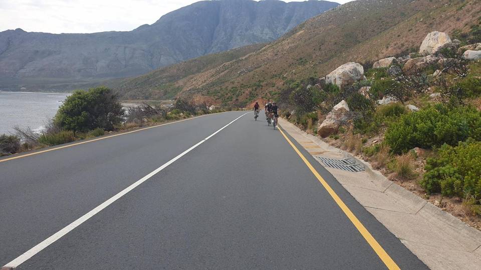
Road · South Africa
Around Kraaifontein
A rolling 39 km road cycling route from Kraaifontein, Western Cape through Durmonte, The Crest and Goedemoed, with 283 m of climbing. Most of it (33.5 km) is on main roads without a cycle lane, 32.2 km where the limit is 80 km/h or more. The first 31 km has no café, shop or water.
At a glance
- Best for
- Rolling day rides for confident riders at ease in traffic
- Distance
- 39.1 km
- Elevation gain
- 283 m
- Riding time
- 1½–2 hours
- Difficulty
- Easy
- Bike
- Road bike
- Surface
- Paved
- Traffic
- Mostly main roads
- Food & water
- Longest gap 31 km
- Navigation
- GPX download
- Start → finish
- Kraaifontein
Map and elevation profile
Elevation profile
- 283 m
- 39 km
Route description
- Kraaifontein
- Durmonte
- The Crest
- Goedemoed
- Vierlanden
- Bergsig
- Proteaville
- Schoongezicht
This 39.1 km ride starts in Kraaifontein and loops around with several named places including Durmonte (33 km), The Crest (33.5 km), and Aurora near the end at 39 km. The route mainly uses 33.5 km of main roads, including 14.1 km on Wellington Road, 13.5 km on Adderley Street and 5.8 km on Philadelphia Road. There are also minor roads, quiet streets, and one km of path, with almost all of the surface paved.
Climbing totals 283 m with a notable 2.4 km climb beginning at 33.8 km gaining 61 m at an average gradient of 2.5%, peaking at 162 m. The lowest point on route is 48 m at 12.8 km; the highest is 175 m at 38.7 km. Almost 59% of the route is flat with small sections of steeper gradients. The longest descent is 3 km dropping 68 m.
Facilities are scarce for most of the route with the longest stretch without café, shop or water being 30.9 km from the start. There are food options near Vierlanden at 35.1 km and a McDonald's at 31.1 km, both a short distance off-route. Bail out train stations are available at Klipheuwel (19.7 km) and Mellish (26.1 km). The ride finishes near the Bootlegger Coffee Company in Kraaifontein.
Highlights
- Climb of 2.4 km at 2.5% gradient
- Wellington Road section for 14.1 km
- Passes Durmonte at 33 km
- Finishes near Bootlegger Coffee Company
Along the route
Places passed
Climbs
| Climb | Starts at | On this ride | Top on this ride |
|---|---|---|---|
| Unnamed climb | 33.8 km | 2.4 km · 61 m · 2.5 % · max 3.9 % | 162 m |
Traffic, surface and gradient
This is not a cycle-track route: 86% is on main roads without a cycle lane, 32.2 km of it where the limit is 80 km/h or more. Riders should be comfortable sharing the road with faster traffic.
- Roads
- 86% main road · 6% quiet street · 5% minor road · 3% path
- Main roads
- 33.5 km on main roads without a cycle lane — likely busier
- Fast roads
- 32.2 km on roads with a limit of 80 km/h or more
- Main roads used
- Wellington Road (14 km), Adderley Street (14 km), Philadelphia Road (6 km)
- Surface
- Paved: 99% of the route is mapped as paved, 1% as unpaved.
- Gradient
- 21% climbing · 21% descending · 59% flat
- Longest descent
- 3 km from 5.8 km, dropping 68 m
Food, water and services
The longest stretch without a café, shop or water is 31 km, from the start. Along the route: 6 cafés and restaurants and 4 shops.
Food, water and shops in ride order
- 31.1 kmMcDonald's · fast food · 200 m off route
- 33.2 kmClicks · pharmacy · 340 m off route
- 35.1 kmTreat Coffee Pod - Vierlanden · café · 40 m off route
- 35.2 kmKwikspar Vierlanden · convenience store · 50 m off route
Need to bail out?
- 19.7 km — Klipheuwel (station), 1.0 km off route
- 26.1 km — Mellish (station), 670 m off route
Stay after this ride
- Highlands Lodge · hotel · 890 m from the finish
- Kolping Guest House · guest house · 1.3 km from the finish
- Meerendal Boutique Hotel · hotel · 2.9 km from the finish
Start and access
At the finish
- Food and coffee
- Bootlegger Coffee Company (460 m)
Know before you go
- Longest stretch with no café, shop or water for 30.9 km from start
- 33.5 km on main roads without a cycle lane
- 32.2 km on roads with posted limits of 80 km/h or more
- 0.1 km with gradient over 10%