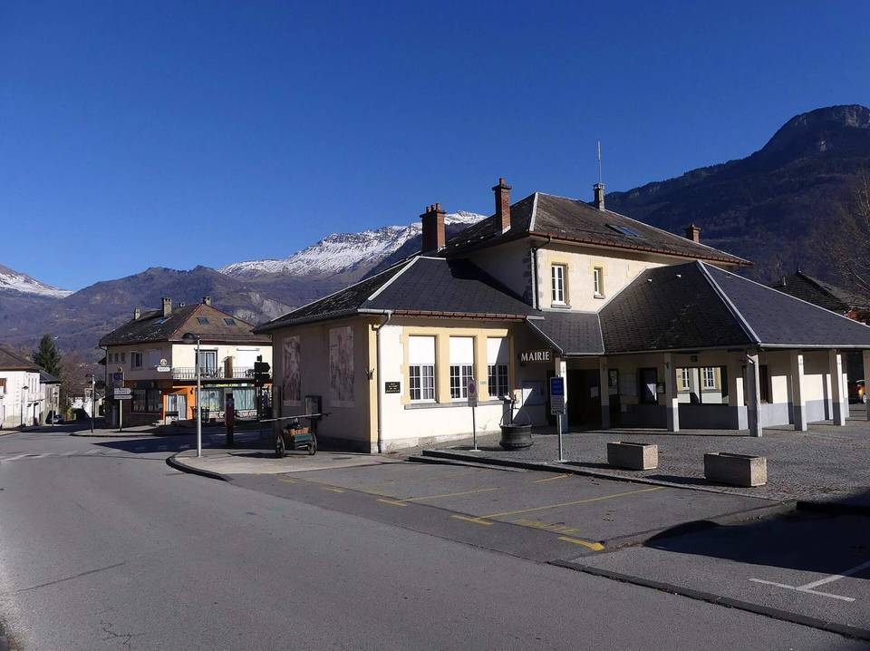
Col de la Madeleine from La Chambre
- 20 km
- 1,517 m
- Hard
- Paved
Elevation profile
- 1,517 m
- 20 km
Route overview
Cyclists comfortable with a long, steep climb of 19.7 km gaining 1517 m elevation.
A 19.7 km climb from La Chambre to Col de la Madeleine in France, gaining 1517 m elevation.
Starting at La Chambre, the route passes through places including La Pontière (1 km), Saint-Martin-sur-la-Chambre (2.1 km), and Montgellafrey (7.8 km) before reaching the Col de la Madeleine at 19.7 km. The climb covers 19 km, gaining 1516 m at an average gradient of 8%, with sections up to 12.7%. Nearly all the route is paved (98%) and mostly on minor roads (71%), with 20% on main roads without cycle lanes. The elevation starts at 472 m near the start and rises steadily to 1988 m near the finish. The first half of the climb contains 52% of the gain. The route includes 17.6 km over 5% gradient, 9.5 km over 8%, and 2.5 km above 10%. Facilities near the start include multiple bakeries, convenience stores, and water points. After 3.2 km to 7.8 km there is a 4.6 km stretch without café, shop, or water. Shops and restaurants appear near 14.9 km and at the top. The road follows named routes D 76, Route des Fées, and D 213. Water points are at km 0, 3, 7.8, and 13.2. Toilets are available near km 0.1 and 14.8. A bike repair stand is near 14.4 km. Saint-Avre - La Chambre station nearby offers bailout options. The road passes beneath the peak L'Homme de Beurre at 2268 m near 18.9 km.
Highlights
- Col de la Madeleine at 1988 m
- Climb averages 8% over 19 km
- Passes through Montgellafrey at 7.8 km
- Peak L'Homme de Beurre nearby at 2268 m
Along the route
Places passed
Climbs
| Climb | Starts at | Length | Gain | Average | Max | Top |
|---|---|---|---|---|---|---|
| L'Homme de Beurre | 0.5 km | 19 km | 1516 m | 8 % | 12.7 % | 1988 m |
L'Homme de Beurre · starts at 0.5 km
What this ride is like
- Roads
- 71% minor road · 20% main road · 7% quiet street
- Main roads
- 4 km on main roads without a cycle lane — likely busier
- Main roads used
- D 76 (9 km), Route des Fées (5 km), D 213 (4 km)
- Surface
- Paved throughout
- Gradient
- 96% climbing · 1% descending · 3% flat
- Steep sections
- 17.6 km over 5% · 9.5 km over 8% · 2.5 km over 10%
Along the way
Food, water and shops
- 0 kmMadeleine · bakery · on the route
- 0 kmDrinking water · 190 m off route
- 0.1 kmVival · convenience store · 40 m off route
- 0.1 kmToilets · on the route
- 0.2 kmPharmacie Debon · pharmacy · 50 m off route
- 3 kmDrinking water · on the route
- 7.8 kmDrinking water · 90 m off route
- 13.2 kmDrinking water · 30 m off route
- 14.4 kmRepair stand · 380 m off route
- 14.4 kmPharmacie Filliol · pharmacy · 350 m off route
- 14.8 kmToilets · 140 m off route
- 14.9 kmChalet du Pain · bakery · 150 m off route
- 14.9 kmSpar · supermarket · 110 m off route
- 19.5 kmLa Banquise 2000 - Chalet de la Madeleine · restaurant · on the route
Need to bail out?
- 0 km — Saint-Avre - La Chambre (station), 620 m off route
Worth a stop
- 1.6 km — Château des Ducs de La Chambre (ruins)
At the start
- Madeleine · bakery · 30 m
- Au Pain de Lauzière · bakery · 140 m
- Vival · convenience store · 90 m
- Le Matafan · fast food · 130 m
- Mont Shake · fast food · 140 m
At the finish
- La Banquise 2000 - Chalet de la Madeleine · restaurant · 20 m
- Les 2 Mazots · restaurant · 100 m
Stay after this ride
- La Perelle · hotel · 1.7 km from the finish
- Les Balcons du Soleil 1 · apartment · 1.8 km from the finish
- Le Chamois - L'Edelweiss · apartment · 1.7 km from the finish
- Les Bouquetins · apartment · 1.7 km from the finish
- Gentiane · apartment · 1.7 km from the finish
Practical information
- Paved
- Point to point
- 1 h 24 min
Know before you go
- 4.6 km stretch with no café, shop or water from km 3.2 to km 7.8
- 4 km on main roads without cycle lane
- Sustained steep gradient sections up to 12.7%