Cyclists.com

Fujairah to Al Buraymi

132 km mixed-surface cycling out-and-back route1,398 m climbing5½–8 hoursGPX

Milah, Ras Al Khaimah, United Arab Emirates · Mixed

A hilly 132 km mixed-surface cycling out-and-back route from Sha'biyyat Milāḩ, Ras Al Khaimah through Huwaylat, Suhaylah and Ad Daymaniyah, with 1,398 m of climbing over the As Simsimānīyah climb. Most of it (94.7 km) is on main roads without a cycle lane, 3.3 km where the limit is 80 km/h or more. There is a 22 km stretch without a café, shop or water (km 27–48). Mixed surface: 83% is mapped as paved and 16% as gravel or unpaved.

Download GPXMap

At a glance

Best for
Long endurance days for confident riders at ease in traffic
Distance
132.2 km
Out and back
Elevation gain
1,398 m
11 m per km
Riding time
5½–8 hours
moving time, estimated
Difficulty
Hard
Bike
Road bike with sturdy tyres, or gravel bike
from the mapped surface
Surface
Mixed surface
83% paved · 16% unpaved
Traffic
Mostly main roads
94.7 km on main roads without a cycle lane · 3.3 km where the limit is 80 km/h or more
Food & water
Longest gap 22 km
3 cafés and restaurants · 1 shop · 4 water points · 3 petrol stations · 1 public toilet · 1 bike shop
Best months
Dec to Feb
Milah climate, 10 years
Navigation
GPX download
free, no sign-in
Start and finish
Sha'biyyat Milāḩ

Map and elevation profile

Elevation profile

Total ascent
1,398 m
Distance
132 km
0200400600800m0 km50100132 km663 m · highest, at 57.5 kmStartFinish · back at the start

Route description

  1. Sha'biyyat Milāḩ
  2. Huwaylatkm 9
  3. As Simsimānīyah climbkm 9
  4. Suhaylahkm 23
  5. Ad Daymaniyahkm 32
  6. Rayykm 53
  7. Ash Shuwayhahkm 70
  8. Al Karbikm 90
  9. Sayh ad Damaniyyahkm 97
  10. Sha'biyyat Milāḩkm 132

Starting from Sha'biyyat Milāḩ, the route heads east passing through Huwaylat at 8.7 km, reaching Suhaylah at 22.9 km and Ad Daymaniyah at 32.4 km before arriving at Al Khalw at 46.6 km. The route features climbing predominantly in the first half, with a total elevation gain of 1398 m. Key climbs include a 5.8 km climb starting at 9 km with an average gradient of 3.3% reaching 408 m elevation, and several shorter climbs including one reaching 663 m at 55.9 km. Road surfaces are mostly paved (83%) but include 16% gravel or unpaved sections. The roads consist of 59% main road, 22% minor road, and some track and quiet street sections. Notably, 75.3 km is on main roads, with 94.7 km without a cycle lane and 3.3 km on roads with speed limits of 80 km/h or more.

The route crosses from the UAE into Oman and back. Towns passed in Oman include Rayy (53.2 km), Ash Shuwayhah (69.7 km), Al Karbī ash Sharqīyah (86.4 km), Al Karbi (90.4 km), Sayh ad Damaniyyah (96.7 km), and Al Wajajah (100.4 km). There is a stretch of 21.7 km without a cafe, shop, or water between 26.7 km and 48.4 km. Available facilities include petrol stations at 26.7 km, 101.9 km, and 120 km, a cafe at 20.4 km (off-route 280 m), and water access points at 48.4 km, 53.2 km, 69.7 km, and 88.1 km.

The route reaches its highest point at 665 m at 72.3 km, beneath Jabal Ruwayshid at 106.6 km and near Jabal Rihab at 28.3 km. The longest descent is 5.9 km starting from 116.8 km, dropping 174 m. The ride is suited to those ready for a long distance with moderate climbing, mainly uphill in the first half. Recorded temperatures are 30°C in November.

Why ride this route?

  • Climbs the As Simsimānīyah climb (5.9 km at 3.2 %).
  • Tops out at 665 m, 72.3 km in.
  • A 5.9 km descent dropping 174 m.
  • Crosses a border: UAE and Oman.

Highlights

  • Climb to 663 m peak at 55.9 km
  • Viewpoint near 66.3 km
  • Jabal Rihab mountain at 28.3 km
  • Hatta sign attraction at 104 km

Along the route

Measured from the route line, the Copernicus elevation model and OpenStreetMap.

Places passed· crosses into Oman

  1. Huwaylat 8.7 km
  2. Suhaylah 22.9 km
  3. Ad Daymaniyah 32.4 km
  4. Al Khalw 46.6 km
  5. Rayy 53.2 km
  6. Ash Shuwayhah 69.7 km
  7. Al Karbī ash Sharqīyah 86.4 km
  8. Al Karbi 90.4 km
  9. Sayh ad Damaniyyah 96.7 km
  10. Al Wajajah 100.4 km

Climbs

Climbs in ride order: where each starts, what this ride climbs, and the full named ascent
ClimbStarts atOn this rideFull ascentTop on this ride
As Simsimānīyah climb9 km5.8 km · 189 m · 3.3 % · max 9.5 %5.9 km · 189 m · 3.2 %408 m
Unnamed climb39.4 km3.1 km · 78 m · 2.6 % · max 6.5 %405 m
Unnamed climb47.9 km2.5 km · 104 m · 4.1 % · max 9.7 %546 m
Unnamed climb51.6 km4.3 km · 148 m · 3.5 % · max 10.6 %663 m
Unnamed climb64.1 km4.2 km · 98 m · 2.3 % · max 4.8 %598 m
Unnamed climb109.4 km2.5 km · 74 m · 2.9 % · max 6.7 %376 m

High point 665 m at 72.3 km; low point 194 m. Passes beneath Jabal Rihab, Jabal Ruwayshid.

On this ride: the part this route climbs, cut from its own elevation profile. Full ascent: the whole named climb, measured the same way on every ride that uses it (its climb page).

As Simsimānīyah climb · full ascent, starts at 8.9 km

5.9 km at 3.2% · 189 m
250300350400m2.1%2.4%3.5%7.0%0 km123455.9 km406 msteepest 7.0%
< 4%4 – 7%7 – 10%> 10%

Traffic, surface and gradient

Measured from OpenStreetMap along the track and the elevation profile.

This is not a cycle-track route: 72% is on main roads without a cycle lane, 3.3 km of it where the limit is 80 km/h or more. Riders should be comfortable sharing the road with faster traffic.

Roads
59% main road · 22% minor road · 15% major road · 2% quiet street · 2% other roads and tracks
Main roads
94.7 km on main roads without a cycle lane — likely busier
Fast roads
3.3 km on roads with a limit of 80 km/h or more
Main roads used
Al Saf-Al Shuwaiha Road (50 km), E44 (11 km), Al Aqar - Al Wajajah - Al Rawdah Road (7 km)
Surface
Mixed surface: 83% is mapped as paved and 16% as gravel or unpaved.
Gradient
28% climbing · 28% descending · 44% flat
Steep sections
3.4 km over 5% · 0.9 km over 8% · steepest 500 m averages 16.7% at 0 km
Longest descent
5.9 km from 116.8 km, dropping 174 m

Food, water and services

Within a few hundred metres of the track, from OpenStreetMap. Opening hours change — treat this as where to look, not a promise.

The longest stretch without a café, shop or water is 22 km, from km 27 to 48. Along the route: 3 cafés and restaurants, 1 shop, 4 water points, 3 petrol stations, 1 public toilet and 1 bike shop.
Food, water and shops in ride order

  1. 20.4 kmJuicy Fruity · café · 280 m off route
  2. 20.4 kmToilets · 280 m off route
  3. 26.7 kmAl Maha · petrol station · on the route
  4. 48.4 kmSpring · 30 m off route
  5. 53.2 kmDrinking water · 110 m off route
  6. 69.7 kmDrinking water · on the route
  7. 88.1 kmDrinking water · on the route
  8. 101.9 kmShell · petrol station · on the route
  9. 108.3 kmHatta Wild Cafe · café · 300 m off route
  10. 108.3 kmBike shop · 290 m off route
  11. 120 kmADNOC · petrol station · 50 m off route
  12. 120.2 kmnaseem al howailat · supermarket · 90 m off route

Worth a stop

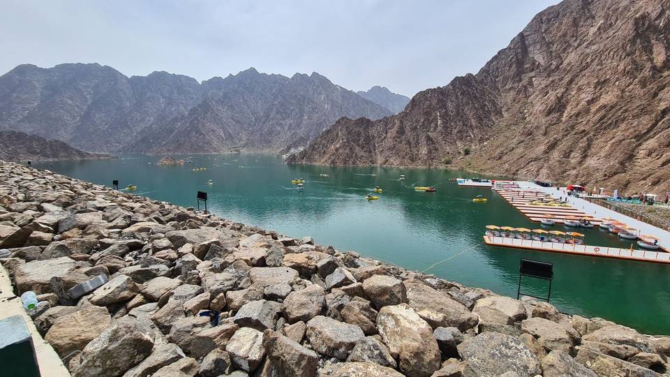
  • 66.3 kmView (viewpoint)
  • 104 kmHatta sign (attraction)

Know before you go

  • 21.7 km without café, shop or water from 26.7 km
  • 94.7 km on main roads without cycle lanes
  • 3.3 km on roads with speed limits 80 km/h or more
  • 16% gravel or unpaved sections

Routes are for inspiration. Roads, surfaces and conditions change — check locally and ride within your limits.

About this route

Date ridden
Route line
Built from a GPS recording of the ride.
Elevation
Recalculated from the Copernicus GLO-90 terrain model every 50 m, not the device’s barometer.
Roads, surface, services
Measured along the line from OpenStreetMap extracts.
Best months
Ten years of ERA5 weather for Milah (Open-Meteo).
GPX
Generated from the route line: track points only, no timestamps or personal data.
Page added
Page last updated

See something wrong with this ride?

Also over the As Simsimānīyah climb