Cyclists.com

Around Khasab

Ra'alat Ad Darah, Musandam, OmanRoad

143 km
Distance
982 m
Elevation gain
Hard
Difficulty
Paved
Surface
Download GPXMap
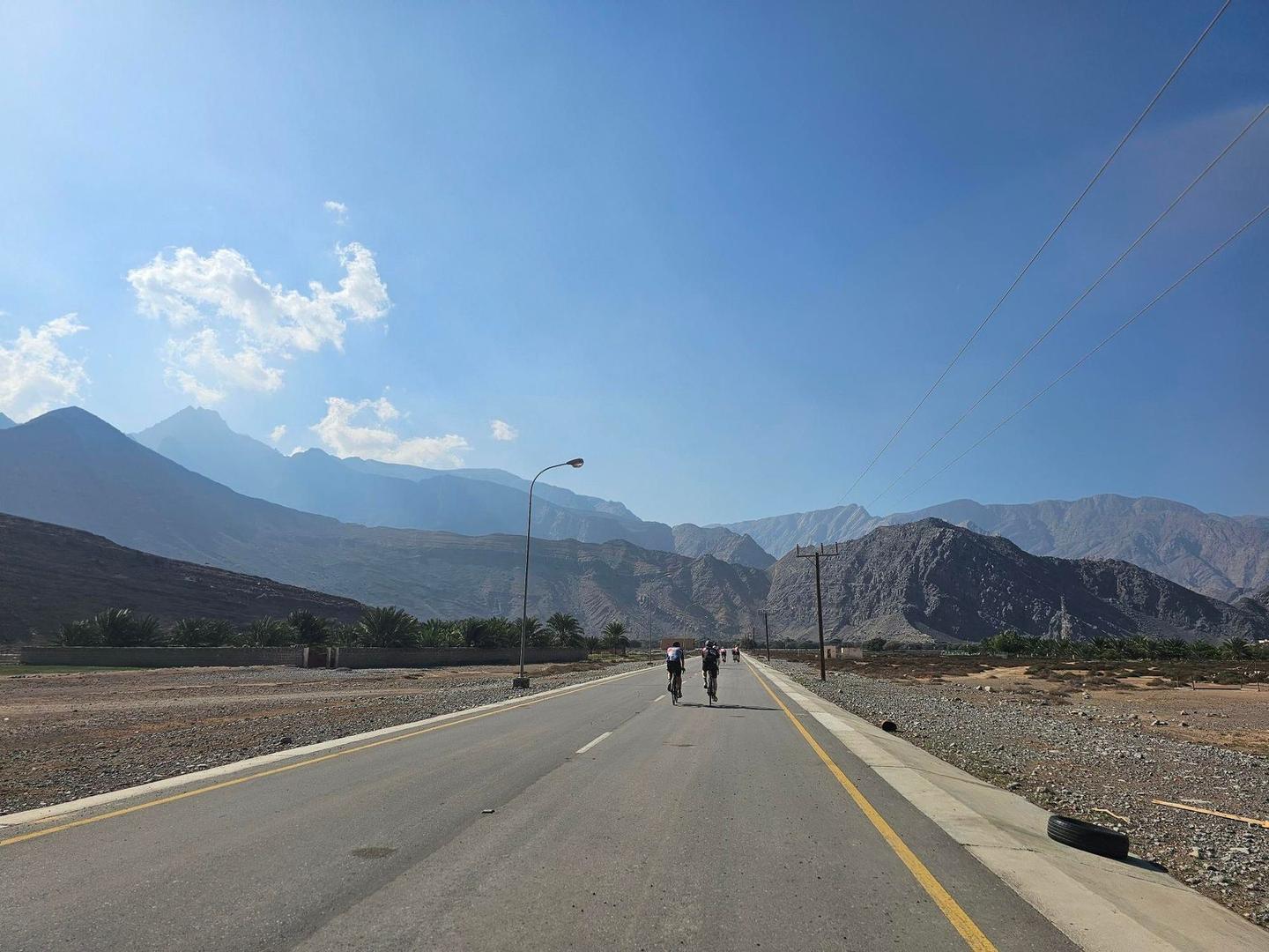
On the road: Around Khasab
AI image

Elevation profile

Total ascent
982 m
Distance
143 km
050100150200m0 km50100143 km193 m · highest, at 30.4 kmStartFinish · back at the start

Route overview

Suitable for cyclists prepared for a long 140 km ride with moderate climbing and some fast main roads.

142.6km out-and-back cycle ride in Musandam, Oman, from Ra'alat Ad Darah with 982m climbing.

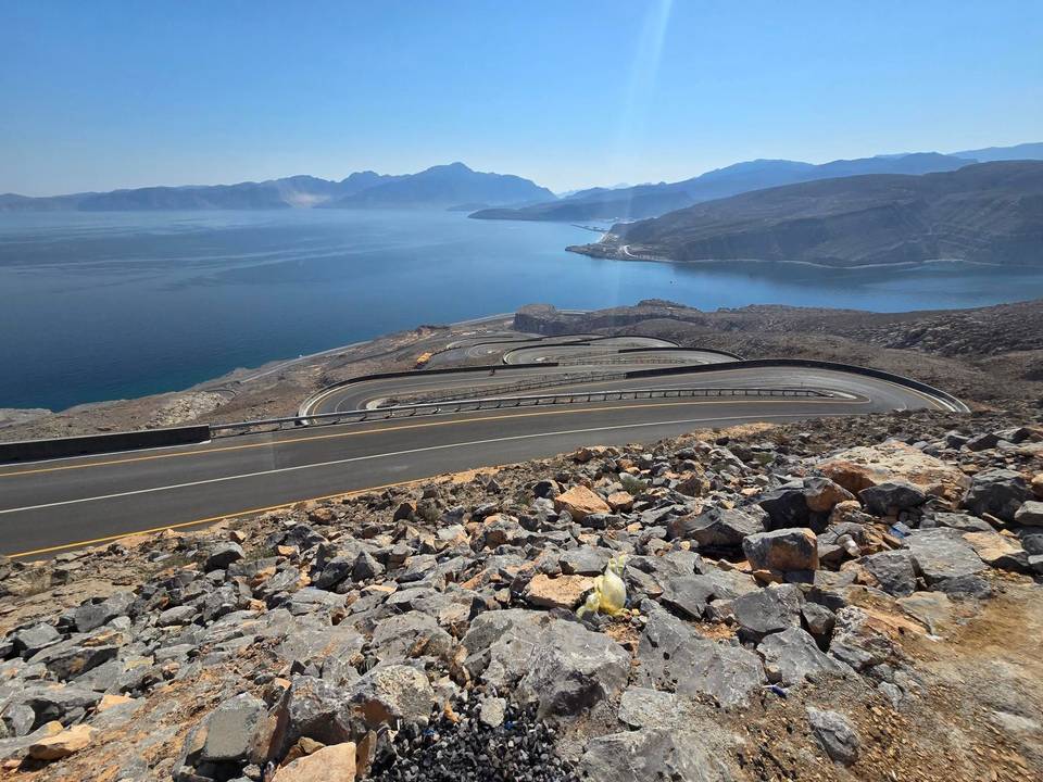
Starting from Ra'alat Ad Darah, the route passes through Fadgha, Bukha, Al Jādī, Hil, and several other towns before reaching Khazinuh at 55.7 km. The ride includes two main climbs: one starting at 25.1 km lasting 2.5 km with 142 m gain at an average gradient of 5.8%, and another starting at 105.1 km lasting 3.2 km with 177 m gain averaging 5.5% gradient. The highest point of 192 m is reached at 109.3 km. The route is paved almost entirely, with 99% paved surfaces and no gravel sections recorded. The majority of the ride is on major roads (86.7 km), followed by main roads (42.1 km), with minor and quiet streets covering a small percentage. Most of the route (128.8 km) lacks cycle lanes and 75.5 km runs on roads with speed limits exceeding 80 km/h. Riders pass near peaks such as Jabal Mustah (223 m at 28.7 km), Jabal Haragah (266 m at 40.8 km), and Jabal Aimus (550 m at 69.3 km).

Highlights

  • Climb of 2.5 km at 5.8% gradient starting km 25.1
  • Highest point 192 m at km 109.3
  • Jabal Mustah peak near km 28.7
  • Jabal Aimus peak near km 69.3

Along the route

Measured from the recorded track and OpenStreetMap.

Places passed· crosses into Oman

  1. Fadgha 11.3 km
  2. Bukha 14.2 km
  3. Al Jādī 17.5 km
  4. Hil 20.1 km
  5. Al Jari 24 km
  6. al Harf 28.1 km
  7. Ḩannā 31.5 km
  8. Qada 36.5 km
  9. Khazinuh 55.7 km
  10. Ra's Hafif 56 km
  11. Khabbat Fatim 58.8 km
  12. Sima 62.1 km
  13. Sall A'la 69.3 km
  14. As Salyan 86.7 km
  15. Khasab 94.3 km
  16. Mūkhī 103.1 km
  17. Ḩill al Gharbīyah 118.9 km
  18. Ghamḑā’ 127.9 km
  19. Tibat 133 km
  20. Al Jeer 137.4 km

Climbs

ClimbStarts atLengthGainAverageMaxTop
25.1 km2.5 km142 m5.8 %18.6 %192 m
Mūkhī climb105.1 km3.2 km177 m5.5 %11.2 %188 m

High point 192 m at 109.3 km; low point 0 m. Passes beneath Jabal Mustah, Jabal Haragah, Jabal Aimus.

Mūkhī climb · starts at 104.9 km

3.1 km at 5.9% · 182 m
50100150m8.4%0 km123.0 km188 msteepest 8.4%
< 4%4 – 7%7 – 10%> 10%

What this ride is like

Measured from OpenStreetMap along the track and the elevation profile.

Roads
63% major road · 31% main road · 3% quiet street · 3% minor road
Main roads
128.8 km on main roads without a cycle lane — likely busier
Fast roads
75.5 km on roads with a limit of 80 km/h or more
Main roads used
Khasab - Tibat Road (78 km), Sall A'la Road (42 km), al Sina'iyah Road (5 km)
Surface
Paved throughout
Gradient
8% climbing · 9% descending · 83% flat
Steep sections
3 km over 5% · 2.5 km over 8% · 1.4 km over 10% · steepest 500 m averages 11.7% at 110.5 km
Longest descent
2.7 km from 113.8 km, dropping 174 m

Along the way

Within a few hundred metres of the track, from OpenStreetMap. Opening hours change — treat this as where to look, not a promise.

Longest stretch without a café, shop or water: 41 km, from 0 km to 41 km.

Food, water and shops

  1. 14.8 kmBukha Hospital · hospital · 260 m off route
  2. 40.8 kmResturant Dhabi Elyamen · restaurant · 60 m off route
  3. 40.8 kmQarah Filling Station · petrol station · 80 m off route
  4. 41.9 kmLulu Hyper Market · supermarket · 240 m off route
  5. 41.9 kmPharmacy · pharmacy · 170 m off route
  6. 43.7 kmfiltered water tank · drinking water · on the route
  7. 77.7 kmAbu Maktoum · restaurant · on the route
  8. 77.7 kmGrocery Stores · convenience store · on the route
  9. 93.1 kmKhasab Service Station · petrol station · 80 m off route
  10. 94.3 kmCafé · 140 m off route
  11. 94.3 kmMuscat Pharmacy · pharmacy · 80 m off route
  12. 98.5 kmToilets · 40 m off route
  13. 114.1 kmConvenience store · 80 m off route
  14. 114.6 kmWater tap · on the route
  15. 114.6 kmToilets · on the route
  16. 117.8 kmFast food · 60 m off route
  17. 123.3 kmFast food · 200 m off route
  18. 124.9 kmBukha Service Station · petrol station · 100 m off route

Need to bail out?

  • 40.5 kmFerry, 230 m off route
  • 97.5 kmFerry, 220 m off route

Whether bikes are carried depends on the service — check before relying on it.

Worth a stop

  • 28.7 kmJabal Mustah (peak, 223 m)
  • 95.9 kmKhasab Fort (castle)
  • 123 kmBukha Fort (castle)

Practical information

Surface
Paved
Route shape
Out & back
Riding time
5–7 hours riding
Season
December with temperatures around 26 °C.

Know before you go

  • Longest stretch with no café, shop or water for 40.8 km from start
  • 128.8 km on main roads without cycle lanes
  • 75.5 km on fast roads with speed limits 80 km/h or more

Routes are for inspiration. Roads, surfaces and conditions change — check locally and ride within your limits.

More rides from Ra'alat Ad Darah