
Cycling in Khasab
2 cycling routes from Khasab, Musandam, Oman, 93 to 147 km, 239 km mapped in all, with up to 1,040 m of climbing in a day. Rolling riding (8 m of climbing per km on average), mostly road routes, 88% of the riding on main roads without a cycle lane. Best months to ride: Dec to Mar.
At a glance
- Routes
- 2
- Lengths
- 93–147 km
- Biggest day
- 1,040 m
- Terrain
- Rolling
- Surface
- Mostly paved
- Bike
- Road bike
- Difficulty
- Hard
- Named climbs
- 3
- Best months
- Dec to Mar
- Longest gap
- 32 km
- GPX
- Every route
Know before you go
Added up from the recorded routes and OpenStreetMap; nothing estimated.
- Surface
- Paved almost throughout.
- Roads
- 88% of the riding on main roads without a cycle lane.
- Climbs
- 3 named climbs.
- Bail-outs
- A railway station or ferry within reach on 2 routes.
- No services
- 32 km on Musandam Grand Loop from Khasab.
- Ridden
- Mar, Dec to Jan, 25–29 °C recorded.
Cycling guide to Khasab
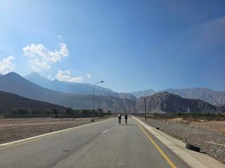
Khasab in Oman provides cyclists with routes of 93 km and 147 km connecting to several towns including Al Jeer, Ra'alat Ad Darah, Tibat, and Bukha. The routes cross international borders between Oman and the UAE and include up to 856 m of climbing. The longer Musandam grand loop includes 768 m of elevation gain and passes many coastal and inland settlements around the region. Both routes have sections of main roads without cycle lanes and stretches of over 30 km without services. Rail stations are accessible near some parts of the rides. These routes are primarily paved with only small gravel areas on the shorter Khasab to Dibba coast road and the zip-line climb, offering a variety of road conditions and country crossings.
More on best time to ride, terrain
Best time to ride
Temperatures recorded in January, December, and March range from 25°C to 29°C, making winter and early spring months suitable for riding in the region.
Terrain
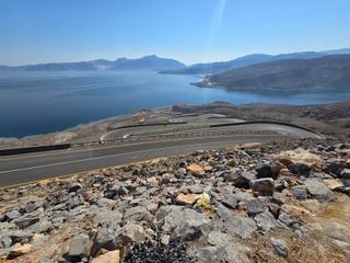
The terrain is mostly rolling with a few steep climbs such as a 2.1 km long climb averaging 12.2% gradient at a high point of 265 m, and a 3.4 km climb averaging 5.2% reaching 190 m. The highest elevation reached on these routes is 265 m, with gradients ranging up to 21.6% on the steepest climb. The routes stay mostly below 300 m elevation, showing some moderate elevation changes.