
Cycling in Masafi
4 cycling routes from Masafi, Fujairah, United Arab Emirates, 65 to 117 km, 400 km mapped in all, with up to 1,259 m of climbing in a day. Hilly riding (13 m of climbing per km on average), mostly road routes, 90% of the riding on main roads without a cycle lane. 1 named climb; the high point is 626 m on Masafi – Dibba – Khor Fakkan. Best months to ride: Nov to Mar.
At a glance
- Routes
- 4
- Lengths
- 65–117 km
- Biggest day
- 1,259 m
- Terrain
- Hilly
- Surface
- Mostly paved
- Bike
- Road bike
- Difficulty
- Hard
- Named climbs
- 1
- Best months
- Nov to Mar
- Longest gap
- 18 km
- GPX
- Every route
Know before you go
Added up from the recorded routes and OpenStreetMap; nothing estimated.
- Surface
- Paved almost throughout.
- Roads
- 90% of the riding on main roads without a cycle lane.
- High point
- 626 m on Masafi – Dibba – Khor Fakkan.
- Day trips
- 3 routes head for bigger hills elsewhere — up to 650 m on Masafi Loop via Khor Fakkan and Fujairah (kept out of the other facts here).
- Climbs
- 1 named climb · 1 ascent of 500 m or more.
- Ridden
- Apr, Oct to Nov, 27–32 °C recorded.
Cycling guide to Masafi
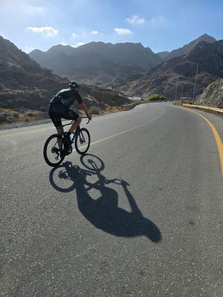
Cyclists riding from Masafi in the Hajar Mountains have several routes to choose from, including loops around Dibba, Khor Fakkan, and Fujairah. The distances range between 65 km and 117 km, with elevation gains spanning 279 m to 837 m. Key places encountered on these routes include Al Baha, Al Ghūnah, Dibba Al Fujairah, Khor Fakkan, and many smaller settlements such as Al Khalabiya, Al Musalla, and Shis. The routes primarily run on paved surfaces, mostly along main roads without cycle lanes, extending over 95 km on average per route. Services such as cafés or shops can be absent for stretches up to 56 km, so riders should prepare accordingly. No railway stations are near most routes except one loop.
More on best time to ride, terrain
Best time to ride
The best months to ride are January, April, October, and November, with temperatures ranging from 18°C to 32°C during these times.
Terrain
The terrain varies from rolling to moderate climbs with average gradients around 3.5 to 4.6%, and maximum gradients reaching near 19%. The highest point among the routes is 650 m, and the biggest climbs range from 5.8 km to 17.2 km in length, with elevation gains up to 614 m. The surface is nearly entirely paved, with minimal gravel on one route.