
Cycling in Munay
1 cycling route from Munay, Ras Al Khaimah, United Arab Emirates, 88 km, 88 km mapped in all, with up to 919 m of climbing in a day. Hilly riding (10 m of climbing per km on average), mostly road routes, 72% of the riding on main roads without a cycle lane. 1 named climb; the high point is 484 m on Fujairah – Shinas via Um al Ghaf. Best months to ride: Dec to Feb.
At a glance
- Routes
- 1
- Lengths
- 88 km
- Biggest day
- 919 m
- Terrain
- Hilly
- Surface
- Mostly paved
- Bike
- Road bike
- Difficulty
- Hard
- Named climbs
- 1
- Best months
- Dec to Feb
- Longest gap
- 46 km
- GPX
- Every route
Know before you go
Added up from the recorded routes and OpenStreetMap; nothing estimated.
- Surface
- Paved almost throughout.
- Roads
- 72% of the riding on main roads without a cycle lane.
- High point
- 484 m on Fujairah – Shinas via Um al Ghaf.
- Climbs
- 1 named climb.
- No services
- 46 km on Fujairah – Shinas via Um al Ghaf.
Cycling guide to Munay
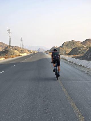
Munay in the United Arab Emirates offers cycling routes mainly within the Hajar Mountains, including an 88 km loop through villages such as Al Wa'ab, Al Qor, and Hatta. The route climbs 919 m and reaches a high point of 484 m, showcasing a blend of paved and minimal gravel surfaces. Among places passed are Sha'biyyat Milāḩ, Sufayri, and Um al Ghaf, providing varied points along the way. The biggest climb features a 3.6 km ascent starting from 66.6 km, gaining 277 m at an average gradient of 7.7%, peaking at 458 m elevation.
The route is predominantly on main roads without cycle lanes for over 63 km, and there is no cycle path on the route. Services can be sparse for almost 46 km, underscoring the need to plan provisions carefully. With no railway stations near the route and mainly paved surfaces, the ride is suited for riders prepared for the terrain and conditions found in this mountainous area.
More on best time to ride, terrain
Best time to ride
April is recorded with temperatures of 30°C, suggesting suitable conditions for cycling during this month.
Terrain
The terrain is mostly mountainous with a total climb of 919 m over the 88 km loop. The biggest climb is 3.6 km long with an average gradient of 7.7% and a maximum of 11.8%, rising from 66.6 km to 458 m high. The highest point on the route is 484 m.