Cyclists.com

Khasab – Dib Dibba

Ra'alat Ad Darah, Musandam, OmanRoad

98 km
Distance
1,023 m
Elevation gain
Hard
Difficulty
Paved
Surface
Download GPXMap
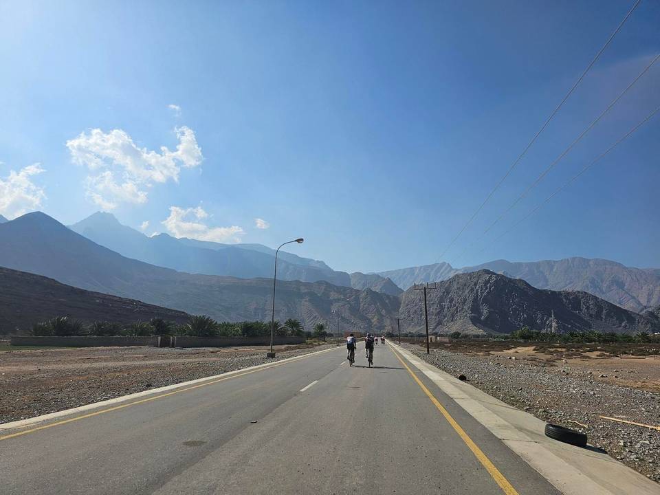
On the road: Khasab – Dib Dibba
AI image

Elevation profile

Total ascent
1,023 m
Distance
98 km
-1000100200300m0 km2040608098 km264 m · highest, at 61.5 kmStartFinish · back at the start

Route overview

Suitable for cyclists comfortable with a 98 km distance and 1023 m total climbing.

A 98 km loop in Oman’s Musandam region starting at Ra'alat Ad Darah with 1023 m climbing.

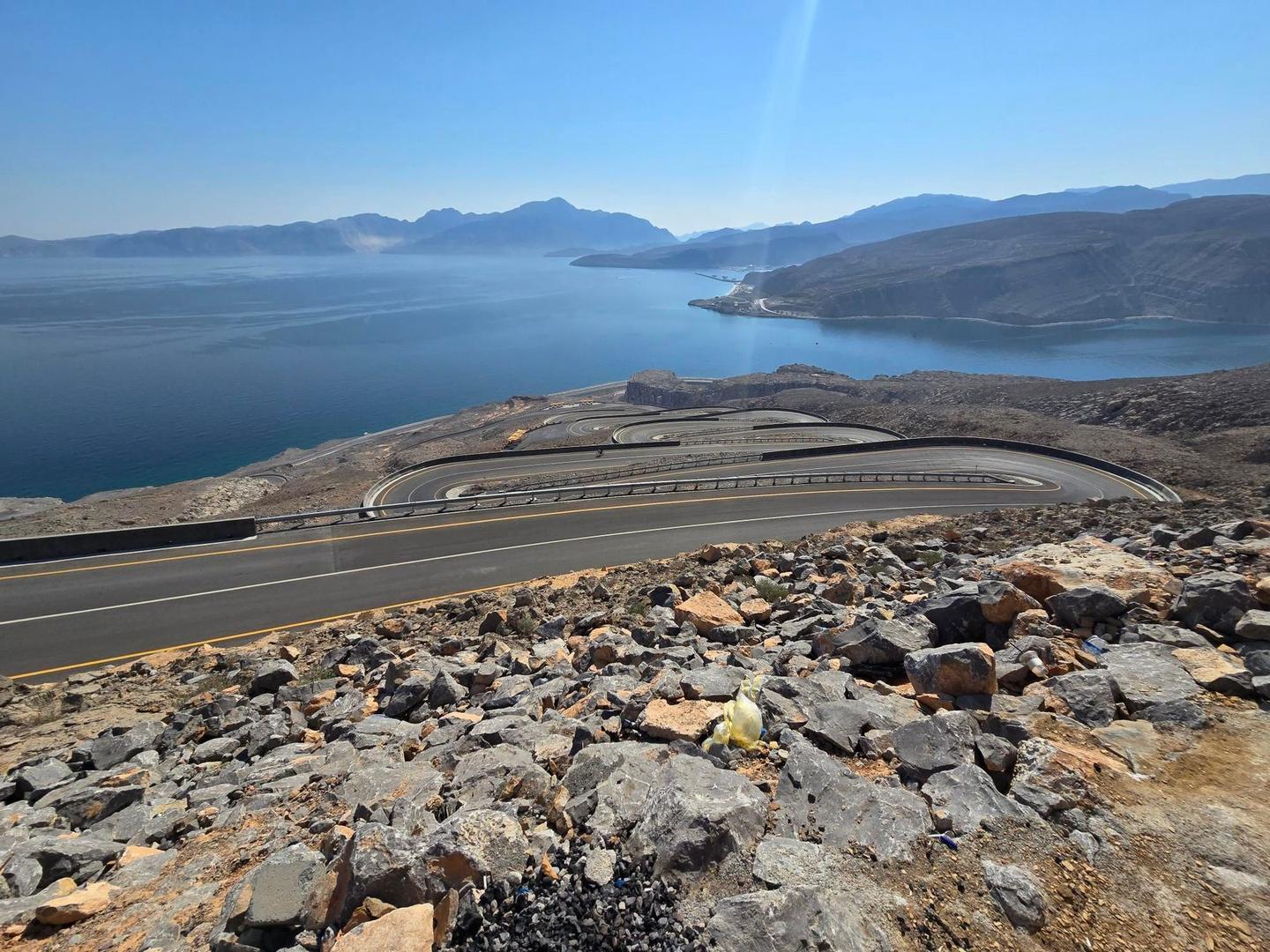
The route begins near Ra'alat Ad Darah and passes through places including Tibat, Ghamḑā’, Fadgha, and Khasab. It primarily follows the Khasab - Tibat Road for 80 km, with 88% on major roads and 96% paved surface. Cycling is mainly on roads, with 84.1 km on main roads lacking cycle lanes and 45.6 km on roads posted 80 km/h or higher. There are several climbs: a 1.4 km climb averaging 3.4% at km 24.2, a longer 3.1 km climb averaging 5.7% shortly after, and two climbs between km 56.5 and 63.7 reaching elevations up to 264 m with gradients up to 31.8%. The highest point is at 264 m at around km 58.7 near Jabal al Harf. The longest descent is 2.6 km starting at km 30.5 with a 174 m drop. Stops for food and drink include fast food outlets near km 14.1 and 19.8, restaurants around km 41 and 46.7, and a supermarket at km 44.9. Water is available at 47.8 km and 70.8 km. A ferry bailout option exists near km 49.7. There is a 22.9 km stretch without café, shop or water between km 70.8 and 93.7. Castles at Bukha (km 14.6) and Khasab (km 42.3) and the peak of Jabal Mustah at km 28.7 lie near the route.

Highlights

  • Jabal al Harf peak at 264 m near km 58.8
  • Castles at Bukha and Khasab
  • Jabal Mustah peak near km 28.7
  • Longest climb 3.1 km at 5.7% gradient

Along the route

Measured from the recorded track and OpenStreetMap.

Places passed· crosses into Oman

  1. Tibat 4.3 km
  2. Ghamḑā’ 9.6 km
  3. Fadgha 11 km
  4. Al Jādī 17.2 km
  5. Ḩill al Gharbīyah 18.8 km
  6. Ḩannā 31.4 km
  7. Mūkhī 34.7 km
  8. Khasab 46.7 km
  9. Qada 53.7 km
  10. al Harf 65.5 km
  11. Al Jari 70.3 km
  12. Hil 74.2 km
  13. Bukha 80 km
  14. Al Jeer 93.7 km

Climbs

ClimbStarts atLengthGainAverageMaxTop
24.2 km1.4 km46 m3.4 %6.8 %53 m
Jabal Mustah26 km3.1 km174 m5.7 %9.9 %192 m
Jabal al Harf56.5 km2.2 km259 m11.8 %31.8 %264 m
Mūkhī climb60.6 km3.1 km182 m5.9 %12.3 %188 m

High point 264 m at 58.7 km; low point 0 m. Passes beneath Jabal Mustah, Jabal Haragah, Jabal al Harf.

Jabal Mustah · starts at 25.9 km

3.1 km at 5.7% · 174 m
50100150m9.2%4.4%0 km123.1 km189 msteepest 9.2%
< 4%4 – 7%7 – 10%> 10%

Jabal al Harf · starts at 56.4 km

2.2 km at 11.8% · 259 m
50100150200250m12%0 km12.1 km264 msteepest 12.4%

Mūkhī climb · starts at 60.5 km

3.1 km at 5.9% · 182 m
50100150m8.4%0 km123.0 km188 msteepest 8.4%

What this ride is like

Measured from OpenStreetMap along the track and the elevation profile.

Roads
88% major road · 4% minor road · 3% quiet street · 3% track
Main roads
84.1 km on main roads without a cycle lane — likely busier
Fast roads
45.6 km on roads with a limit of 80 km/h or more
Main roads used
Khasab - Tibat Road (80 km)
Surface
Paved throughout
Gradient
16% climbing · 15% descending · 69% flat
Steep sections
6.2 km over 5% · 3.5 km over 8% · 1.2 km over 10% · steepest 500 m averages 19% at 60.3 km
Longest descent
2.6 km from 30.5 km, dropping 174 m

Along the way

Within a few hundred metres of the track, from OpenStreetMap. Opening hours change — treat this as where to look, not a promise.

Longest stretch without a café, shop or water: 23 km, from 71 km to 94 km.

Food, water and shops

  1. 12.7 kmBukha Service Station · petrol station · 40 m off route
  2. 14.1 kmFast food · 200 m off route
  3. 14.3 kmBukha Hospital · hospital · 260 m off route
  4. 19.8 kmFast food · 50 m off route
  5. 39.4 kmToilets · 50 m off route
  6. 41 kmResturant Dhabi Elyamen · restaurant · 60 m off route
  7. 44.9 kmLulu Hyper Market · supermarket · 130 m off route
  8. 44.9 kmPharmacy · pharmacy · 60 m off route
  9. 46.7 kmPakistani Restaurant, great and cheap · restaurant · 90 m off route
  10. 47.8 kmfiltered water tank · drinking water · 40 m off route
  11. 49.5 kmQarah Filling Station · petrol station · 60 m off route
  12. 70.3 kmConvenience store · on the route
  13. 70.8 kmWater tap · 30 m off route
  14. 70.8 kmToilets · 40 m off route

Need to bail out?

  • 49.7 kmFerry, 200 m off route

Whether bikes are carried depends on the service — check before relying on it.

Worth a stop

  • 14.6 kmBukha Fort (castle)
  • 28.7 kmJabal Mustah (peak, 223 m)
  • 42.3 kmKhasab Fort (castle)

Practical information

Surface
Paved
Route shape
Loop
Riding time
4–5½ hours riding
Season
December with temperatures recorded at 28°C.

Know before you go

  • 22.9 km with no café, shop or water from km 70.8 to 93.7
  • 84.1 km on main roads without cycle lanes
  • 45.6 km on roads with 80 km/h+ speed limits
  • Steepest 500m section at 19% gradient at km 60.3

Routes are for inspiration. Roads, surfaces and conditions change — check locally and ride within your limits.

More rides from Ra'alat Ad Darah