
Cyclists.com

Stage 8 of 10 · Munich to Venice via Brenner, Lake Garda and Bologna← Stage 7Stage 9 →

Torri del Benaco to Verona

59 km road cycling route201 m climbing2½–3½ hoursGPX

Torri del Benaco, Veneto, Italy · Road

A flat 59 km road cycling route from Torri del Benaco, Veneto to Verona through Garda, Cisano and Pacengo, with 201 m of climbing.
Route contributed by Marcus · Created from a ride on Friday 25th September 2026

Download GPXMap

At a glance

Best for
Flat, steady riding
Distance
59.2 km
Point to point
Elevation gain
201 m
3 m per km
Riding time
2½–3½ hours
moving time, estimated
Difficulty
Leisure
Bike
Road bike
from the mapped surface
Surface
Mostly paved
92% paved · 4% unpaved · 4% no data
Traffic
Mostly minor roads
9.3 km on main roads without a cycle lane · 22.4 km on cycle paths or lanes
Food & water
Regular
524 cafés and restaurants · 54 shops · 51 water points · 17 petrol stations · 70 public toilets · 20 bike shops
Navigation
GPX download
free, no sign-in
Start → finish
Torri del Benaco → Verona

Map and elevation profile

On the road: Torri del Benaco to Verona, Torri del Benaco

Elevation profile

Total ascent
201 m
Distance
59 km
050100150m0 km204059 km139 m · highest, at 42.5 kmStartFinish

What it was like to ride

Sleeping and eating on this stage

Where Marcus actually stayed and ate on the day, and what it was like.

Where we slept

Where we ate

  • Gelateria Amorino

    Ice cream · Corso Sant'Anastasia 1, Verona

    Map

Route description

  1. Torri del Benaco
  2. Gardakm 7
  3. Cisanokm 12
  4. Pacengokm 21
  5. Camalavicinakm 29
  6. Campagna Rossakm 35
  7. Sommacampagnakm 44
  8. Ceolarakm 48
  9. San Massimokm 54
  10. Veronakm 59

Starting in Torri del Benaco (km 0), the route passes through Garda (km 6.8), Bardolino (km 10.3), and Lazise (km 15.2) along mostly paved surfaces with 38% on cycle paths. The terrain is predominantly flat, with a single climb between km 32.5 and 33.9 gaining 46 m at an average 3.3% gradient, reaching 112 m elevation. Other road types include minor roads (22%), main roads (16%), quiet streets (12%) and some path and track sections making up the remainder.

The route continues past Peschiera del Garda (km 25.1), Sommacampagna (km 43.6), and finishes at Verona (km 59.2). Main roads include roughly 9 km without cycle lanes. Cafés and shops are generally frequent, but there is a 5.3 km stretch without café, shop, or water from 37.8 km to 43.1 km. Several petrol stations, bike shops and toilets are also along the way. The highest point of the ride is 139 m at km 41.7, while the lowest is 63 m at km 57.9.

Highlights

  • Passes Monte Bre near km 4.7
  • Climb at km 32.5–33.9 gains 46 m at 3.3%
  • Cycle paths cover 22 km of the route
  • Longest descent 1.8 km from km 43.6

Along the route

Measured from the route line, the Copernicus elevation model and OpenStreetMap.

Places passed

  1. Garda 6.8 km
  2. Sportsman-Ceola 8.4 km
  3. Bardolino 10.3 km
  4. Cisano 12.3 km
  5. Gralaoni-Pralesi 13.1 km
  6. Lazise 15.2 km
  7. Pacengo 20.5 km
  8. Peschiera del Garda 25.1 km
  9. Casa Ottello 26.4 km
  10. Camalavicina 29 km
  11. Corte Monte Salionze 32.4 km
  12. Salionze 33.1 km
  13. Campagna Rossa 34.8 km
  14. Oliosi 35.8 km
  15. San Rocco 38 km
  16. Sommacampagna 43.6 km
  17. Pirlar 45.7 km
  18. Palazzo 46.9 km
  19. Ceolara 47.9 km
  20. Caselle 48.9 km
  21. Casone 51.1 km
  22. San Massimo 53.5 km
  23. Santa Lucia 56.2 km
  24. Golosine 57 km

Climbs

Climbs in ride order: where each starts, what this ride climbs, and the full named ascent
ClimbStarts atOn this rideTop on this ride
Unnamed climb32.5 km1.4 km · 46 m · 3.3 % · max 5.1 %112 m

High point 139 m at 41.7 km; low point 63 m. Passes beneath Monte Bre, Monte Are.

Traffic, surface and gradient

Measured from OpenStreetMap along the track and the elevation profile.

Mostly minor roads and streets on the map; 9.3 km is on main roads without a cycle lane.

Roads
38% cycle path · 22% minor road · 16% main road · 12% quiet street · 12% other roads and tracks
Main roads
9.3 km on main roads without a cycle lane — likely busier
Cycle paths
22.4 km on cycle paths or roads with a cycle lane
Main roads used
Ciclovia del Sole (4 km), Via San Carlo (4 km)
Surface
Predominantly paved: 92% is mapped as paved, 4% as unpaved or gravel and 4% has no surface data.
Gradient
9% climbing · 6% descending · 85% flat

Food, water and services

Within a few hundred metres of the track, from OpenStreetMap. Opening hours change — treat this as where to look, not a promise.

No stretch is longer than 15 km without a café, shop or water. Along the route: 524 cafés and restaurants, 54 shops, 51 water points, 17 petrol stations, 70 public toilets and 20 bike shops.

Food, water and shops in ride order

  1. 2.6 kmLido Brancolino · café · 40 m off route
  2. 6.9 kmBar Kallua · café · 40 m off route
  3. 7.1 kmDrinking water · on the route
  4. 10.3 kmDrinking water · on the route
  5. 11.5 kmParafarmacia · pharmacy · 50 m off route
  6. 12.4 kmMini Market · convenience store · 80 m off route
  7. 16.9 kmeni · café · 30 m off route
  8. 19.4 kmPangea Dinokiosk & Gadget · kiosk · 70 m off route
  9. 21.1 kmCafe Del Sorrentino · café · on the route
  10. 25.1 kmCeresa · bakery · on the route
  11. 25.2 kmTabacchi · convenience store · 40 m off route
  12. 26.4 kmDrinking water · on the route
  13. 33.5 kmDrinking water · on the route
  14. 43.9 kmPasticceria Caliari · café · on the route
  15. 44.3 kmSan Marco Petroli · petrol station · 120 m off route
  16. 53.5 kmCaffè Centrale · café · on the route
  17. 54.6 kmFarmacia XXIV Giugno · pharmacy · on the route
  18. 56.9 kmMondo moto e bici · bike shop · 330 m off route

Need to bail out?

  • 0 km — Torri del Benaco Traghetto (ferry), 40 m off route
  • 6.4 km — Garda (ferry), 90 m off route
  • 15.1 km — Lazise (ferry), on the route
  • 22.3 km — Monorotaia (station), 220 m off route

Whether bikes are carried depends on the service — check before relying on it.

Worth a stop

  • 15.3 km — Castello di Lazise (castle)
  • 19.4 km — Holmes Hotel (attraction)
  • 25.1 km — Canale di Mezzo (viewpoint)
  • 29.7 km — Passerella birdwatching (viewpoint)
  • 44.2 km — Villa Venier (monument)
  • 55.5 km — Forte Fenilone (ruins)

Stay after this ride

  • Hotel Crowne Plaza · hotel · 20 m from the finish
  • Palazzo Cordioli · guest house · 1.1 km from the finish
  • Residenza Tevere · apartment · 1.1 km from the finish
  • Hotel Fiera · hotel · 1.1 km from the finish
  • Hotel Corte Ongaro · hotel · 1.2 km from the finish

Start and access

Starts at Torri del Benaco. Mapped within a short walk of the start and finish, from OpenStreetMap.

At the start

Trains and ferries
Torri del Benaco Traghetto (40 m)
Food and coffee
Il Baretto (270 m), La Limonata (240 m), Bakery and Bar Corradi (320 m)

At the finish

Food and coffee
Le Arche (150 m), Piadineria Birreria Artigiana Bacchabundus ZAI (150 m), 3Angle Restaurant (220 m)
Pharmacy and medical
Farmacia Comunale Golosine (840 m)

Know before you go

  • Longest stretch without café, shop or water is 5.3 km from km 37.8 to 43.1
  • 9.3 km on main roads without cycle lanes
  • 4% gravel or unpaved surface sections
  • Steepest 500 m segment averages 4.7% gradient at km 33.6

Routes are for inspiration. Roads, surfaces and conditions change — check locally and ride within your limits.

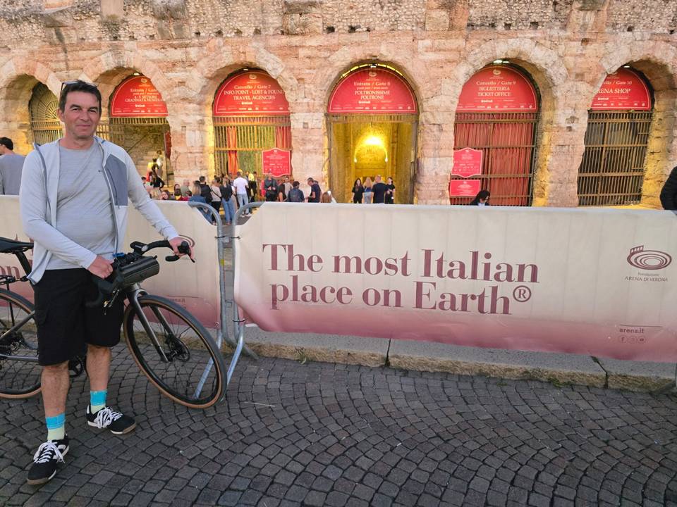
11 photographs from the road

Stage of

About this route

Ridden by
Marcus
Date ridden
Route line
Built from a GPS recording of the ride.
Elevation
Recalculated from the Copernicus GLO-90 terrain model every 50 m, not the device’s barometer.
Roads, surface, services
Measured along the line from OpenStreetMap extracts.
GPX
Generated from the route line: track points only, no timestamps or personal data.
Page added
Page last updated

See something wrong with this ride?

Rides starting nearby