
Stage 16 of 20 · Rotterdam to Budapest← Stage 15Stage 17 →
Vilshofen an der Donau to Linz
A flat 109 km road cycling route from Vilshofen an der Donau to Linz through Schmalhof, Irring and Altstadt, with 359 m of climbing over the Schlögen climb.
At a glance
- Best for
- Flat, steady riding for fit, experienced riders
- Distance
- 108.8 km
- Elevation gain
- 359 m
- Riding time
- 7 h 46 min
- Difficulty
- Hard
- Bike
- Road bike
- Surface
- Mostly paved
- Traffic
- Some main roads
- Food & water
- Regular
- Best months
- May to Sep
- Navigation
- GPX download
- Start → finish
- Vilshofen an der Donau → Linz
Map and elevation profile
Elevation profile
- 359 m
- 109 km
What it was like to ride
Route description
- Vilshofen an der Donau
- Schmalhof
- Irring
- Altstadt
- Haar
- Kramesau
- Schlögen climb
- Moos
- Feldkirchen an der Donau
- Linz
The ride starts near Vilshofen an der Donau passing several small places including Waizenbach, Hördt, Windorf, and Sandbach before reaching Passau at 26.1 km. The surface is mostly paved with minor gravel or unpaved sections making up 7%. The route uses a mix of minor roads (24%), paths (22%), main roads (20%), quiet streets (16%), tracks (9%), cycle paths (4%) and roads with cycle lanes (3%). Around 21.8 km are on main roads without a cycle lane, and 15.5 km are on roads with speed limits of 80 km/h or more. The longest named roads include B130 for 10.7 km and St 2125 for 6.3 km. Cafés, bakeries, and shops are available along the route including at 2.1 km, 24.9 km, 37.1 km, and 79.9 km, while a longest dry stretch of 9.6 km occurs between 85.5 km and 95.1 km. Bailing out is possible at stations in Vilshofen, Passau and Puchenau West, plus several ferry points along the route.
Why ride this route?
- Climbs the Schlögen climb (5 km at 3.3 %).
- Tops out at 463 m, 70.9 km in.
- Crosses a border: Germany and Austria.
Highlights
- Climb to 463 m at 70.9 km
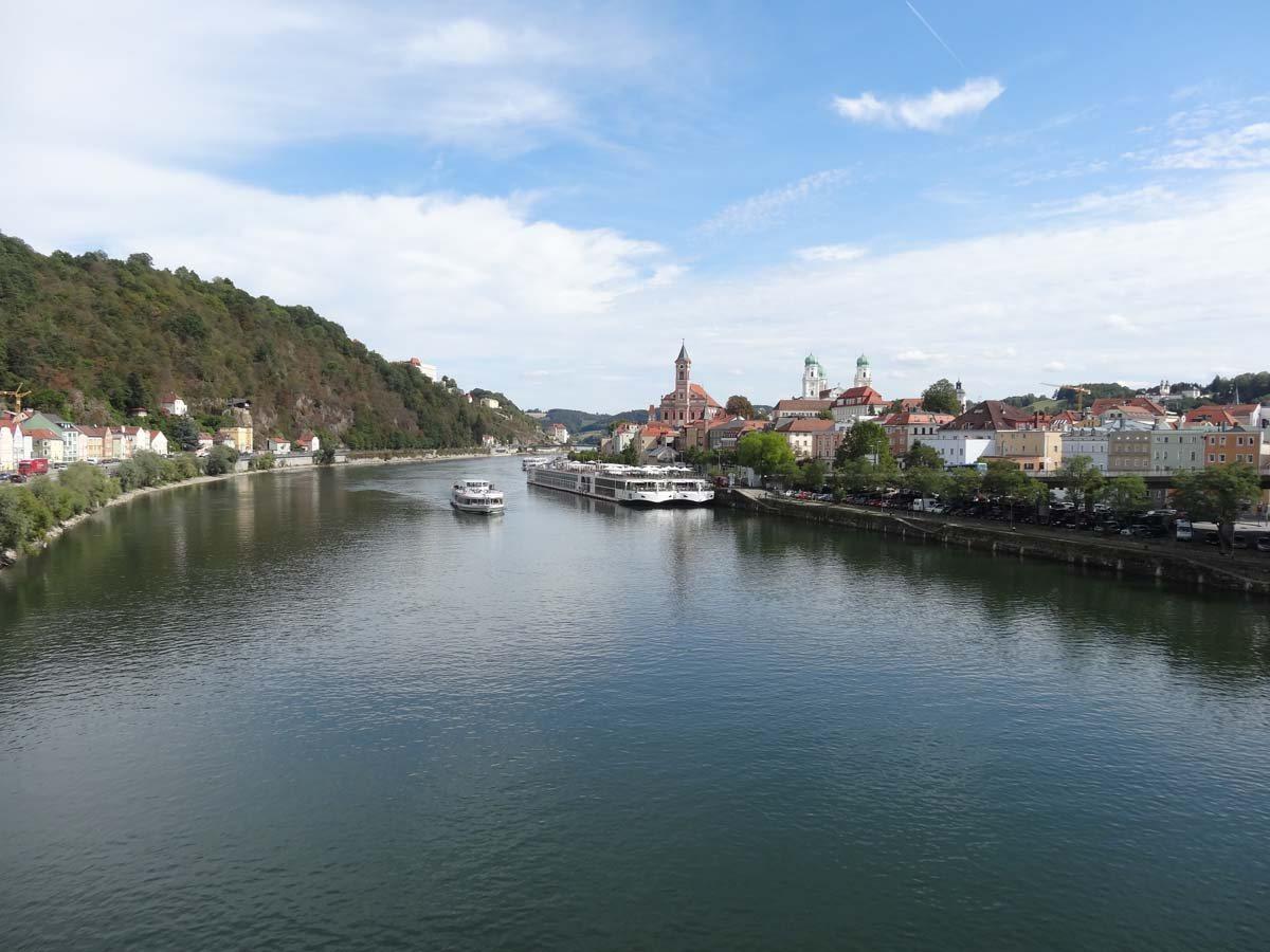
- Passau town at 26.1 km
- Jochensteinblick viewpoint at 49.6 km
- Castles at Schloss Obernzell and Schloss Ottensheim
Along the route
Places passed· crosses into Austria
Climbs
| Climb | Starts at | On this ride | Full ascent | Top on this ride |
|---|---|---|---|---|
| Schlögen climb | 65.9 km | 5 km · 167 m · 3.3 % · max 5.8 % | 5 km · 167 m · 3.3 % | 463 m |
Schlögen climb · full ascent, starts at 65.7 km
Traffic, surface and gradient
Expect stretches on main roads without a cycle lane (21.8 km in all) between quieter sections.
- Roads
- 24% minor road · 22% path · 20% main road · 16% quiet street · 16% other roads and tracks · 2% unmapped
- Main roads
- 21.8 km on main roads without a cycle lane — likely busier
- Fast roads
- 15.5 km on roads with a limit of 80 km/h or more
- Cycle paths
- 7.2 km on cycle paths or roads with a cycle lane
- Main roads used
- B130 (11 km), St 2125 (6 km), PA 51 (6 km), Donauradweg (4 km)
- Surface
- Predominantly paved: 90% is mapped as paved, 7% as unpaved or gravel and 3% has no surface data.
- Gradient
- 8% climbing · 7% descending · 85% flat
- Longest descent
- 3.8 km from 71.9 km, dropping 168 m
Food, water and services
No stretch is longer than 15 km without a café, shop or water. Along the route: 476 cafés and restaurants, 54 shops, 19 water points, 11 petrol stations, 34 public toilets and 60 bike shops.
Food, water and shops in ride order
- 2.1 kmFlamencoffee · café · 40 m off route
- 2.6 kmToilets · 90 m off route
- 5 kmShell · petrol station · 150 m off route
- 22.5 kmShell · petrol station · 70 m off route
- 25.5 kmEngel-Apotheke · pharmacy · 120 m off route
- 26.7 kmDrinking water · on the route
- 37.1 kmCafe 5 Sinne · café · 140 m off route
- 41 kmToilets · on the route
- 42 kmHafner · pharmacy · 70 m off route
- 49.3 kmWasserstein · spring · 100 m off route
- 52.1 kmSprit · petrol station · 290 m off route
- 65.9 kmCamping Schlögen · supermarket · 110 m off route
- 80.6 kmLagerhaus · petrol station · 140 m off route
- 82.3 kmSpar · supermarket · 110 m off route
- 96 kmRodlbudl · café · 50 m off route
- 96.5 kmDEINRAD · bike shop · 160 m off route
- 106.3 kmRadsport Brückl · bike shop · 190 m off route
- 106.4 kmToilets · 50 m off route
Need to bail out?
- 1.9 km — Vilshofen (Niederbay) (station), 690 m off route
- 9.8 km — Ferry, on the route
- 25 km — Passau Hbf (station), 70 m off route
- 42.4 km — Schiffsanlegestelle (ferry), on the route
- 48.7 km — Schiffsanlegestelle (ferry), 100 m off route
- 59.8 km — Schiffsanlegestelle (ferry), 50 m off route
- 66.2 km — Anlegestelle Schlögen (ferry), 130 m off route
- 100.7 km — Puchenau West (station), 250 m off route
Worth a stop
- 5.8 km — Der Windorfer Bärenfang (attraction)
- 26.9 km — Veste Niederhaus (castle)
- 30.6 km — Donaublick (viewpoint)
- 42.5 km — Schloss Obernzell (castle)
- 49.6 km — Jochensteinblick (Fernrohr) (viewpoint)
- 66.2 km — Kleinkastell Schlögen (archaeological site)
Stay after this ride
- Motel One · hotel · 40 m from the finish
- Hotel Wolfinger · hotel · 80 m from the finish
- Mama Muh · hotel · 250 m from the finish
- limehome Friedrichstraße · hotel · 550 m from the finish
- Zum Schwarzen Bären · hotel · 350 m from the finish
Start and access
At the start
- Food and coffee
- Olala (870 m)
At the finish
- Food and coffee
- Joseph Brot (30 m), Two Rabbits (50 m), Das Bruckner (50 m)
- Pharmacy and medical
- Hofstätter-Apotheke (100 m)
Know before you go
- Longest dry stretch of 9.6 km between 85.5 km and 95.1 km
- 21.8 km on main roads without cycle lanes
- 15.5 km on roads at 80 km/h or more
- 7% gravel or unpaved sections