Cyclists.com

Lourinha – Rio Maior

Atalaia, Lisbon, PortugalRoad

122 km
Distance
1,353 m
Elevation gain
Hard
Difficulty
Paved
Surface
Download GPXMap
On the road: Lourinha – Rio Maior
AI image

Elevation profile

Total ascent
1,353 m
Distance
122 km
0200400600m0 km255075100122 km531 m · highest, at 34.6 kmStartFinish · back at the start

Route overview

This ride suits experienced cyclists prepared for a long 122 km with 1353 m of climbing.

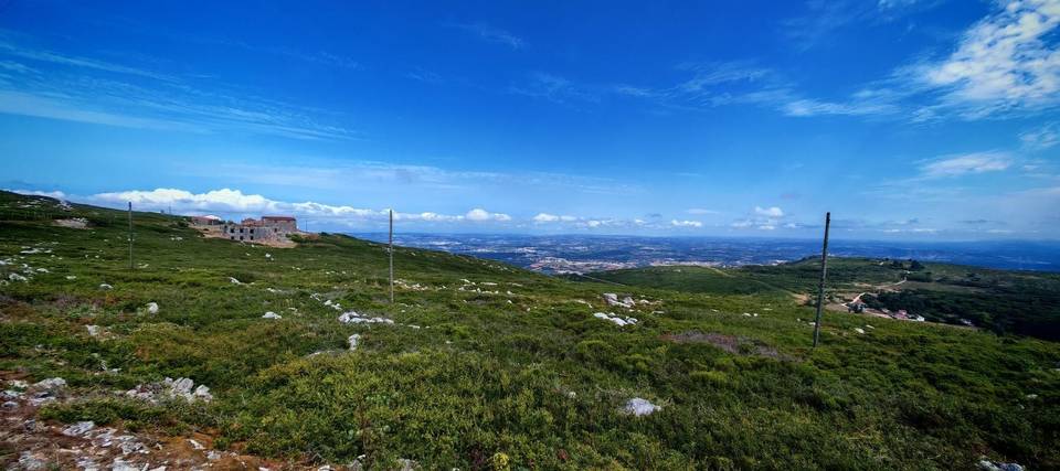
122 km loop ride from Atalaia, Portugal, with 1353 m climbing, reaching 540 m altitude near Pragança.

This 122 km loop starts and ends in Atalaia, Lisbon region. The route passes through many small places including Santa Bárbara, Campelos, Pragança at 37.5 km, and Rio Maior at 62.9 km. At 24.7 km begins the longest climb lasting 9 km, rising 459 m at an average 5.1% gradient to 540 m altitude near km 33.6, beneath Penha do Meio Dia (573 m). The road surface is predominantly paved (95%), with a small 4% gravel or unpaved section. The majority of the route (79%) is on main roads, with 93.1 km on main roads without a cycle lane, including stretches on EN 114 (30.9 km) and EN 1 (11 km). The ride features five marked climbs, including two shorter climbs after 78 km and 94.7 km with moderate gradients. The route descends steeply in places, with a longest descent of 5.1 km from km 34.7. Food and drink options are available throughout, with cafés and shops in places such as Campelos at 12.8 km, Pragança at 40.7 km, and Rio Maior at 62.9 km. The longest stretch without café, shop or water is 10 km between 48 km and 58 km. There are three bailouts at Outeiro station and Dagorda halt. Bike shops and petrol stations are scattered along the route for support.

Highlights

  • Climb near Pragança to 540 m
  • Longest climb: 9 km at 5.1% avg
  • Passes through Rio Maior at 62.9 km
  • Views near Penha do Meio Dia (573 m)

Along the route

Measured from the recorded track and OpenStreetMap.

Places passed

  1. Santa Bárbara 3.7 km
  2. Marquiteira 4.5 km
  3. Pregança do Mar 6.3 km
  4. Cabeça Gorda 9.9 km
  5. Campelos 12.8 km
  6. Outeiro da Cabeça 18.6 km
  7. Vilar 24.2 km
  8. Vila Verde dos Francos 28.1 km
  9. Casais do Chorão 30.8 km
  10. Arieiro 34.3 km
  11. Pragança 37.5 km
  12. Cercal 45.2 km
  13. Asseiceira 58.3 km
  14. Rio Maior 62.9 km
  15. Freiria 64.3 km
  16. Senhora da Luz 67.8 km
  17. Casal do Brejo 68.7 km
  18. Casal do Rei 69.9 km
  19. Ribeira de Castros 72.3 km
  20. Crastos 72.3 km
  21. Vidais 74 km
  22. Mosteiros 76 km
  23. Trabalhia 77.2 km
  24. Casal do Frade 78 km
  25. Matoeira 78.5 km
  26. Gaeiras 83.8 km
  27. Casal do Zambujeiro 85.3 km
  28. Óbidos 87 km
  29. Pinhal 88.2 km
  30. A-da-Gorda 90 km
  31. Sobral da Lagoa 91.3 km
  32. Amoreira 93.2 km
  33. Casal da Arruda 95.6 km
  34. Casal das Ladeiras 96.3 km
  35. Serra d'El-Rei 99.2 km
  36. Coimbrã 103.4 km
  37. Atouguia da Baleia 105.1 km
  38. Alto Veríssimo 109.4 km
  39. Alto Foz 110.1 km
  40. Casal da Murta 112.6 km
  41. Seixal 114.1 km

Climbs

ClimbStarts atLengthGainAverageMaxTop
Vilar climb24.7 km9 km459 m5.1 %11.5 %540 m
78 km2.7 km88 m3.3 %5.4 %130 m
94.7 km2.8 km93 m3.3 %4.7 %124 m
106.5 km2.9 km68 m2.4 %3 %104 m
114.1 km2.9 km88 m3 %8.9 %94 m

High point 540 m at 33.6 km; low point 4 m. Passes beneath Outeiro da Cabeça, Cabeça Gorda, Penha do Meio Dia.

Vilar climb · starts at 24.6 km

9 km at 5.1% · 459 m
100200300400500m2.8%6.7%2.2%6.6%10%6.6%0 km123456789.0 km540 msteepest 10.5%
< 4%4 – 7%7 – 10%> 10%

What this ride is like

Measured from OpenStreetMap along the track and the elevation profile.

Roads
79% main road · 7% minor road · 7% quiet street · 3% track
Main roads
93.1 km on main roads without a cycle lane — likely busier
Fast roads
13 km on roads with a limit of 80 km/h or more
Cycle paths
1.8 km on cycle paths or roads with a cycle lane
Main roads used
EN 114 (31 km), EN 1 (11 km), EN 361-1 (10 km), EN 247 (7 km)
Surface
Paved throughout
Gradient
24% climbing · 24% descending · 51% flat
Steep sections
5 km over 5% · 1.5 km over 8% · steepest 500 m averages 8.5% at 33 km
Longest descent
5.1 km from 34.7 km, dropping 325 m

Along the way

Within a few hundred metres of the track, from OpenStreetMap. Opening hours change — treat this as where to look, not a promise.

Food, water and shops

  1. 3.7 kmPrio · petrol station · on the route
  2. 12.8 kmPastelaria Flor · café · 70 m off route
  3. 12.8 kmFarmácia Campelos · pharmacy · 60 m off route
  4. 37.5 kmTap · water tap · 60 m off route
  5. 40.7 kmAlter Café, Rochaforte · café · 40 m off route
  6. 47.8 kmPôr do Sol 1 · restaurant · 50 m off route
  7. 58.3 kmCafé Xuquinhas · café · on the route
  8. 62.2 kmPrio · petrol station · 50 m off route
  9. 62.4 kmPingo Doce · supermarket · 100 m off route
  10. 62.7 kmBicicletas RM Bikes - Villa Romana · bike rental · 90 m off route
  11. 74 kmDoce Rainha · café · 50 m off route
  12. 74 kmFarmácia Vidais · pharmacy · 50 m off route
  13. 87 kmOs Filipes · café · on the route
  14. 87.7 kmToilets · 100 m off route
  15. 88.7 kmContinente Bom Dia · supermarket · 100 m off route
  16. 99.2 kmMeu Super · supermarket · 60 m off route
  17. 99.4 kmA Serrana · café · 90 m off route
  18. 104.6 kmGalp · petrol station · 60 m off route

Need to bail out?

  • 18.8 kmOuteiro (station), 270 m off route
  • 90.3 kmDagorda - Peniche (halt), 110 m off route

Whether bikes are carried depends on the service — check before relying on it.

Worth a stop

  • 30.8 kmMoinho de Avis (attraction)
  • 36.7 kmCastro de Pragança (archaeological site)
  • 59.5 kmParque do Peregrino (picnic site)
  • 67.6 kmCapelinha da Senhora da Luz (attraction)
  • 87.7 kmMiradouro da Porta da Vila (viewpoint)
  • 104.4 kmCastelo de Atouguia da Baleia (castle)

Practical information

Surface
Paved
Route shape
Loop
Riding time
5–7 hours riding
Season
Aug

Know before you go

  • 10 km longest stretch without café, shop or water (48-58 km)
  • 93.1 km on main roads without a cycle lane
  • 13 km on fast roads (80 km/h or more)
  • 4% gravel or unpaved surface

Routes are for inspiration. Roads, surfaces and conditions change — check locally and ride within your limits.

More rides from Atalaia