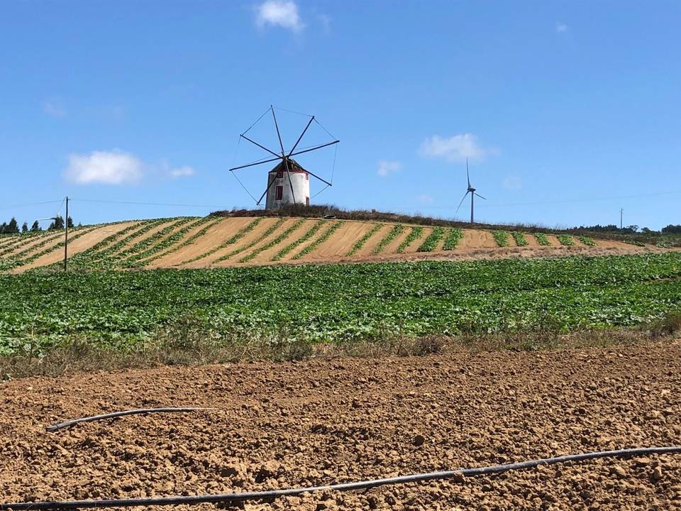
Road · Portugal
Atouguia da Baleia – Alcoentre via Campelos
A hilly 135 km road cycling loop from Atouguia da Baleia, Leiria through Serra d'El-Rei, Seixal and Alcoentre, with 1,446 m of climbing over Vilar climb (540 m). Most of it (99.5 km) is on main roads without a cycle lane, 7.5 km where the limit is 80 km/h or more.
At a glance
- Best for
- Long endurance days for confident riders at ease in traffic
- Distance
- 135.3 km
- Elevation gain
- 1,446 m
- Riding time
- 5–7 hours
- Difficulty
- Hard
- Bike
- Road bike
- Surface
- Mostly paved
- Traffic
- Mostly main roads
- Food & water
- Regular
- Best months
- May to Sep
- Navigation
- GPX download
- Start and finish
- Atouguia da Baleia
Map and elevation profile
Elevation profile
- 1,446 m
- 135 km
Route description
- Atouguia da Baleia
- Serra d'El-Rei
- Seixal
- Vilar
- Vilar climb (540 m)
- Alcoentre
- Mata de Baixo
- Ribeira dos Ameais
- Caldas da Rainha
- Atouguia da Baleia
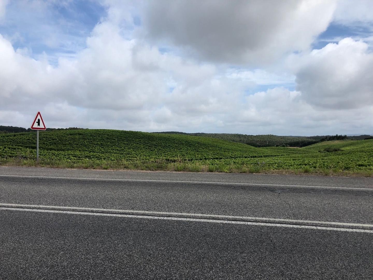
This 135.3 km loop route starts and finishes at Atouguia da Baleia. Early climbs include a 1.8 km ascent at 2.2% average gradient gaining 40 m, followed by a 3 km climb at 2.3% with 68 m gain near km 12.8. Another climb from km 29.8 is 3 km at 2.8%, with a max gradient of 7.2% and 84 m gain. The major climb begins at km 44.8, lasting 8.9 km, averaging 5.1% and reaching a height of 538 m. Other climbing parts are smaller but include a 4 km ascent at 3% near km 85 and shorter climbs later in the route. The highest point lies around 53.7 km. The route features 95% paved surfaces, 76% on main roads and 9% on quiet streets. There are 99.5 km on main roads without cycle lanes, and 7.5 km are on roads with speed limits over 80 km/h.
The route passes through many places including Serra d'El-Rei, Lourinhã, Campelos, Vilar, Caldas da Rainha, and others. Cafés are available at km 6.3, 11.5, 23.5, 33.1, 61.3, 80.7, 96.8, 108.9, and 120.3 with shops and supermarkets along the way, notably in Lourinhã and Caldas da Rainha. There are bike shops near the start and at 80.7 km, and two railway stations at 39 km and 109.7 km offer bailout points. The longest stretch without café, shop or water is 10.4 km from km 70.3 to 80.7. Water taps and springs are available at multiple points including km 2 and 58.1. Toilets can be found near km 22.1 and 108.9.
The profile features 23% climbing and 23% descending with 54% flat sections. Steep gradients over 5% span 5.5 km with short sections over 8%. The steepest 500 m section reaches 8% gradient near 54.6 km, descending 325 m over 4.8 km starting just after 56.4 km. Peaks near the road include Outeiro da Cabeça (180 m) and Cabeça Gorda (165 m) around km 39 to 42.
Why ride this route?
- Climbs Vilar climb (540 m) (9 km at 5.1 %).
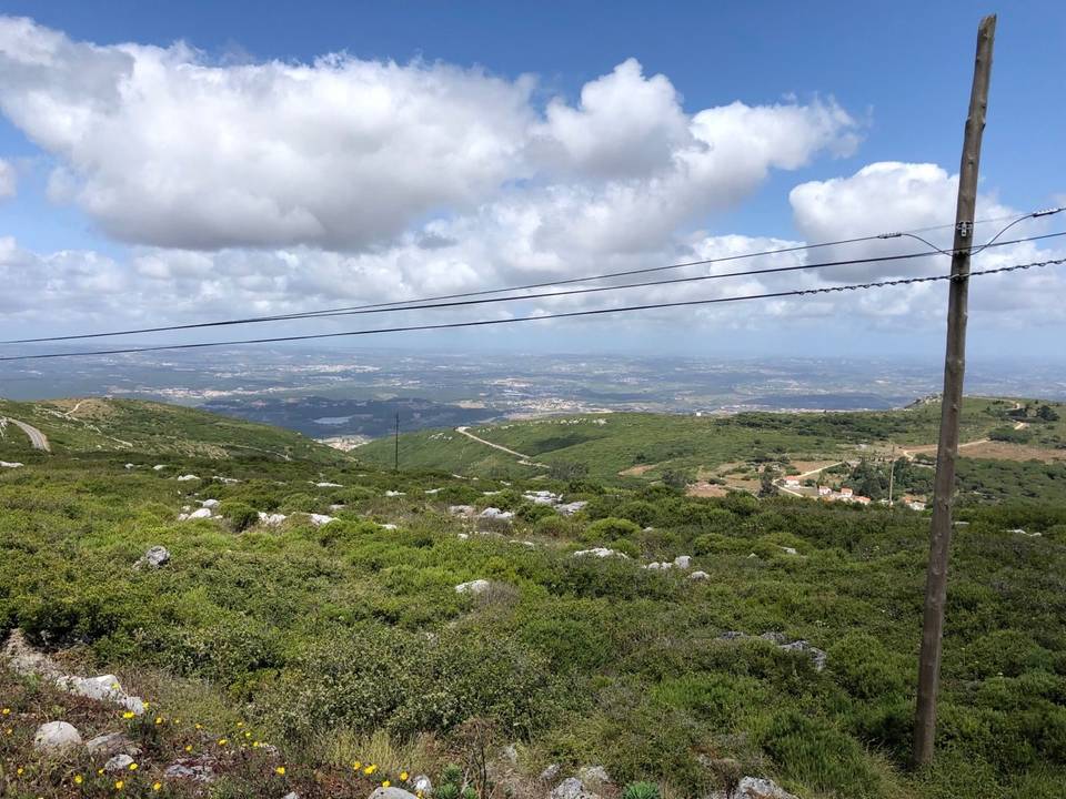
- Tops out at 538 m, 53.7 km in.
Highlights
- Climb to 538 m near km 53.7
- Pass through Lourinhã at 23 km
- Longest climb 8.9 km at 5.1% avg
- Peaks Outeiro da Cabeça and Cabeça Gorda near km 40
Along the route
Places passed
Climbs
| Climb | Starts at | On this ride | Full ascent | Top on this ride |
|---|---|---|---|---|
| Unnamed climb | 0.2 km | 1.8 km · 40 m · 2.2 % · max 3.9 % | — | 78 m |
| Unnamed climb | 12.8 km | 3 km · 68 m · 2.3 % · max 3 % | — | 103 m |
| Unnamed climb | 29.8 km | 3 km · 84 m · 2.8 % · max 7.2 % | — | 107 m |
| Vilar climb (540 m) | 44.8 km | 8.9 km · 457 m · 5.1 % · max 10.1 % | 9 km · 459 m · 5.1 % | 538 m |
| Unnamed climb | 85.3 km | 4 km · 123 m · 3 % · max 5.5 % | — | 186 m |
| Unnamed climb | 105.7 km | 1.8 km · 46 m · 2.6 % · max 5.3 % | — | 127 m |
| Unnamed climb | 120.5 km | 2 km · 62 m · 3.1 % · max 6.8 % | — | 94 m |
Vilar climb (540 m) · full ascent, starts at 44.7 km
< 4%4 – 7%7 – 10%> 10%
Traffic, surface and gradient
This is not a cycle-track route: 74% is on main roads without a cycle lane, 7.5 km of it where the limit is 80 km/h or more. Riders should be comfortable sharing the road with faster traffic.
- Roads
- 76% main road · 9% quiet street · 5% minor road · 3% path · 7% other roads and tracks
- Main roads
- 99.5 km on main roads without a cycle lane — likely busier
- Fast roads
- 7.5 km on roads with a limit of 80 km/h or more
- Cycle paths
- 2.7 km on cycle paths or roads with a cycle lane
- Main roads used
- EN 1 (14 km), EN 361-1 (10 km), EN 247 (9 km), EM 603 (7 km)
- Surface
- Predominantly paved: 95% is mapped as paved, 4% as unpaved or gravel.
- Gradient
- 23% climbing · 23% descending · 54% flat
- Steep sections
- 5.5 km over 5% · 0.4 km over 8% · steepest 500 m averages 8% at 54.6 km
- Longest descent
- 4.8 km from 56.4 km, dropping 325 m
Food, water and services
No stretch is longer than 15 km without a café, shop or water. Along the route: 129 cafés and restaurants, 38 shops, 12 water points, 13 petrol stations, 7 public toilets and 4 bike shops.
Food, water and shops in ride order
- 2 kmFonte dos Cabreiros · spring · 200 m off route
- 6.3 kmA Serrana · café · 60 m off route
- 7.1 kmMoeve · petrol station · 130 m off route
- 11.5 kmEntre Amigos · café · 80 m off route
- 22.1 kmLidl · supermarket · 130 m off route
- 22.4 kmDrinking water · 150 m off route
- 23.5 kmDouble AM · café · 90 m off route
- 33.1 kmAmanhecer - Minimercado Zeca · convenience store · 60 m off route
- 40 kmLusoceram · supermarket · 160 m off route
- 61.3 kmAlter Café, Rochaforte · café · on the route
- 80.7 kmCafé os Padeiros · café · on the route
- 82.1 kmDrinking water · on the route
- 85 kmPingo Doce · supermarket · 80 m off route
- 89.6 kmDrinking water · 210 m off route
- 96.8 kmTaverna Zé Raul · café · 30 m off route
- 108.9 kmLocal Café · café · on the route
- 108.9 kmToilets · 60 m off route
- 109.3 kmAuchan Supermercado · supermarket · 40 m off route
Need to bail out?
- 39 km — Outeiro (station), 280 m off route
- 109.7 km — Caldas da Rainha (station), 540 m off route
Worth a stop
- 11.2 km — Parque de merendas (picnic site)
- 23 km — Baloiço adaptado da Lourinhã (attraction)
- 82.1 km — Parque do Peregrino (picnic site)
- 108.9 km — Chapéus (attraction)
- 122.8 km — Cabeço da Serra (peak, 108 m)
Know before you go
- 99.5 km on main roads without cycle lanes
- 7.5 km on roads with 80 km/h+ speed limits
- Longest 10.4 km stretch without café/shop/water km 70.3–80.7
- Short gravel and track sections totaling 8.4 km