
Cycling in Atalaia
10 cycling routes from Atalaia, Lisbon, Portugal, 33 to 122 km, 747 km mapped in all, with up to 1,443 m of climbing in a day. Hilly riding (10 m of climbing per km on average), mostly road routes, 65% of the riding on main roads without a cycle lane. 4 named climbs; the high point is 652 m on Lourinha – Ventosa. Best months to ride: May to Sep.
At a glance
- Routes
- 10
- Lengths
- 33–122 km
- Biggest day
- 1,443 m
- Terrain
- Hilly
- Surface
- Mostly paved
- Bike
- Road bike
- Difficulty
- Easy to Hard
- Named climbs
- 4
- Best months
- May to Sep
- Longest gap
- 23 km
- GPX
- Every route
- Lourinha – Silveira33 km364 m ↑Easy·Loop·Jul 2025GPX
- Lourinha – Sao Pedro da Cadeira via Lourinhã57 km708 m ↑Moderate·Loop·Jul 2025GPX
- Lourinha – Cadaval via Campelos60 km472 m ↑Moderate·Loop·Aug 2026GPX
- Lourinha – Cadaval via Moita Dos Ferreiros64 km711 m ↑Moderate·Loop·Jul 2026GPX
- Lourinha – Caldas da Rainha via Lourinhã75 km584 m ↑Moderate·Loop·Jun 2026GPX
- Lourinha – Torres Vedras via Silveira78 km573 m ↑Moderate·Loop·Jul 2026GPX
- Lourinha – Obidos via Gaeiras80 km748 m ↑Hard·Loop·Jul 2026GPX
- Lourinha – Cadaval via Torres Vedras81 km738 m ↑Hard·Loop·Aug 2026GPX
- Lourinha – Ventosa96 km1,443 m ↑Hard·Loop·Jul 2026GPX
- Lourinha – Rio Maior122 km1,353 m ↑Hard·Loop·Aug 2026GPX
Know before you go
Added up from the recorded routes and OpenStreetMap; nothing estimated.
- Surface
- Paved almost throughout — 19 km of gravel or unpaved road across the routes.
- Roads
- 65% of the riding on main roads without a cycle lane · 5 km on cycle paths or lanes.
- High point
- 652 m on Lourinha – Ventosa.
- Climbs
- 4 named climbs · 1 ascent of 500 m or more.
- Bail-outs
- A railway station or ferry within reach on 9 routes.
- Ridden
- Jul to Aug, 23–30 °C recorded.
Cycling guide to Atalaia
Atalaia in the Lisbon region of Portugal serves as a start for multiple cycling loops ranging from 33 km to 122 km. Routes pass through many local places like Lourinhã, Cadaval, Gaeiras, and Caldas da Rainha, offering a variety of distances and elevation gains to explore. The longest route covers 122 km with significant climbing, while shorter loops provide moderate distance and elevation options. These routes include multiple climbs, some reaching maximum elevations of up to 652 m, spread across distances with some climbs over 10 km long. Riders can find several railway stations near the routes, from one to six, depending on the course selected, allowing for accessible start and end points.
More on best time to ride, terrain
Best time to ride
Routes were recorded between June and August, with temperatures from 23°C to 30°C, indicating summer as the best time to ride.
Terrain
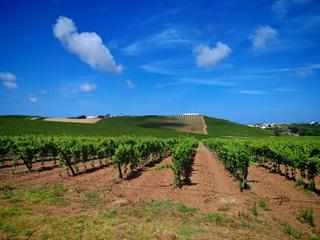
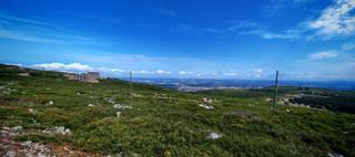
The terrain around Atalaia is mostly rolling with some significant climbs. Average gradients of the biggest climbs are between 2.6% and 5.1%, with maximum gradients from 4.4% to 16.1%. The highest point reached on the routes is 652 m. Climbs vary in length up to about 11.4 km, indicating sustained ascents. Overall, the elevation gains range roughly from 364 m to 1,443 m across the different loops.