Cyclists.com

Lourinha – Cadaval via Campelos

Atalaia, Lisbon, PortugalRoad

60 km
Distance
472 m
Elevation gain
Moderate
Difficulty
Paved
Surface
Download GPXMap
On the road: Lourinha – Cadaval via Campelos

Elevation profile

Total ascent
472 m
Distance
60 km
050100150200m0 km204060 km148 m · highest, at 8.5 kmStartFinish · back at the start

Route overview

This ride suits cyclists who want a medium distance route with moderate climbing in a loop.

A 60 km loop from Atalaia in Lisbon region with 472 m climbing including three main climbs.

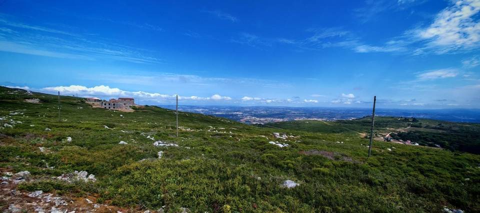
The route starts just outside Atalaia and passes through Lourinhã at 2.4 km before climbing 128 m over 3.1 km from km 4.1 to reach 147 m at km 7.2. It continues through several villages including Matas, Capelas, and Barrocas, reaching the highest point at 149 m around km 8. Most of the first half features 58% of the total elevation gain. After a longest descent of 2.6 km from km 14.1, the route includes a 2.1 km climb from km 16.3 gaining 88 m. The loop then passes through Maxial at 27 km, Aldeia Grande, and Vilar before ongoing minor and quiet roads leading to Outeiro da Cabeça and Campelos. The last significant climb is 1.7 km starting at 56.5 km, gaining 86 m up to 94 m, just before the finish back at Atalaia. The surface is 94% paved with some 5% gravel or unpaved mainly on minor roads and tracks. About 41 km are on main roads without cycle lanes, including some fast sections (1.2 km at 80 km/h+). There are food and drink options in Lourinhã at 2.4 km, restaurants around 13 km and 29 km, cafés near 40 and 46.5 km, and other places to refuel or buy supplies. Two bailouts by railway station appear at 23.3 km and 40.2 km. The longest stretch without a café, shop, or water is 12.3 km from km 14.6 to 26.9.

Highlights

  • Climb of 128 m over 3.1 km from km 4.1
  • Passes Lourinhã at 2.4 km with café, water, and station
  • Peaks near road: Bombarda 151 m, Cabeça Gorda 165 m
  • Three main climbs with max gradients up to 8.2%

Along the route

Measured from the recorded track and OpenStreetMap.

Places passed

  1. Lourinhã 2.4 km
  2. Matas 6.7 km
  3. Capelas 7.4 km
  4. Barrocas 8 km
  5. Pregança do Mar 8.2 km
  6. Abrunheira 24 km
  7. Ermegeira 25.2 km
  8. Maxial 26.9 km
  9. Aldeia Grande 29.3 km
  10. Vilar 34.8 km
  11. Outeiro da Cabeça 40.6 km
  12. Campelos 46.4 km
  13. Ribeira de Palheiros 47.8 km
  14. Miragaia 51.7 km
  15. Nadrupe 53.2 km

Climbs

ClimbStarts atLengthGainAverageMaxTop
Lourinhã climb4.1 km3.1 km128 m4.1 %7.9 %147 m
16.3 km2.1 km88 m4.3 %7 %115 m
56.5 km1.7 km86 m5.1 %8.2 %94 m

High point 149 m at 8 km; low point 8 m. Passes beneath Bombarda, Cabeça Gorda, Outeiro da Cabeça.

Lourinhã climb · starts at 4.1 km

3.1 km at 4.1% · 128 m
50100m4.2%4.7%0 km123.0 km147 msteepest 4.7%
< 4%4 – 7%7 – 10%> 10%

What this ride is like

Measured from OpenStreetMap along the track and the elevation profile.

Roads
70% main road · 14% quiet street · 13% minor road · 3% track
Main roads
41.2 km on main roads without a cycle lane — likely busier
Fast roads
1.2 km on roads with a limit of 80 km/h or more
Main roads used
EN 8-2 (10 km), EN 361-1 (10 km), EN 115-2 (7 km), EN 361 (4 km)
Surface
Paved throughout
Gradient
17% climbing · 20% descending · 63% flat
Steep sections
2.6 km over 5% · 0.3 km over 8% · steepest 500 m averages 7.8% at 58.5 km
Longest descent
2.6 km from 14.1 km, dropping 35 m

Along the way

Within a few hundred metres of the track, from OpenStreetMap. Opening hours change — treat this as where to look, not a promise.

Food, water and shops

  1. 2.3 kmGaragem Avenida do Oeste · petrol station · 60 m off route
  2. 2.4 kmVilla Park · café · 60 m off route
  3. 2.4 kmDrinking water · 130 m off route
  4. 3.3 kmMinipreço · supermarket · 50 m off route
  5. 3.3 kmFarmácia Marteleirense · pharmacy · 100 m off route
  6. 13 kmOs Severianos · restaurant · 60 m off route
  7. 13 kmWater tap · 40 m off route
  8. 14.6 kmConvenience store · 30 m off route
  9. 14.6 kmPrio · petrol station · on the route
  10. 29.1 kmO Troféu · restaurant · 30 m off route
  11. 29.3 kmDrinking water · 70 m off route
  12. 34.8 kmPrincesa de Alcântara · restaurant · 50 m off route
  13. 39.3 kmLusoceram · supermarket · 120 m off route
  14. 40.5 kmCafé Central · café · 270 m off route
  15. 46.4 kmFarmácia Campelos · pharmacy · on the route
  16. 46.5 kmAdega da Vila · café · on the route
  17. 53.2 kmCarlos dos Leitões · restaurant · on the route
  18. 56.2 kmFeira da Lourinhã · market · 250 m off route

Need to bail out?

  • 23.3 kmRamalhal (station), 270 m off route
  • 40.2 kmOuteiro (station), 290 m off route

Whether bikes are carried depends on the service — check before relying on it.

Worth a stop

  • 2.4 kmBaloiço adaptado da Lourinhã (attraction)
  • 25.8 kmGruta da Ermejeira (archaeological site)
  • 37.3 kmCabeça Gorda (peak, 165 m)

Practical information

Surface
Paved
Route shape
Loop
Riding time
2½–3 hours riding
Season
July and August with temperatures from 23 to 30 °C.

Know before you go

  • 41 km on main roads without cycle lanes
  • 1.2 km on roads with 80 km/h+ speed limit
  • Longest no café, shop or water stretch: 12.3 km from 14.6 to 26.9
  • About 5% gravel or unpaved road surface

Routes are for inspiration. Roads, surfaces and conditions change — check locally and ride within your limits.

More rides from Atalaia