Bratislava to Gabčíkovo
- 56 km
- 0 m
- Easy
- Paved

Elevation profile
- 0 m
- 56 km
Route overview
Suitable for riders seeking a flat 56 km route with minimal climbing.
Day 18 of Rotterdam to Budapest: 55.7 km from Bratislava to Gabčíkovo with 0 m of climbing, retraced from the map.
This flat 55.7 km route begins in Bratislava at 159 m near Slavín and descends gently to 115 m near the end. It passes through several villages including Old Town, Hamuliakovo, Šamorín, Mliečno, and others before finishing in Gabčíkovo. The terrain is almost entirely flat with just 0.1 km over 5% gradient. The route primarily follows paved surfaces (95%), with most of the distance on cycle paths (35 km), quiet streets (9.6 km), and minor roads, with a few sections on main roads and tracks. There is 2.5 km on main roads without cycle lanes, including 2.3 km on roads with speed limits over 80 km/h. Notable refuelling options include cafés and restaurants at start and along the way, and a Tesco supermarket at the finish. Cyclists should note a longest stretch of 17.4 km without cafés, shops, or water from 35.4 km to 52.8 km. Several bail out points are available including Bratislava main station and ferries at Hamuliakovo and Kyselica. Toilets and bike shops are found near the start and mid-route points.
Highlights
- Start near Slavín peak at 159 m
- Cycle paths cover 63% of route
- Passes through Šamorín and Hamuliakovo
- Longest café/shop gap of 17.4 km from 35.4 to 52.8 km
Along the route
Places passed
What this ride is like
- Roads
- 63% cycle path · 17% quiet street · 7% minor road · 5% path
- Main roads
- 2.5 km on main roads without a cycle lane — likely busier
- Fast roads
- 2.3 km on roads with a limit of 80 km/h or more
- Cycle paths
- 35.7 km on cycle paths or roads with a cycle lane
- Surface
- Paved throughout
- Gradient
- 0% climbing · 1% descending · 99% flat
Along the way
Longest stretch without a café, shop or water: 17 km, from 35 km to 53 km.
Food, water and shops
- 0 kmToilets · 40 m off route
- 0.5 kmDr. Max · pharmacy · on the route
- 0.7 kmTUMA · bike shop · 30 m off route
- 1 kmMedická záhrada · water tap · 70 m off route
- 2.1 kmYeme · supermarket · 70 m off route
- 3.7 kmJurki · petrol station · 50 m off route
- 6.8 kmBufet Relax · restaurant · on the route
- 12.7 kmBufet Gajc · pub · 50 m off route
- 19.2 kmCafe Dunaj · bar · 90 m off route
- 26.5 kmCOOP Jednota · supermarket · 50 m off route
- 26.5 kmWater tap · 90 m off route
- 26.5 kmSamária · pharmacy · 50 m off route
- 27 kmTankujeme! · petrol station · 240 m off route
- 32.4 kmWater tap · 60 m off route
- 32.7 kmToilets · 40 m off route
- 52.8 kmReštaurácia Nimród · restaurant · 110 m off route
- 55 kmPharmacy · 50 m off route
- 55.3 kmAVAJETT · petrol station · 90 m off route
Need to bail out?
- 0 km — Bratislava main station (station), 860 m off route
- 20.9 km — Prístav Hamuliakovo (ferry), 50 m off route
- 35.4 km — Kyselica (ferry), 170 m off route
Worth a stop
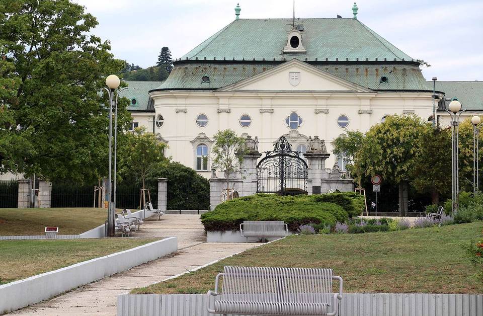
- 0 km — Office of the Government of the Slovak Republic (castle)
- 18 km — Bird life observation hide (viewpoint)
- 21.1 km — Leaning Tower of Hamuliakovo (attraction)
- 26.9 km — István Sidó (attraction)
- 32.7 km — Holy place of wheeping Virgin Mary (attraction)
At the start
- U Adriany · café · 40 m
- Triple Five Coffee Roasters · café · 60 m
- Kaliforňan · fast food · 90 m
- Divný Janko · restaurant · 80 m
- Skupinová Terapia · pub · 260 m
At the finish
- Tesco Supermarket · supermarket · 270 m
- Paša · fast food · 180 m
- Pizzeria Kovacs · restaurant · 210 m
Stay after this ride
- Účelové zariadenie Gabčíkovo · hotel · 1.4 km from the finish
Practical information
- Paved
- Point to point
- 3 h 59 min
Know before you go
- 17.4 km without café, shop or water from 35.4 to 52.8 km
- 2.5 km on main roads without cycle lane
- 2.3 km on roads with 80 km/h+ speed limit