Road · Switzerland
A mountainous 20 km road cycling route from Brig through Ried-Brig, Schallberg and Rosswald, with 1,395 m of climbing over the Brig climb. Most of it (11.2 km) is on main roads without a cycle lane, 2.8 km where the limit is 80 km/h or more.
The route starts in Brig and immediately begins climbing, covering 18.2 km and gaining 1362 m to reach an elevation of 2049 m at the top. The average gradient is 7.5% with a maximum of 20.2%. The first half of the climb accounts for 42% of the elevation gain, with a total of 90% climbing, 6% descending and 4% flat. The road surface is predominantly paved (96%) with 4% gravel or unpaved, and 1% unmapped.
The 19.6 km route runs on a mix of road types: 10.9 km on main roads (all without a cycle lane), 4.7 km on minor roads, 2.9 km on quiet streets, and 0.7 km on paths. The longest named roads are the 9S (10.9 km) and Simplonstrasse (3.9 km). There is a 5.1 km stretch without cafés, shops, or water between 14.1 and 19.2 km. Starting in Brig, there are several refreshment and resupply options including cafés, fast food, and a bike shop. A bailout station is at Brig Bahnhofplatz. Along the climb are places such as Naters, Ried-Brig, Schallberg, Rosswald, Berisal, Rothwald, and Kulm at the finish.
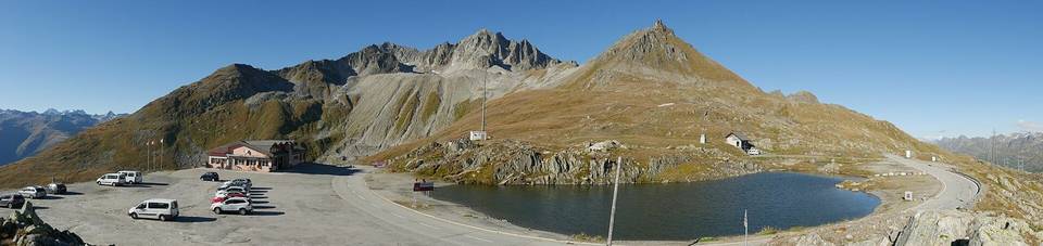
Water points are available at 2.5, 5.8, 10.7, and near the finish at 19.5 km. Toilets are located near the start and at 19.1 km. Notable stops include the café Kaffee Klatsch near the start, and restaurants Schutzhaus at 14.1 km and Simplonblick at the finish. A viewpoint is near Kreuz at 2 km and the Ganterbrücke attraction near 9.4 km.
| Climb | Starts at | On this ride | Full ascent | Top on this ride |
|---|---|---|---|---|
| Brig climb | 0 km | 18.2 km · 1362 m · 7.5 % | 18.2 km · 1362 m · 7.5 % | 2049 m |
This is not a cycle-track route: 57% is on main roads without a cycle lane, 2.8 km of it where the limit is 80 km/h or more. Riders should be comfortable sharing the road with faster traffic.
No stretch is longer than 15 km without a café, shop or water. Along the route: 44 cafés and restaurants, 10 shops, 13 water points, 6 public toilets and 3 bike shops.