Cyclists.com

Furka Pass from Gletsch

Gletsch, SwitzerlandRoad

Routed from the map This classic road was traced on OpenStreetMap and measured against the terrain model; no member has recorded it yet. Ridden it? Add your recording and photos.

11 km
Distance
666 m
Elevation gain
Easy
Difficulty
Paved
Surface

Elevation profile

Total ascent
666 m
Distance
11 km
Elevation (m)05001,0001,5002,0002,5003,0000 km2.5 km5 km7.5 km10 kmHighest point2,430 m at 10.5 kmStart0 kmFinish10 km

Route overview

Suitable for riders looking for a short but steep mountain climb of 10.5 km with 666 m gain.

A 10.5 km climb from Gletsch to Furka Pass in Switzerland reaching 2429 m.

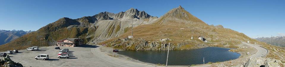
The route begins at Gletsch (1763 m) and climbs continuously for 10.4 km on a paved main road (number 19) to a high point at 2429 m at Furka Pass. The total elevation gain is 666 m with an average gradient of 6.4% and sections up to 10.4%. Nearly all the route is ascending, with 8.9 km over 5% gradient and 1.7 km over 8%, including 0.5 km over 10%. The climb is mostly on main roads without a cycle lane and mostly on roads with speed limits of 80 km/h or more. The road passes near peaks such as Uf de Bidmer at 2.4 km, Blauberg near 10.4 km, and Furkastock at the top at 10.5 km. There is a cafe, Truck Lounge Goms, just 14 m off route near the start at 0.2 km, and another cafe, Snack-Buvette Belvédère, near 7.8 km. Water taps and toilets are available near the start and at the top. Shops and bailout points are available at Gletsch and near Muttbach-Belvédère station at 9.8 km, though the latter lies 661 m off route. A 7.6 km stretch between 0.2 and 7.8 km has no cafe, shop or water. The surface is fully paved and the entire route is on main road 19. The climb profiles mostly upward with no flat sections, with 46% of elevation gain in the first half of the route. The Gletsch station allows for bailout or arrival by train.

Highlights

  • Furka Pass summit at 2429 m
  • Climb starts at Gletsch station
  • Peaks Uf de Bidmer and Blauberg nearby
  • Paved main road 19 throughout

Along the route

Measured from the recorded track and OpenStreetMap.

Climbs

ClimbStarts atLengthGainAverageMaxTop
Furkastock0.1 km10.4 km664 m6.4 %10.4 %2429 m

High point 2429 m at 10.5 km; low point 1763 m. Passes beneath Uf de Bidmer, Blauberg, Furkastock.

Furkastock · starts at 0.1 km

10.4 km at 6.4% · 664 m
1800190020002100220023002400ELEVATION (M)7.0%6.3%5.2%6.3%8.7%8.4%7.7%5.0%1.4%0 km12345678910.3 kmDISTANCE (KM)Furkastock · 2,429 mSTEEPEST 8.7%
< 4%4 – 7%7 – 10%> 10%

What this ride is like

Measured from OpenStreetMap along the track and the elevation profile.

Roads
100% main road
Main roads
10.5 km on main roads without a cycle lane — likely busier
Fast roads
9.3 km on roads with a limit of 80 km/h or more
Main roads used
19 (11 km)
Surface
Paved throughout
Gradient
99% climbing · 1% descending · 0% flat
Steep sections
8.9 km over 5% · 1.7 km over 8% · 0.5 km over 10%

Along the way

Within a few hundred metres of the track, from OpenStreetMap. Opening hours change — treat this as where to look, not a promise.

Food, water and shops

  1. 0 kmWater tap · on the route
  2. 0.1 kmToilets · on the route
  3. 0.2 kmTruck Lounge Goms · café · on the route
  4. 7.8 kmSnack-Buvette Belvédère · café · 70 m off route
  5. 7.8 kmDrinking water · 120 m off route
  6. 10.5 kmKiosk · on the route
  7. 10.5 kmToilets · on the route

Need to bail out?

  • 0 kmGletsch (station), on the route
  • 9.8 kmMuttbach-Belvédère (station), 660 m off route

Whether bikes are carried depends on the service — check before relying on it.

Worth a stop

  • 0.3 kmKlein Wasserkraftwerk (attraction)

At the start

  • Gletsch · station · 0 m
  • Truck Lounge Goms · café · 120 m

Practical information

Surface
Paved
Route shape
Point to point
Riding time
45 min

Know before you go

  • 7.6 km without café, shop or water between 0.2 and 7.8 km
  • 10.5 km on main roads without a cycle lane
  • 9.3 km on roads with speed limits of 80 km/h or more
  • Maximum gradient 10.4% over 0.5 km

Routes are for inspiration. Roads, surfaces and conditions change — check locally and ride within your limits.