
Cyclists.com

Chaumont to Langres

Chaumont, Champagne-Ardenne, FranceRoad

44 km
Distance
412 m
Elevation gain
Moderate
Difficulty
Paved
Surface

Elevation profile

412 m over 44 km

Route overview

A manageable half-day ride for riders comfortable with 44 km and 412 m of climbing, most of it gentle apart from the finish.

A 43.8 km point-to-point ride from Chaumont to Langres across the Haute-Marne plateau, with 412 m of climbing and a final 2.7 km ramp into Langres.

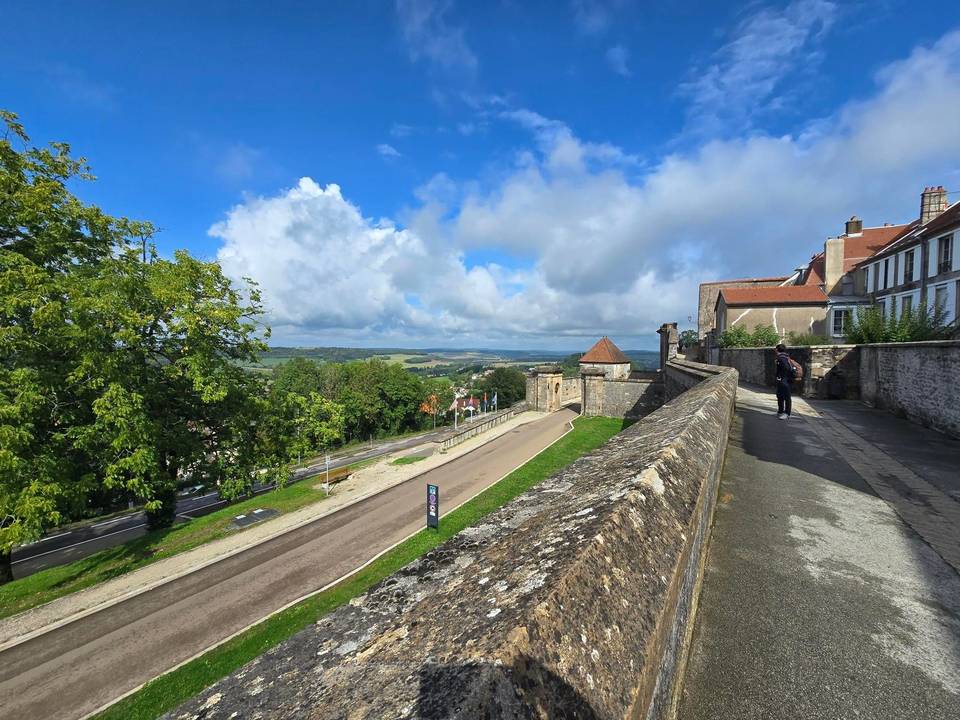
The route leaves Chaumont and drops out along the valley through Chamarandes-Choignes, passing Le Haut du Val and Brottes before reaching Neuilly-sur-Suize. The low point of the day comes at 302 m near km 8.6, after which the road begins to lift onto the plateau: a steady 1.7 km climb from Crenay gains 51 m at 2.9%, topping out at 366 m. From there the middle section rolls south through Leffonds, where there is drinking water at km 19.2, then Marac and Beauchemin, the latter sitting beneath Mont Jourdeuil at 446 m. Nearly half the climbing (48%) is done by halfway, and the terrain between Saint-Ciergues, Saint-Martin-lès-Langres, Melville, Humes and Jorquenay stays undulating rather than steep. The sting is saved for the end. After Champigny-lès-Langres and Saint-Gilles the road tips up at km 39.8 for 2.7 km at 4.8%, with a maximum of 8.1%, gaining 128 m to reach 461 m. A viewpoint, the Table d'orientation et panorama ouest, comes at km 42 as the route climbs the last metres to the high point of 470 m at km 43.2 in Langres.

Highlights

  • Final 2.7 km climb at 4.8%, ramping to 8.1% into Langres
  • Table d'orientation et panorama ouest at km 42
  • Beauchemin beneath Mont Jourdeuil, 446 m
  • High point of 470 m in Langres itself

Along the route

Measured from the recorded track and OpenStreetMap.

Places passed

  1. Chamarandes-Choignes 2.5 km
  2. Chamarandes 2.5 km
  3. Le Haut du Val 3.4 km
  4. Brottes 5 km
  5. Neuilly-sur-Suize 8.4 km
  6. Crenay 12.1 km
  7. Rochevilliers 14.9 km
  8. Leffonds 19.2 km
  9. Marac 24.8 km
  10. Beauchemin 29.5 km
  11. Saint-Ciergues 31.8 km
  12. Saint-Martin-lès-Langres 31.9 km
  13. Melville 32.9 km
  14. Humes 35.4 km
  15. Jorquenay 37 km
  16. Champigny-lès-Langres 39.2 km
  17. Saint-Gilles 40.5 km
  18. Brévoines 41.4 km

On the road

  • Le Saint-Hubert (Restaurant) 0 km
  • Pizzeria Le Palmier (Restaurant) 0 km
  • Le Jardin (Restaurant) 0 km
  • Sherwood (Restaurant) 0 km
  • La Table des Halles (Restaurant) 0 km
  • La Mouette Rieuse (Restaurant) 0.1 km
  • La Crêpe s’Affiche (Restaurant) 0.1 km
  • Hollywood Pizza (Restaurant) 0.1 km
  • Choucha food (Restaurant) 0.1 km
  • Bistrot - Le Tandem (Restaurant) 0.2 km
  • Délices du Caire (Restaurant) 0.3 km
  • Total (Fuel station) 3.7 km

Climbs

Starts atLengthGainAverageMaxTop
12.1 km1.7 km51 m2.9 %3.8 %366 m
39.8 km2.7 km128 m4.8 %8.1 %461 m

High point 470 m at 43.2 km; low point 302 m. Passes beneath Mont Jourdeuil.

Practical information

Surface
Paved
Route shape
Point to point
Riding time
2½–3 hours riding
Season
Recorded in September at 22°C, which suits the plateau crossing well; late spring to early autumn is the natural window.

Know before you go

  • Steep finish: pitches to 8.1% after 40 km of riding
  • No water or café listed between km 19.2 and km 39.8

Routes are for inspiration. Roads, surfaces and conditions change — check locally and ride within your limits.

6 photographs from the road

Part of