Road · United Kingdom
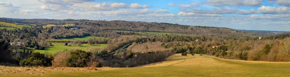
Ditchling Beacon from Ditchling
A mountainous 3 km road cycling route from Ditchling, with 172 m of climbing over Ditchling Beacon.
At a glance
- Best for
- Short, climbing-heavy rides
- Distance
- 3.2 km
- Elevation gain
- 172 m
- Riding time
- 14 min
- Difficulty
- Easy
- Bike
- Road bike
- Surface
- Mostly paved
- Traffic
- Mostly minor roads
- Food & water
- Regular
- Best months
- Jun to Sep
- Navigation
- GPX download
- Start → finish
- Ditchling
Map and elevation profile
Elevation profile
- 172 m
- 3 km
Route description
- Ditchling
- Ditchling Beacon
Starting just off Ditchling at 63 m elevation, the route climbs steadily over 3.2 km to reach 235 m at Ditchling Beacon beneath the 249 m peak. The main climb is 2.8 km long, averaging 6.2% gradient, including 1.2 km over 8% and 0.6 km over 10%, with a steepest 500 m section at 10.2% gradient around 1.7 km.
Most of the route is on minor roads (2.5 km, 77%) and the surface is predominantly paved (91%) with a small 6% on gravel or unpaved and 3% unmapped. There is a long 2.8 km stretch without any café, shop, or water from 0.2 to 3 km. The climb is mostly uphill (84%), with very little descending or flat sections. The start village, Ditchling, offers cafés, pubs, toilets, and a museum. An ice cream van may be available at the finish in summer.
Why ride this route?
- Climbs Ditchling Beacon (2.8 km at 6.2 %).
Highlights
- Climb to Ditchling Beacon at 235 m
- Peak Ditchling Beacon at 249 m
- Start in Ditchling with cafés and pubs
Along the route
Climbs
| Climb | Starts at | On this ride | Full ascent | Top on this ride |
|---|---|---|---|---|
| Ditchling Beacon | 0.5 km | 2.8 km · 171 m · 6.2 % · max 10.7 % | 2.8 km · 171 m · 6.2 % | 235 m |
Ditchling Beacon · full ascent, starts at 0.5 km
< 4%4 – 7%7 – 10%> 10%
Traffic, surface and gradient
Mostly minor roads and streets on the map.
- Roads
- 77% minor road · 23% other roads and tracks
- Surface
- Predominantly paved: 91% is mapped as paved, 6% as unpaved or gravel and 3% has no surface data.
- Gradient
- 84% climbing · 3% descending · 12% flat
- Steep sections
- 1.8 km over 5% · 1.2 km over 8% · 0.6 km over 10% · steepest 500 m averages 10.2% at 1.7 km
Food, water and services
No stretch is longer than 15 km without a café, shop or water. Along the route: 5 cafés and restaurants and 1 public toilet.
Food, water and shops in ride order
- 0.1 kmThe Green Welly · café · on the route
- 0.1 kmToilets · 30 m off route
- 0.2 kmDitchling Pharmacy · pharmacy · on the route
Worth a stop
- 0.1 km — Ditchling Museum of Art + Craft (attraction)
- 3.2 km — Ditchling Beacon (peak, 249 m)
Stay after this ride
- Stoneywish · campsite · 2.2 km from the finish
- Blackberry Wood (Meadow Campsite) · campsite · 2.4 km from the finish
Start and access
At the start
- Food and coffee
- The Green Welly (130 m), The Nutmeg Tree (150 m), The Bull (110 m)
At the finish
- Food and coffee
- Ice Cream Van (summer only) (190 m)
Know before you go
- 2.8 km without café, shop or water from 0.2 to 3 km
- 6% gravel or unpaved surface
- 77% on minor roads