
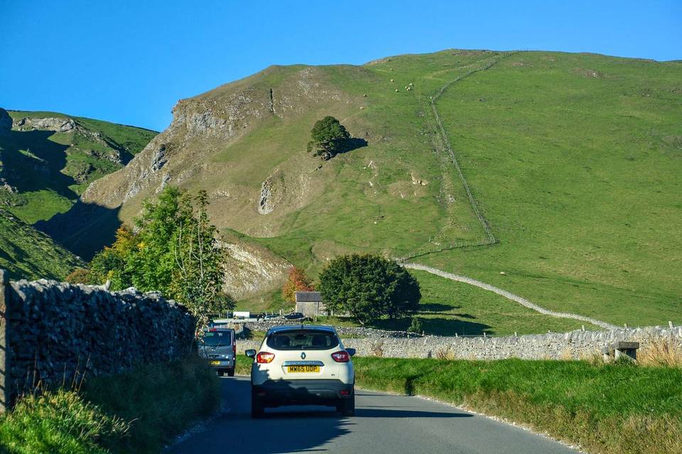
Cat and Fiddle Road from Macclesfield
- 11 km
- 445 m
- Easy
- Paved
Elevation profile
- 445 m
- 11 km
Route overview
Suitable for riders prepared for a short but steep 445 m climb over 10.5 km.
10.5 km climb on Cat and Fiddle Road from Macclesfield, UK, gaining 445 m.
This route starts in Macclesfield at 138 m elevation and heads north through Hurdsfield at 1.1 km. The first significant climb begins at 0.6 km, lasting 5.5 km, gaining 294 m at an average gradient of 5.3% with a maximum of 8.8%. After a short descent from 6.1 to 7.7 km dropping 68 m, the second climb starts at 7.9 km, ascending 150 m over 2.6 km at 5.9% average and reaching a maximum gradient of 9.9%, topping out at 508 m at the finish near Walker Barn at 10.5 km. The route is predominantly on minor roads (68%) with some major roads (28%), all but a small amount (about 2%) paved. Main roads lack cycle lanes over 2.9 km, with 1.5 km of roads with speed limits over 80 km/h. Facilities near start include cafes like Caffè Nero and shops, a water point at 1.1 km, and toilets at 3.8 km. There is a 4 km stretch from 3.8 to 7.8 km without cafés, shops, or water, so refuel before then. At the finish, Peak View Cafe is nearby.
Highlights
- Climb starts near Macclesfield at 0.6 km
- Maximum gradient 9.9% at 8.7 km
- Peak View Cafe near finish
- Elevation gain 445 m in 10.5 km
Along the route
Places passed
Climbs
| Climb | Starts at | Length | Gain | Average | Max | Top |
|---|---|---|---|---|---|---|
| Hurdsfield climb | 0.6 km | 5.5 km | 294 m | 5.3 % | 8.8 % | 432 m |
| Macclesfield climb | 7.9 km | 2.6 km | 150 m | 5.9 % | 9.9 % | 508 m |
Hurdsfield climb · starts at 0.6 km
Macclesfield climb · starts at 7.9 km
What this ride is like
- Roads
- 68% minor road · 28% major road
- Main roads
- 2.9 km on main roads without a cycle lane — likely busier
- Fast roads
- 1.5 km on roads with a limit of 80 km/h or more
- Surface
- Paved throughout
- Gradient
- 70% climbing · 19% descending · 11% flat
- Steep sections
- 4.4 km over 5% · 1.7 km over 8% · 0.3 km over 10% · steepest 500 m averages 9.8% at 8.7 km
Along the way
Food, water and shops
- 0 kmEsso · petrol station · 210 m off route
- 0.2 kmCaffè Nero · café · on the route
- 0.3 kmPeak Cyclesport · bike shop · 190 m off route
- 0.4 kmCohens Chemist · pharmacy · 130 m off route
- 1.1 kmSwettenham Street Maintenance Yard Water Point · water point · 50 m off route
- 1.2 kmThe Co-operative Food · convenience store · on the route
- 3.8 kmToilets · on the route
- 9.6 kmPeak View Cafe · café · 40 m off route
Need to bail out?
- 0.4 km — Macclesfield (station), 80 m off route
At the start
- Caffè Nero · café · 40 m
- Costa · café · 40 m
- GAIL's · bakery · 50 m
- Macclesfield · station · 240 m
- The Castle Inn · pub · 100 m
At the finish
- Peak View Cafe · café · 750 m
Practical information
- Paved
- Point to point
- 45 min
Know before you go
- 2.9 km on main roads without cycle lanes
- 1.5 km on roads with 80 km/h+ speed limit
- 4 km without café, shop or water between 3.8 and 7.8 km
