Cyclists.com

Winnats Pass from Castleton

Castleton, United KingdomRoad

Routed from the map This classic road was traced on OpenStreetMap and measured against the terrain model; no member has recorded it yet. Ridden it? Add your recording and photos.

2 km
Distance
192 m
Elevation gain
Easy
Difficulty
Paved
Surface

Elevation profile

Total ascent
192 m
Distance
2 km
Elevation (m)01002003004005000 km0.5 km1 km1.5 km2 kmHighest point413 m at 2.1 kmStart0 kmFinish2 km

Route overview

Suitable for riders seeking a short but steep climb with significant gradients.

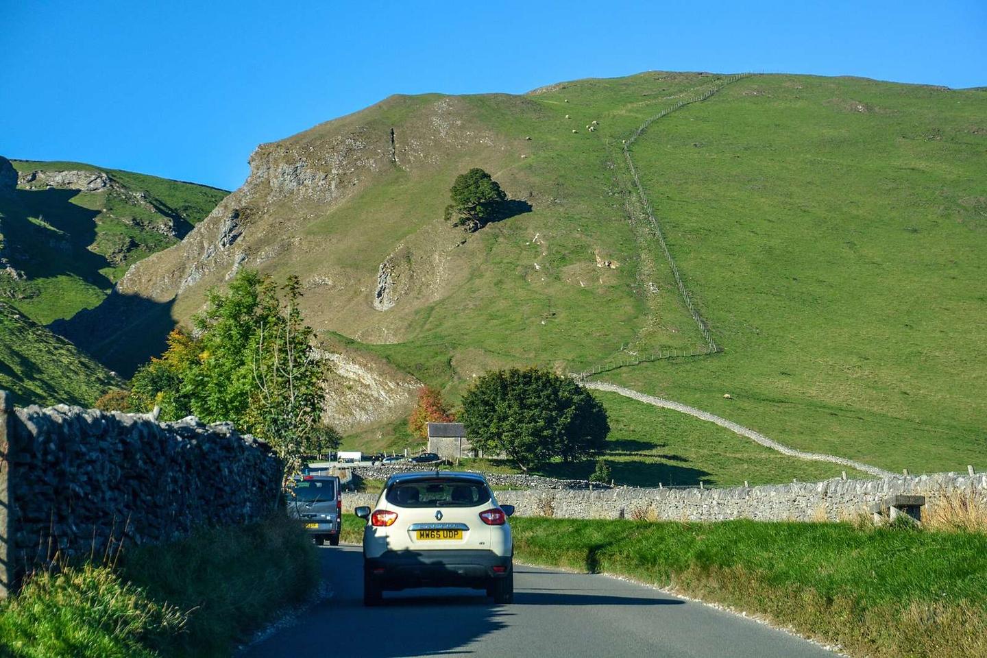
A 2.1 km climb with 192 m gain from Castleton up Winnats Pass in the UK.

The route starts at Castleton at 221 m height and climbs steadily over 2.1 km to 413 m at the top of Winnats Pass. The average gradient is 9.2%, with a maximum of 15% and about 1.2 km of the route exceeding 10% gradient. The road is mainly minor roads, with 95% paved surface and a short 5% gravel section. The climb is predominantly uphill for 95% of its length, with just a small descent of 5%. Climbing intensity is high, with 1.5 km above 5% and 1.3 km over 8%. The first 1.3 km have no café, shop or water, but a café is found just off-route at 1.3 km. Toilets and the Speedwell Cavern attraction are available near the start at 0.3 km, just 27 m and 11 m off the path respectively. Along the climb are peaks near the road including Hurd Low at 0.7 km (433 m), Mam Tor at 1.4 km (517 m), and Slitherstone Hill at the top at 2.1 km (477.5 m). The road is on minor roads with a 2 km stretch on roads posted at speeds 80 km/h or more.

Highlights

  • Climb from Castleton to 413 m
  • Peaks near the road: Hurd Low, Mam Tor, Slitherstone Hill
  • Steep climb averaging 9.2%, max 15%
  • Speedwell Cavern attraction near start

Along the route

Measured from the recorded track and OpenStreetMap.

Climbs

ClimbStarts atLengthGainAverageMaxTop
Slitherstone Hill0 km2.1 km192 m9.2 %15 %413 m

High point 413 m at 2.1 km; low point 221 m. Passes beneath Hurd Low, Mam Tor, Slitherstone Hill.

Slitherstone Hill · starts at 0 km

2.1 km at 9.2% · 192 m
250300350400ELEVATION (M)5.2%0 km12.1 kmDISTANCE (KM)Slitherstone Hill · 413 mSTEEPEST 13.5%
< 4%4 – 7%7 – 10%> 10%

What this ride is like

Measured from OpenStreetMap along the track and the elevation profile.

Roads
95% minor road
Fast roads
2 km on roads with a limit of 80 km/h or more
Surface
Paved throughout
Gradient
95% climbing · 5% descending · 0% flat
Steep sections
1.5 km over 5% · 1.3 km over 8% · 1.2 km over 10%

Along the way

Within a few hundred metres of the track, from OpenStreetMap. Opening hours change — treat this as where to look, not a promise.

Food, water and shops

  1. 0.3 kmToilets · on the route
  2. 1.3 kmCafé · 340 m off route

Worth a stop

  • 0.3 kmSpeedwell Cavern (attraction)

Stay after this ride

  • Rowter Farm Campsite · campsite · 880 m from the finish
  • Dunscar Farm · guest house · 2.1 km from the finish
  • Ye Olde Nags Head · hotel · 2.6 km from the finish
  • Technical Speleological Group · hostel · 2.7 km from the finish
  • Pervil House · guest house · 2.7 km from the finish

Practical information

Surface
Paved
Route shape
Point to point
Riding time
9 min

Know before you go

  • 1.3 km with no café, shop or water from start
  • 2 km on main roads with speed limits 80 km/h or more
  • Short 5% section of gravel

Routes are for inspiration. Roads, surfaces and conditions change — check locally and ride within your limits.