
Cyclists.com

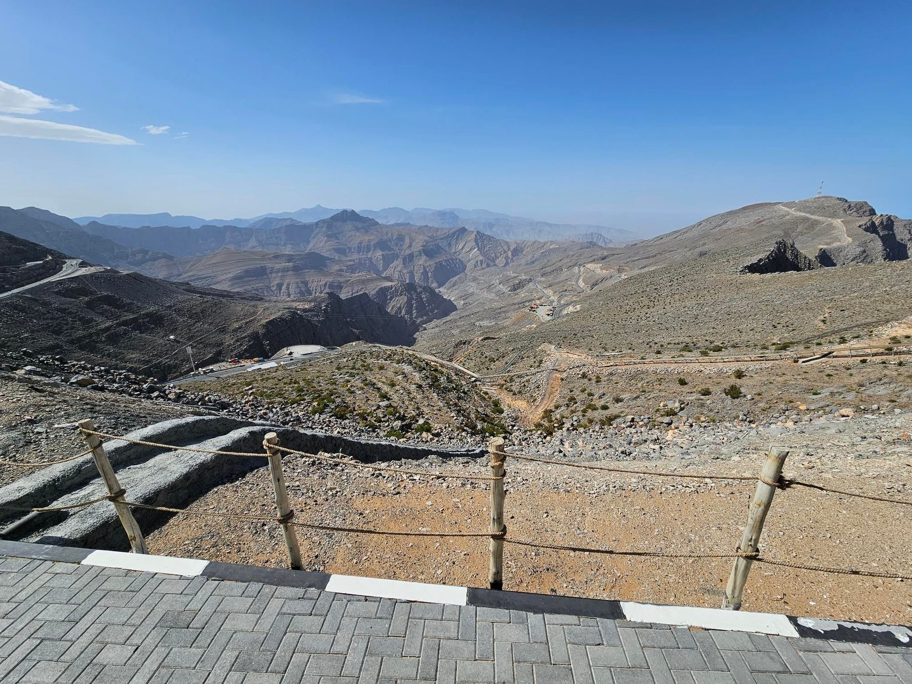
Jebel Jais summit from Ras Al Khaimah

Ras Al Khaimah, Hajar Mountains, United Arab EmiratesRoad

84 km
Distance
1,520 m
Elevation gain
Hard
Difficulty
Paved
Surface

Elevation profile

1,520 m over 84 km

Route overview

Riders comfortable with 83.5 km and 1,520 m of climbing, nearly all of it in one sustained 24 km ascent.

An 83.5 km loop from Ras Al Khaimah into the Hajar Mountains, with a 24 km climb to 1,515 m on Jebel Jais before a long descent to the coast.

The loop leaves Ras Al Khaimah and warms up on a short rise from km 2.7, 3.5 km at 3.5% topping out at 175 m, before running inland past a 338 m peak and an ADNOC fuel station at km 8.4, beneath Jibal Asmat As Si'eli (700 m). The main climb starts at km 16.1 and does not relent for 24.1 km, gaining 1,254 m at an average of 5.2% with a maximum of 7.2%. It passes the hamlets of Lahsa in Wadi Jib at km 20.1, Wassab at km 29.6 and Baighit at km 35.9, with viewpoints at km 20, 28.2, 33.4 and 37.4 and rest areas around km 34. The high point of 1,515 m comes at km 40.3, beneath Jabal ar Rahrah (1,691 m). Fully 93% of the day's climbing is done in the first half. The road then runs past Dafalas at km 42.5, below Jabal Maqatail (1,556 m) and Jabal Shintal (1,435 m), with further viewpoints to km 48.8 and a rest area at km 58.1. The descent continues through Ad Daqayiq at km 67.1 and Khab Al Lis at km 76.6 to the low point of 17 m at km 80.4, then back to the start.

Highlights

  • 24.1 km climb at 5.2% to the 1,515 m high point
  • Jabal ar Rahrah (1,691 m) above the summit road
  • Viewpoints at km 33.4, 37.4 and 48.8
  • Hamlets of Lahsa, Wassab and Baighit on the ascent

Along the route

Measured from the recorded track and OpenStreetMap.

Places passed· crosses into Oman

  1. Lahsa, Wadi Jib 20.1 km
  2. Wassab 29.6 km
  3. Baighit 35.9 km
  4. Dafalas 42.5 km
  5. Ad Daqayiq 67.1 km
  6. Khab Al Lis 76.6 km

On the road

  • ADNOC (Fuel station) 8.4 km
  • Viewpoint 20 km
  • Viewpoint 28.2 km
  • Viewpoint 33.4 km
  • Rest area 34.1 km
  • Rest area 34.8 km
  • Viewpoint 37.4 km
  • 1484m (Viewpoint) 37.4 km
  • Viewpoint 43.3 km
  • Viewpoint 46 km
  • Viewpoint 47.4 km
  • Viewpoint 48.8 km

Climbs

Starts atLengthGainAverageMaxTop
2.7 km3.5 km121 m3.5 %6.2 %175 m
16.1 km24.1 km1254 m5.2 %7.2 %1515 m

High point 1515 m at 40.3 km; low point 17 m. Passes beneath Jibal Asmat As Siʻeli, Jabal ar Rahrah, Jabal Maqatail.

Practical information

Surface
Paved
Route shape
Loop
Riding time
4½–6 hours riding
Season
The single recording is from May, at 36°C, so cooler months are likely to suit the climb better.

Know before you go

  • The route crosses into Oman and back into the UAE
  • Only one fuel stop listed, at km 8.4; nothing else for the next 70 km
  • 36°C recorded in May on the exposed climb

Routes are for inspiration. Roads, surfaces and conditions change — check locally and ride within your limits.

5 photographs from the road

More rides from Ras Al Khaimah