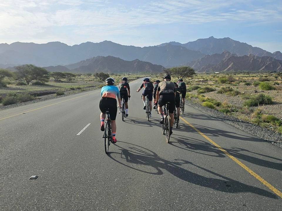
Road · United Arab Emirates
Umm al Qaywayn – Ras al-Khaimah
A flat 55 km road cycling loop from Al Marjan Island, with 31 m of climbing.
At a glance
- Best for
- Flat, steady riding
- Distance
- 55 km
- Elevation gain
- 31 m
- Riding time
- 1½–2 hours
- Difficulty
- Easy
- Bike
- Road bike
- Surface
- Paved
- Traffic
- Some main roads
- Food & water
- Longest gap 16 km
- Navigation
- GPX download
- Start and finish
- Al Marjan Island
Map and elevation profile
Elevation profile
- 31 m
- 55 km
Route description
- Al Marjan Island
- Al Marjan Island
This 55 km route starts and finishes in Umm al Qaywayn, passing Al Marjan Island near the start. The terrain is flat with an elevation gain of just 31 m, the highest point being 17 m at 17.5 km and the lowest 1 m at 21 km. The route is a loop, offering a mix of road types and surfaces.
The route comprises mainly paved roads (83%), with no gravel or unpaved sections but 17% unmapped surface. Road types include 16.3 km on minor roads, 11.1 km on other roads, 9.6 km on quiet streets, 7.8 km on main roads, 5.4 km on major roads, and 4.4 km on paths. Notably, there are 13.2 km on main roads without cycle lanes and 11.2 km on roads with speed limits of 80 km/h or more. The longest named roads ridden are Marjan Island Boulevard for 12 km, Al Ittihad Road for 11.2 km, and Al Qwartez Street for 9.6 km.
Services along the route include cafés, restaurants, bars, shops, and toilets, with a longest stretch of 16.3 km without cafés, shops or water from 10.2 to 26.5 km. Several food and drink options lie slightly off-route, including restaurants Salt at 10.2 km, Seoul Galbi & Okura at 45 km, and Hooka at 54.6 km. Convenience store ZOOM is at 26.5 km. Toilets are available at 1.7 km, 28.3 km, and 49.1 km. At the start and finish are a café (Decaf Food Truck), restaurants Salt and Hooka, and convenience store ZOOM.
Highlights
- Al Marjan Island at 1.4 km
- Highest point 17 m at 17.5 km
- Longest named road: Marjan Island Boulevard (12 km)
- Longest stretch without café or shop for 16.3 km
Traffic, surface and gradient
Expect stretches on main roads without a cycle lane (13.2 km in all) between quieter sections.
- Roads
- 30% minor road · 20% other · 18% quiet street · 14% main road · 18% other roads and tracks
- Main roads
- 13.2 km on main roads without a cycle lane — likely busier
- Fast roads
- 11.2 km on roads with a limit of 80 km/h or more
- Main roads used
- Marjan Island Boulevard (12 km), Al Ittihad Road (11 km), Al Qwartez Street (10 km)
- Surface
- Paved: 83% of the route is mapped as paved and 17% has no surface data.
- Gradient
- 0% climbing · 0% descending · 100% flat
Food, water and services
The longest stretch without a café, shop or water is 16 km, from km 10 to 27. Along the route: 11 cafés and restaurants, 1 shop and 3 public toilets.
Food, water and shops in ride order
- 1.7 kmBar · 240 m off route
- 1.7 kmToilets · 230 m off route
- 10.2 kmSalt · restaurant · 100 m off route
- 26.5 kmZOOM · convenience store · 70 m off route
- 28.3 kmBar · 90 m off route
- 28.3 kmToilets · 110 m off route
- 37.5 kmDecaf Food Truck · café · 60 m off route
- 45 kmSeoul Galbi & Okura · restaurant · 90 m off route
- 49.1 kmThe Village English Pub · pub · 50 m off route
- 49.1 kmToilets · 70 m off route
- 53.9 kmHealth First · pharmacy · 70 m off route
- 54.6 kmHooka · restaurant · 110 m off route
Start and access
At the start and finish
- Food and coffee
- Decaf Food Truck (300 m), Hooka (300 m), Salt (340 m)
- Shops
- ZOOM (930 m)
Know before you go
- 13.2 km on main roads without a cycle lane
- 11.2 km on roads posted 80 km/h or more
- Longest stretch without café, shop or water for 16.3 km from 10.2 to 26.5 km