
Cycling in Rosehall
2 cycling routes from Rosehall, Highland, United Kingdom, 83 to 115 km, 198 km mapped in all, with up to 1,108 m of climbing in a day. Rolling riding (9 m of climbing per km on average), mostly gravel routes, 77% paved, 31% of the riding on main roads without a cycle lane. Best months to ride: Jun to Aug.
At a glance
- Routes
- 2
- Lengths
- 83–115 km
- Biggest day
- 1,108 m
- Terrain
- Rolling
- Surface
- 77% paved
- Bike
- Gravel bike
- Difficulty
- Hard
- Best months
- Jun to Aug
- Longest gap
- 84 km
- GPX
- Every route
Know before you go
Added up from the recorded routes and OpenStreetMap; nothing estimated.
- Surface
- 77% paved · 22% gravel or unpaved — 43 km of gravel or unpaved road across the routes.
- Roads
- 31% of the riding on main roads without a cycle lane.
- High point
- 409 m on Rosehall to Altnaharra.
- Bail-outs
- A railway station or ferry within reach on 1 route.
- No services
- 84 km on Rosehall to Durness.
Cycling guide to Rosehall
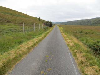
Rosehall in the Highland region serves as a start for two main point-to-point cycling routes. The first heads north to Altnaharra, covering 82.7 km with 751 m of elevation gain. Key places along this route include West Merkland before reaching Altnaharra. The second route extends to Durness, spanning 114.9 km and 1108 m of climbing. It passes many small places including West Merkland, Allt na Caillich, Eriboll, Laid, Sangobeg, Leirinmore, Smoo, Sangomor, and Keoldale before finishing in Durness. Both routes remain fully within Great Britain and offer a mix of paved and unpaved surfaces. Although no cycle paths are present, 17.5 km and 43.5 km of the respective routes include main roads without cycle lanes. The routes provide long stretches without services, up to around 84 km, and two railway stations lie near the longer route to Durness.
More on terrain
Terrain
The terrain includes moderate climbs with the biggest climb on the route to Altnaharra being 2.8 km long at 7.2% average gradient, reaching 404 m height. The Durness route includes a 5.6 km climb at 3.6% average gradient, peaking at 220 m. Elevations reach just over 400 m on both routes, indicating rolling terrain with significant ascents.