Road · United Arab Emirates
Nazwa Loop
A flat 88 km road cycling loop from Nazwa, Sharjah through Al Dafain, Al Khawālid and Sha'biyyat Bahayis, with 144 m of climbing. Most of it (83.8 km) is on main roads without a cycle lane, 33.4 km where the limit is 80 km/h or more. There is a 31 km stretch without a café, shop or water (km 56–87).
At a glance
- Best for
- Flat, steady riding for confident riders at ease in traffic
- Distance
- 88.2 km
- Elevation gain
- 144 m
- Riding time
- 3–4 hours
- Difficulty
- Moderate
- Bike
- Road bike
- Surface
- Paved
- Traffic
- Mostly main roads
- Food & water
- Longest gap 31 km
- Best months
- Dec to Feb
- Navigation
- GPX download
- Start and finish
- Nazwa
Map and elevation profile
Elevation profile
- 144 m
- 88 km
Route description
- Nazwa
- Al Dafain
- Al Khawālid
- Sha'biyyat Bahayis
- Al Fayah
- Mahafiz
- Nazwa
The Nazwa loop begins at Nazwa, near the peak of Qarn Nazwa (200 m). The route passes through Al Dafain at 22.7 km, where the highest point of 185 m is reached at 27.1 km. It continues through Al Khawālid at 31.8 km, Sha'biyyat Bahayis at 38.2 km, and Al Fayah at 55.6 km. From Al Fayah, the route goes on to Mahafiz at 68.7 km, then back to Nazwa at 86.3 km. The terrain is mostly flat with 95% flat, 3% climbing, and 2% descending. Climbing is gentle, with only 0.1 km above 10% gradient, beginning at the start.
Why ride this route?
- The flattest of the 5 rides from Nazwa.
Highlights
- Peak near the start: Qarn Nazwa (200 m)
- Highest point at 27.1 km (185 m)
- Longest named road: Mahafiz - Al Fayah Road (14.6 km)
- Passes through six towns including Al Dafain and Al Fayah
Along the route
Places passed
Traffic, surface and gradient
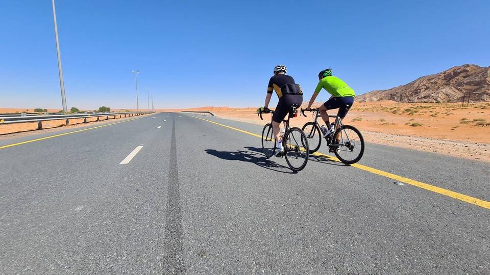
This is not a cycle-track route: 95% is on main roads without a cycle lane, 33.4 km of it where the limit is 80 km/h or more. Riders should be comfortable sharing the road with faster traffic.
- Roads
- 79% main road · 17% major road · 3% quiet street · 1% track
- Main roads
- 83.8 km on main roads without a cycle lane — likely busier
- Fast roads
- 33.4 km on roads with a limit of 80 km/h or more
- Main roads used
- Mahafiz - Al Fayah Road (15 km), Al Dhaid-Maliha Road (10 km), E55 (4 km)
- Surface
- Paved: 99% of the route is mapped as paved, 1% as unpaved.
- Gradient
- 3% climbing · 2% descending · 95% flat
Food, water and services
The longest stretch without a café, shop or water is 31 km, from km 56 to 87. Along the route: 6 cafés and restaurants, 5 shops, 1 water point and 1 petrol station.
Food, water and shops in ride order
- 0 kmAl Fareed Restaurant · restaurant · 120 m off route
- 0.3 kmNazwa Valley Grocery · supermarket · 190 m off route
- 12 km2 December Cafeteria · café · 50 m off route
- 22.2 kmSharjah Coop · supermarket · 100 m off route
- 22.9 kmDrinking water · 80 m off route
- 47.9 kmADNOC · petrol station · on the route
- 55.6 kmMavia Al Faya · restaurant · 80 m off route
- 86.9 kmAbdulla Al Kabi Cafétéria · restaurant · 180 m off route
- 86.9 kmDesert Mountain Supermarket · supermarket · 180 m off route
Start and access
At the start and finish
- Food and coffee
- Al Fareed Restaurant (120 m), Ghadeer Saeed Café & Restaurant (280 m)
- Shops
- Desert Mountain Supermarket (300 m), Nazwa Valley Grocery (330 m)
Know before you go
- 83.8 km on main roads without cycle lane
- 33.4 km on roads with posted limits of 80 km/h or more
- 1 km of gravel or unpaved surface
- No café, shop or water for 31.3 km after km 55.6