Cyclists.com

National Cycle Route 88

Barry, Vale of Glamorgan, United KingdomRoad

Signed route The waymarked National Cycle Route 88 (National Cycle Network), traced from OpenStreetMap and measured against the terrain model; no member has recorded it yet. Ridden it? Add your recording and photos.

32 km
Distance
261 m
Elevation gain
Easy
Difficulty
Paved
Surface
Download GPXMap

Elevation profile

Total ascent
261 m
Distance
32 km
0255075100125m0 km102032 km101 m · highest, at 25.9 kmStartFinish

Route overview

Suitable for cyclists comfortable with moderate climbing over 32 km.

National Cycle Route 88 in Vale of Glamorgan, 32 km from The Knap to Ewenny with 261 m climbing.

National Cycle Route 88 starts at The Knap in Barry and passes through places including Porthkerry, Penmark, Pancross, Llancarfan, St Mary Church, and Llantwit Major before reaching Ewenny at 32 km. The route mainly follows minor roads (91%) with some paths, cycle paths, quiet streets, and short sections on main roads. Most of the surface is paved (98%) with a very small proportion of gravel or unpaved (1%). Climbing is moderate with two main ascents: one starting at 6.1 km lasting 1.6 km and rising 43 m at an average gradient of 2.6%, and another starting at 28.6 km lasting 1.7 km with 48 m climbing at 2.8%. The highest point is 100 m at 25.7 km. The route profile is a mix of flat, climbing, and descending with the longest descent of 2.4 km dropping 61 m after 26 km. Facilities along the route include cafés near Barry and Llantwit Major, pubs near Penmark and Marcross, shops at several places including Barry and Ewenny, drinking water points near 3.4 km and 25.7 km, public toilets at Porthkerry and Llantwit Major, and repair stands at 15.7 km and 31.2 km. The longest stretch without café, shop, or water is 10.1 km between 5.5 and 15.6 km. There are railway stations at Barry at the start and Llantwit Major near 17 km for bailout.

Highlights

  • Monknash Monastery ruins near 24 km
  • Penmark Castle ruins near 5.4 km
  • Two climbs around 6 km and 29 km
  • Longest descent 2.4 km dropping 61 m at 26 km

Along the route

Measured from the recorded track and OpenStreetMap.

Places passed

  1. Lower Porthkerry 2.3 km
  2. Penmark 5.7 km
  3. Pancross 7.4 km
  4. Llancarfan 7.5 km
  5. St Mary Church 13.3 km
  6. Llanmaes 15.7 km
  7. Llantwit Major 17.5 km
  8. Dimlands 18.8 km
  9. St Donats 21 km
  10. Marcross 22.6 km
  11. Monknash 24.1 km
  12. Broughton 24.5 km
  13. Wick 26 km

Climbs

ClimbStarts atLengthGainAverageMaxTop
6.1 km1.6 km43 m2.6 %4.2 %61 m
28.6 km1.7 km48 m2.8 %4.1 %83 m

High point 100 m at 25.7 km; low point 11 m.

What this ride is like

Measured from OpenStreetMap along the track and the elevation profile.

Roads
91% minor road · 3% path · 2% main road · 2% cycle path
Fast roads
3.2 km on roads with a limit of 80 km/h or more
Surface
Paved throughout
Gradient
23% climbing · 24% descending · 54% flat
Longest descent
2.4 km from 26 km, dropping 61 m

Along the way

Within a few hundred metres of the track, from OpenStreetMap. Opening hours change — treat this as where to look, not a promise.

Food, water and shops

  1. 1.5 kmMiss Marco's · café · on the route
  2. 1.5 kmPorthkerry Public Toilets · toilets · 40 m off route
  3. 3.3 kmWHSmith · convenience store · 110 m off route
  4. 3.4 kmDrinking water · 120 m off route
  5. 3.4 kmWell Health and Beauty · pharmacy · 190 m off route
  6. 5.5 kmThe Six Bells Inn · pub · on the route
  7. 15.7 kmRepair stand · on the route
  8. 17.2 kmCo-op Food · supermarket · 130 m off route
  9. 17.2 kmWell Pharmacy · pharmacy · 170 m off route
  10. 17.5 kmCafe Velo · café · on the route
  11. 17.5 kmToilets · on the route
  12. 22.6 kmThe Doghouse · pub · on the route
  13. 25.7 kmDrinking water · on the route
  14. 26.1 kmWick Village Shop · convenience store · 40 m off route
  15. 31.2 kmEwenny Village Shop · convenience store · on the route
  16. 31.2 kmRepair stand · on the route
  17. 31.8 kmCoast Coffee · café · on the route

Need to bail out?

  • 0 kmBarry (station), 790 m off route
  • 17.1 kmLlantwit Major (station), 80 m off route

Whether bikes are carried depends on the service — check before relying on it.

Worth a stop

  • 0.6 kmCwm Ciddy Sawmill (ruins)
  • 5.4 kmPenmark Castle (ruins)
  • 17.5 kmOld Guild Hall/Town Hall (archaeological site)
  • 24.2 kmMonknash Monastery (ruins)

At the start

  • Barry · station · 790 m

At the finish

  • Coast Coffee · café · 20 m
  • Ewenny Village Shop · convenience store · 580 m
  • Ewenny Pottery Cafe · café · 410 m

Stay after this ride

  • Ewenny Farm Guest House · guest house · 20 m from the finish
  • Best Western Heronston Hotel & Spa · hotel · 930 m from the finish
  • New Inn Guest House · guest house · 1.2 km from the finish

Practical information

Surface
Paved
Route shape
Point to point
Riding time
2 h 17 min
Best months
Jun to Sep — daily highs of 18–20 °C in those months

Know before you go

  • Longest stretch with no café, shop or water is 10.1 km from 5.5 to 15.6 km
  • 3.2 km on fast roads with speeds 80 km/h or above
  • 0.7 km on main roads without cycle lanes

Routes are for inspiration. Roads, surfaces and conditions change — check locally and ride within your limits.

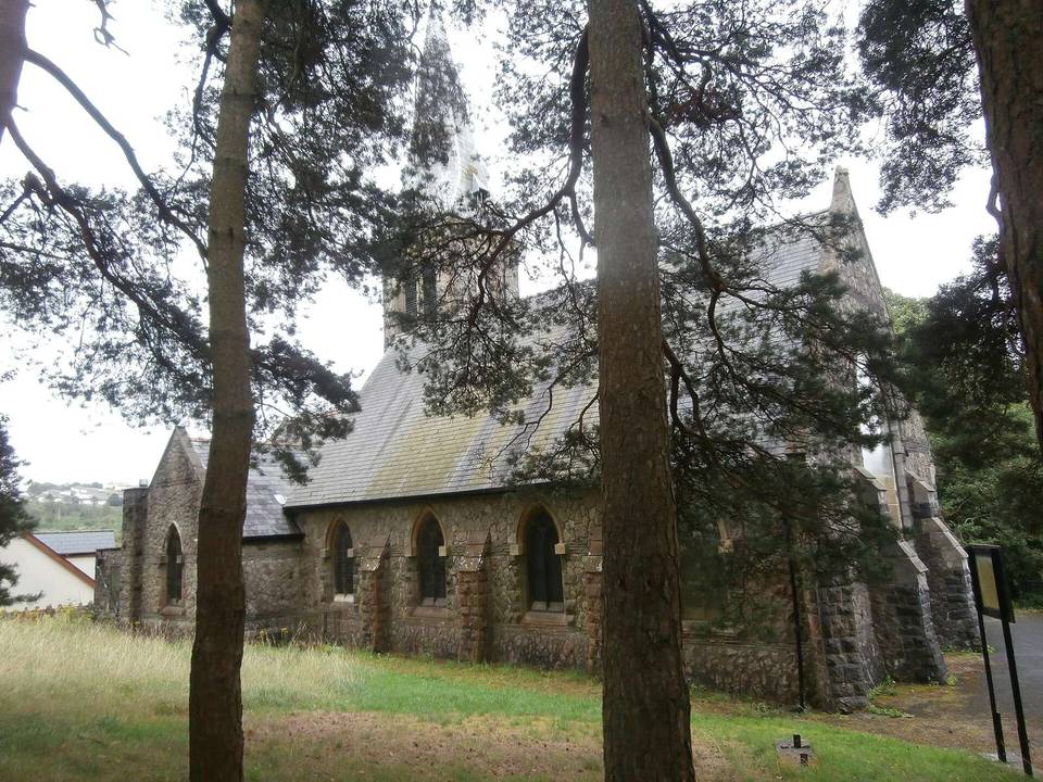
2 photographs from the road

Photo: Alan Hughes · CC BY-SA 2.0 · Wikimedia Commons