Bo'ness to Helensburgh
- 106 km
- 618 m
- Hard
- Paved
Elevation profile
- 618 m
- 106 km
Route overview
Longer distance riders able to handle moderate climbing over 100 km
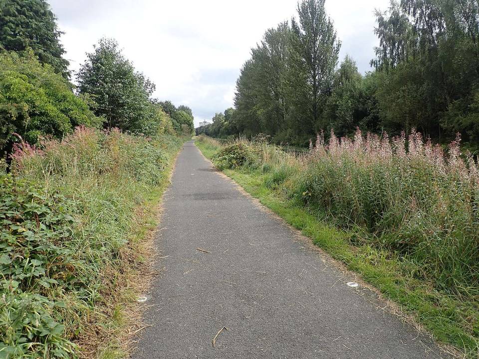
Stage 2 of 2 of the John Muir Way: 105.5 km from Bo'ness to Helensburgh with 618 m of climbing, on the signed route.
The route begins at Bo'ness and heads past Kinneil and Linlithgow before continuing through Polmont, Redding, and across various small towns including Bonnybridge and Kilsyth. It covers 105.5 km with an elevation gain of 618 m. The initial climb starts shortly after the beginning at km 1.4, reaching 90 m after 2.1 km at an average gradient of 3.9% with a maximum of 8.1%. Graded sections of climbing also occur near km 61.5 and a gentler ascent near the end of the ride from km 96.8.
Highlights
- Climb near km 1.4 with max gradient 8.1%
- High point at Boards at 171 m elevation
- Forth and Clyde Canal Towpath 17.6 km
- Union Canal Towpath 10.1 km
Along the route
Places passed
Climbs
| Climb | Starts at | Length | Gain | Average | Max | Top |
|---|---|---|---|---|---|---|
| — | 1.4 km | 2.1 km | 84 m | 3.9 % | 8.1 % | 90 m |
| — | 61.5 km | 2.3 km | 102 m | 4.4 % | 7.3 % | 170 m |
| — | 96.8 km | 2.7 km | 59 m | 2.2 % | 2.9 % | 104 m |
What this ride is like
- Roads
- 48% cycle path · 18% path · 12% minor road · 8% quiet street
- Main roads
- 5.8 km on main roads without a cycle lane — likely busier
- Fast roads
- 4.9 km on roads with a limit of 80 km/h or more
- Cycle paths
- 49.5 km on cycle paths or roads with a cycle lane
- Main roads used
- Forth and Clyde Canal Towpath (18 km), Union Canal Towpath (10 km), C9 (4 km)
- Surface
- 77% paved · 22% gravel or unpaved
- Gradient
- 12% climbing · 13% descending · 75% flat
- Steep sections
- 1.5 km over 5% · steepest 500 m averages 6.4% at 2.9 km
- Longest descent
- 2.7 km from 67.6 km, dropping 107 m
Along the way
Food, water and shops
- 0 kmToilets · 110 m off route
- 0.6 kmHastons of Bo'ness · petrol station · 100 m off route
- 6.4 kmKeyStore · convenience store · on the route
- 15.2 kmaran · café · 100 m off route
- 16.6 kmTesco · supermarket · 60 m off route
- 25.4 kmFalkirk Wheel Cafe · café · 60 m off route
- 28.7 kmJET · petrol station · 230 m off route
- 29 kmRepair stand · on the route
- 43 kmRepair stand · on the route
- 50.9 kmAntermony Road Co-op · supermarket · 90 m off route
- 53.8 kmLennoxtown Service Station · petrol station · 270 m off route
- 70 kmDrinking water · 80 m off route
- 71.8 kmCountry Cycles · bike rental · 90 m off route
- 87.4 kmToilets · on the route
- 89.2 kmTop Up Tap · drinking water · 70 m off route
- 102.1 kmCosta · café · 80 m off route
- 102.1 kmRowlands Pharmacy · pharmacy · 70 m off route
- 102.3 kmToilets · 40 m off route
Need to bail out?
- 1.4 km — Kinneil Halt (station), 130 m off route
- 15.2 km — Polmont (station), 200 m off route
- 24.9 km — Camelon (station), 1.4 km off route
- 39.9 km — Croy (station), 1.4 km off route
- 48.1 km — Seagull Trust Cruises (ferry), 760 m off route
- 89.2 km — Balloch (station), 120 m off route
- 101.3 km — Helensburgh Upper (station), 80 m off route
Worth a stop
- 2.8 km — Kinneil House (castle)
- 27.8 km — Antonine Wall (ruins)
- 43 km — Antonine Wall (ruins)
- 87.4 km — Balloch Castle (castle)
- 93 km — Burial Ground (archaeological site)
- 102.1 km — Celtic Cross (monument)
At the start
- McMoo's · café · 250 m
- The Junction · café · 380 m
- Sweet Bakery · bakery · 300 m
- The Anchor Tavern · pub · 200 m
- Pier Pizza · fast food · 150 m
At the finish
- Costa · café · 150 m
- The Terrace Coffee House · café · 80 m
- Dino's Ice Cream · ice cream · 50 m
- Vanilla · ice cream · 20 m
- Helensburgh Cycles · bike shop · 100 m
Stay after this ride
- La Jupe · guest house · 30 m from the finish
- Riva · hotel · 70 m from the finish
- Sinclair Guest House · guest house · 360 m from the finish
- Ashfield · guest house · 400 m from the finish
- Moorlands B&B · guest house · 1.0 km from the finish
Practical information
- Paved
- Point to point
- 7 h 32 min
- Jun to Sep — daily highs of 16–19 °C in those months
Know before you go
- 11.2 km longest stretch without café, shop or water from km 77 to 88.2
- 5.8 km on main roads without a cycle lane
- 4.9 km on roads with speeds 80 km/h or more
- 22% gravel or unpaved surface