Cyclists.com

Cap d'Agde to Sigean

Cap d'Agde, Languedoc, FranceRoad

99 km
Distance
211 m
Elevation gain
Moderate
Difficulty
Paved
Surface
On the road: Cap d'Agde to Sigean

Elevation profile

211 m over 99 km

Route overview

Suits riders after a long but easy day: nearly 100 km with only 211 m of climbing, almost all of it in the first half.

A 98.8 km point-to-point along the Languedoc coast from Cap d'Agde to Sigean, with just 211 m of climbing.

The route leaves Cap d'Agde and runs inland to Agde at km 6.5 before returning to the coastal strip past Grau d'Agde and La Tamarissière. Vias, Portiragnes Plage and Portiragnes follow in quick succession, then Cers and Villeneuve-lès-Béziers bring the road towards the only rise of any substance. From km 30.7 a 1.7 km climb gains 48 m at 2.9%, with a maximum of 5.1% and a top at 64 m, and the high point of the whole ride, 70 m, comes at km 32.7 on the approach to Béziers. Past the hamlets around Fonséranes and Les Neuf Écluses the road drops back through Bayssan and Lespignan, and by km 51.1 the elevation is down to -1 m, the lowest point of the day. Some 84% of all the climbing is done in the first half. The second half is flat coastal riding: Saint-Pierre-la-Mer at km 60, Narbonne-Plage, Les Ayguades and Gruissan at km 71.7, then a long run to Port-la-Nouvelle at km 88.3. The finish comes shortly after, at Sigean, 93.8 km in, with the last few kilometres among the hamlets around the village.

Highlights

  • High point of 70 m at km 32.7, just before Béziers
  • The one climb: 1.7 km at 2.9%, topping out at 64 m
  • Coastal villages of Narbonne-Plage and Gruissan
  • Sea-level flatlands, dipping to -1 m at km 51.1

Along the route

Measured from the recorded track and OpenStreetMap.

Places passed

  1. Agde 6.5 km
  2. Grau d'Agde 9.5 km
  3. La Tamarissière 10.2 km
  4. Vias 12.3 km
  5. Portiragnes Plage 17.5 km
  6. Portiragnes 21 km
  7. Cers 23.7 km
  8. Villeneuve-lès-Béziers 25.7 km
  9. Moulins de Saint-Pierre 28.5 km
  10. Saint-Pierre 28.5 km
  11. La Dévèze 29.1 km
  12. Le Mail 29.1 km
  13. Combe Grasse 30.1 km
  14. Rebaut le Bas 33 km
  15. Béziers 33.1 km
  16. Camperdut 34.1 km
  17. Plaine de Fonséranes 34.1 km
  18. Le Faubourg 34.5 km
  19. Les Neuf Écluses 35 km
  20. La Dragonne 35.6 km
  21. Beauséjour 36 km
  22. Le Contrôle 36.2 km
  23. La Redonnière 37.4 km
  24. Bayssan 38.4 km
  25. Terres Volées 38.4 km
  26. Lespignan 44.3 km
  27. Saint-Pierre-la-Mer 60 km
  28. Narbonne-Plage 62.9 km
  29. Les Ayguades 67 km
  30. Le Bouis 70.3 km
  31. Gruissan 71.7 km
  32. Port-la-Nouvelle 88.3 km
  33. Chemin de la Grève-Nord 88.7 km
  34. Mourrel du Teule 89.6 km
  35. Le Bouchet 89.8 km
  36. Les Grazelles 93.2 km
  37. Sigean 93.8 km
  38. Le Viala 93.9 km
  39. Le Peyrou 94 km
  40. Les Trois Moulins 94 km
  41. L'Étang Boyé 94 km

On the road

  • Crêperie La Grange (Restaurant) 0 km
  • L'Arlequin (Restaurant) 0 km
  • Miami Prime (Restaurant) 0 km
  • Moda Café (Café) 0 km
  • Nautilus (Restaurant) 0 km
  • Quai n°XV (Restaurant) 0 km
  • Le Pitchoun (Restaurant) 0 km
  • Hanoi (Restaurant) 0 km
  • Eni (Fuel station) 0.1 km
  • Chez Gégé (Restaurant) 0.2 km
  • La Casa Nostra (Restaurant) 0.2 km
  • Le Monde des Grillades (Restaurant) 0.2 km

Climbs

Starts atLengthGainAverageMaxTop
30.7 km1.7 km48 m2.9 %5.1 %64 m

High point 70 m at 32.7 km; low point -1 m.

Practical information

Surface
Paved
Route shape
Point to point
Riding time
6–8 hours riding
Season
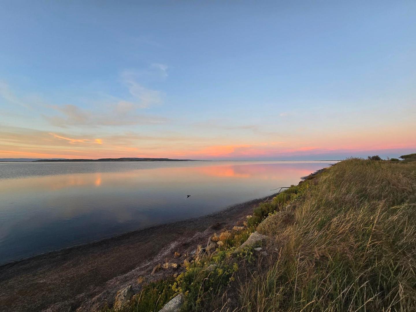
The single September recording had temperatures of 29°C, so spring or autumn will be more comfortable than high summer on this shadeless coast.

Know before you go

  • No cafés or water points listed after Agde at km 6.9 — carry supplies
  • 29°C recorded in September on this exposed coastal route

Routes are for inspiration. Roads, surfaces and conditions change — check locally and ride within your limits.

11 photographs from the road

Part of

More rides from Cap d'Agde