Road · United Arab Emirates
Dubai Islands via the Abra
A flat 95 km road cycling loop from The Greens through Al Thanyah 1, Al Quoz Industrial 2 and Burj Khalifa, with 11 m of climbing.
At a glance
- Best for
- Flat, steady riding
- Distance
- 95.2 km
- Elevation gain
- 11 m
- Riding time
- 3½–5 hours
- Difficulty
- Moderate
- Bike
- Road bike
- Surface
- Paved
- Traffic
- Some main roads
- Food & water
- Regular
- Best months
- Dec to Feb
- Navigation
- GPX download
- Start and finish
- The Greens
Map and elevation profile
Elevation profile
- 11 m
- 95 km
Route description
- The Greens
- Al Thanyah 1
- Al Quoz Industrial 2
- Burj Khalifa
- Umm Hurair
- Al Buteen
- Al Baraha
- Jumeirah 1
- Umm Suqeim 3
- The Greens
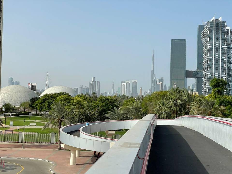
Starting in Dubai, the route passes through numerous city districts including Al Thanyah 1 at 1.8 km, Al Barsha areas between 4 km and 7 km, and the Al Quoz Industrial areas from about 9 km to 17 km. It continues towards Business Bay at 18 km, passing the Burj Khalifa at 20 km, and traverses Za'abeel, Trade Centre, and Oud Metha up to 31 km. The route then moves through central areas such as Al Rigga and Deira by km 37, before heading along the Corniche Deira and Al Shindagha towards coastal locations like Jumeirah and Umm Suqeim.
The route has no significant climbs with a total elevation gain of only 143 m and peaks at 11 m around km 12.7, dipping to -1 m near km 18.8. It is entirely flat with no sustained steep gradients. Surfaces are mainly paved (90%), with the remainder unmapped. The journey is on mixed road types: 40% main roads, 18% minor roads, 18% quiet streets, 15% paths, and smaller shares of cycle paths and pedestrian areas. For example, First Al Khail Street is ridden for 7.9 km. There are 40.5 km on main roads without cycle lanes, including 2.6 km on fast roads (80 km/h or more).
Stops for food and drink include cafés like Starbucks (2 km), Burnout (30 km), Kulfi Chai (56 km), and Pitfire Pizza Greens near the end (91.5 km). There is a stretch of 8.5 km without café, shop, or water facilities from 39 km to 47.5 km. Supermarkets, bike shops, petrol stations, and toilets are available at various points. Bailout points are accessible via ferries and stations such as Business Bay MTS (18 km) and Marina Mall Water Bus (83 km).
Highlights
- Passes Burj Khalifa at 20.3 km
- Along Corniche Deira at 49.7 km
- Visit Jumeirah Mosque near 57.5 km
- Cafés available near 2 km and 91.5 km
Along the route
Places passed
Traffic, surface and gradient
Expect stretches on main roads without a cycle lane (40.5 km in all) between quieter sections.
- Roads
- 40% main road · 18% minor road · 18% quiet street · 15% path · 10% other roads and tracks
- Main roads
- 40.5 km on main roads without a cycle lane — likely busier
- Fast roads
- 2.6 km on roads with a limit of 80 km/h or more
- Cycle paths
- 4.1 km on cycle paths or roads with a cycle lane
- Main roads used
- First Al Khail Street (8 km), Al Asayel Street (5 km), Abdullah Omran Taryam Street (4 km), Jumeira Street (3 km)
- Surface
- Paved: 90% of the route is mapped as paved and 10% has no surface data.
- Gradient
- 0% climbing · 0% descending · 100% flat
Food, water and services
No stretch is longer than 15 km without a café, shop or water. Along the route: 1023 cafés and restaurants, 388 shops, 9 water points, 14 petrol stations, 49 public toilets and 26 bike shops.
Food, water and shops in ride order
- 2 kmStarbucks · café · 80 m off route
- 2 kmBin Sina Pharmacy · pharmacy · 50 m off route
- 8.4 kmTraffic Cafe · café · 100 m off route
- 16.1 kmAl Tamimi New Pharmacy · pharmacy · 50 m off route
- 19.2 kmToilets · 90 m off route
- 20.7 kmCareem Bike · bike rental · on the route
- 29.8 kmEmarat · petrol station · 230 m off route
- 32.9 kmToilets · on the route
- 34.8 kmRas Al Khor Pharmacy · pharmacy · 50 m off route
- 36 kmAmba · café · 70 m off route
- 50.7 kmCareem · bike rental · 80 m off route
- 54.7 kmENOC · petrol station · 120 m off route
- 57.7 kmSpinneys · supermarket · 60 m off route
- 60.3 kmSugar Bae · café · on the route
- 65.8 kmBW Cafe · café · 30 m off route
- 67.2 kmDrinking water · 80 m off route
- 76.7 kmHive Board Game Café · café · 110 m off route
- 89.7 kmR105m · drinking water · 170 m off route
Need to bail out?
- 18.2 km — Business Bay MTS (ferry), 170 m off route
- 28.3 km — max (station), 1000 m off route
- 35 km — Deira Old Souk (ferry), on the route
- 53 km — Al Ghubaiba (station), 280 m off route
- 60.7 km — Jumeirah One Fishing Harbour (ferry), 280 m off route
- 76.5 km — Dubai Internet City (station), 670 m off route
- 82.9 km — Marina Mall (Water Bus) (ferry), 1.0 km off route
- 90.2 km — Al Fardan Exchange (station), 70 m off route
Worth a stop
- 27.3 km — The palace of Sheikh Hamdan bin Rashid Al Maktoum (castle)
- 31.7 km — Ansar Gallery (attraction)
- 35.8 km — Aerosoft by Sylvia & Jangjoo (attraction)
- 57.5 km — Jumeirah Mosque (attraction)
- 64.5 km — Jumeirah Beach (attraction)
- 75.8 km — ARN Arabian Radio Network (viewpoint)
Start and access
At the start and finish
- Food and coffee
- Caribou (100 m), Pitfire Pizza Greens (230 m), Nando's (40 m)
- Shops
- Choitram's (Greens Village) (260 m), Bluemart Supermarket (380 m)
Know before you go
- 40.5 km on main roads without cycle lane
- 2.6 km on fast roads with speed 80 km/h+
- Longest stretch without café, shop or water for 8.5 km from 39 to 47.5 km