
Cycling in Alcudia
2 cycling routes from Alcudia, Mallorca, Spain, 60 to 97 km, 156 km mapped in all, with up to 1,517 m of climbing in a day. Hilly riding (12 m of climbing per km on average), mostly road routes, 40% of the riding on main roads without a cycle lane. 1 named climb; the high point is 977 m on Alcudia to Port de Pollença via Lluc and Gorg Blau. Best months to ride: Apr to Jun.
At a glance
- Routes
- 2
- Lengths
- 60–97 km
- Biggest day
- 1,517 m
- Terrain
- Hilly
- Surface
- Mostly paved
- Bike
- Road bike
- Difficulty
- Moderate to Hard
- Named climbs
- 1
- Best months
- Apr to Jun
- GPX
- Every route
Know before you go
Added up from the recorded routes and OpenStreetMap; nothing estimated.
- Surface
- Paved almost throughout — 7 km of gravel or unpaved road across the routes.
- Roads
- 40% of the riding on main roads without a cycle lane · 7 km on cycle paths or lanes.
- High point
- 977 m on Alcudia to Port de Pollença via Lluc and Gorg Blau.
- Climbs
- 1 named climb.
- Bail-outs
- A railway station or ferry within reach on 1 route.
Cycling guide to Alcudia
Cyclists riding from Alcudia in Mallorca can choose from three main routes offering varied distances and elevations. The Alcudia out-and-back route covers 48.7 km with 811 m of climbing, including a 3.5 km climb at 5.5% average gradient starting at 6.7 km, reaching 201 m elevation. It passes through Port de Pollença and includes 6.7 km of cycle path. The longer Alcudia to Alcudia route stretches 96.6 km with 1408 m of climbing, passing through Pollença, Lluc, Caimari, Selva, Moscari, Campanet, and Port de Pollença. Its biggest climb is 7.5 km at 5.8% average gradient, starting at 13.7 km, with a maximum gradient of 9.2% and a high point at 534 m. The Alcudia to Palma route is 59.6 km with 389 m elevation gain, passing multiple towns such as Campanet, Inca, and Santa Maria del Camí. It features a 1.8 km climb at 3.5%, starting at 17.2 km, reaching 116 m above sea level. All routes have predominantly paved surfaces and involve some stretches on main roads without cycle lanes.
More on best time to ride, terrain
Best time to ride
May, with temperatures ranging from 25°C to 31°C recorded on routes.
Terrain
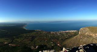
The terrain around Alcudia varies from rolling to mountainous. The climbs range from shorter ascents of under 2 km at moderate gradients around 3.5% to longer climbs over 7 km averaging approximately 5.5-5.8%. The highest elevation recorded on these routes is 977 m on the longest ride, with the largest total elevation gain at 1408 m. Typical gradients for the main climbs lie between 5.5% and 5.8%, with maximum gradients up to 9.2%.