
Cycling in Melton Mowbray
3 cycling routes from Melton Mowbray, England, United Kingdom, 47 to 118 km, 233 km mapped in all, with up to 427 m of climbing in a day. Mostly flat riding (4 m of climbing per km on average), mostly road routes. Best months to ride: Jun to Sep.
At a glance
- Routes
- 3
- Lengths
- 47–118 km
- Biggest day
- 427 m
- Terrain
- Flat
- Surface
- Mostly paved
- Bike
- Road bike
- Difficulty
- Moderate to Hard
- Best months
- Jun to Sep
- GPX
- Every route
Know before you go
Added up from the recorded routes and OpenStreetMap; nothing estimated.
- Surface
- Paved almost throughout — 13 km of gravel or unpaved road across the routes.
- Roads
- 6% of the riding on main roads without a cycle lane.
- Bail-outs
- A railway station or ferry within reach on 3 routes.
- Ridden
- Jul to Aug, 12–25 °C recorded.
Cycling guide to Melton Mowbray
Cyclists riding from Melton Mowbray have access to three main loops ranging from 47 km to 118 km, all shaping circular routes through nearby villages and countryside. The Melton Mowbray – Bingham loop covers 67.6 km with 461 m of climbing, passing through many places including Sysonby, Scalford, and Belvoir. The Greetham loop is shorter at 47.4 km and includes 311 m of elevation gain, cycling through areas like Stapleford and South Witham. The longest ride, the Melton Mowbray – Spalding loop, extends to 118.2 km with 569 m of climbing, incorporating spots such as Burton Lazars, Spalding, and Bourne. Each route is predominantly paved, offers some gravel sections, and features at least one railway station nearby for easy access or exit.
More on best time to ride, terrain
Best time to ride
July through August is the recorded best time to ride, with temperatures around 12°C in August and up to 25°C in August on the longer routes.
Terrain
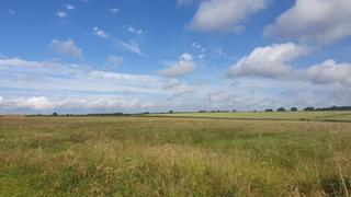
The terrain around Melton Mowbray is mainly rolling with moderate elevation gains across the loops. The highest points reach up to 174 m, with the steepest climb being 2 km at 4.4% average gradient and maximum 7.8%. Gradients commonly range from gentle to moderate, with climbing distributed throughout the routes but none very steep or mountainous.